…where east meets west
- Home
- Brief History
- The Greenwich Meridian
- Greenwich
(1675–1958) - Herstmonceux
(1948–1990) - Cambridge
(1990–1998) - Outstations (1822–1971)…
- – Chingford (1822–1924)
- – Deal
(1864–1927) - – Abinger
(1923–1957) - – Bristol & Bradford on Avon
(1939–1948) - – Bath
(1939–1949) - – Hartland
(1955–1967) - – Cape of Good Hope
(1959–1971)
- Administration…
- – Funding
- – Governance
- – Inventories
- – Pay
- – Regulations
- – Royal Warrants
- Contemporary Accounts
- People
- Publications
- Science
- Technology
- Telescopes
- Chronometers
- Clocks & Time
- Board of Longitude
- Libraries & Archives
- Visit
- Search
The Garden to the west of Flamsteed House
By the 1940s, the Observatory’s main site at Greenwich occupied an area of 2.46 acres. This section deals only with the garden to the west of Flamsteed House. Other parts of the grounds are covered in the following sections:
The Courtyard
The Astronomers’ Garden
The Meridian Garden
The Magnetic and South Grounds
The Observatory Garden (now part of the Royal Park)
The Christie Enclosure (now part of the Royal Park)
Although occupied since 1911, the slip of ground between the path in the Park and the west wing of Flamsteed House has only been an official part of the Observatory Grounds since 2004.
The Garden in Flamsteed’s time
When the Observatory was built back in 1675, there was a thin strip of garden to the west of the house. It survived essentially unaltered for over 100 years.
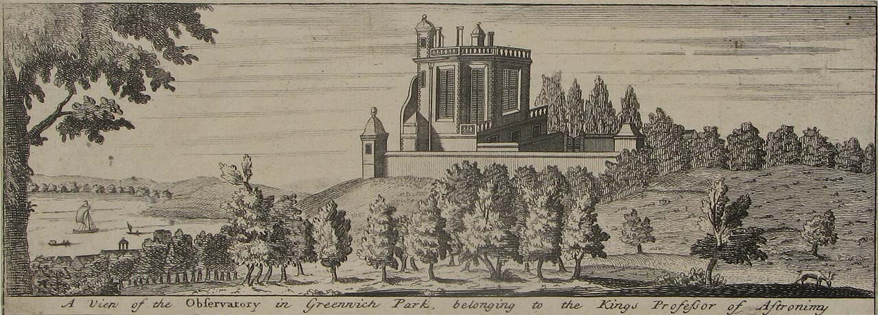
In this view, the western retaining wall can be seen in front of Flamsteed House. Although the thin strip of garden between the wall and the house is higher than the ground in the park, the height of the wall obscures it from view. A view of the Observatory in Greenwich Park belonging to the King's Professor of Astronimy published by John Bowles in 1723/4.
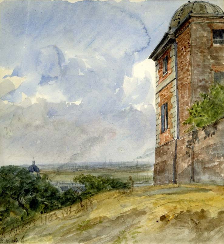
Looking northwards along the western boundary in about 1820. The West Dome (Western Summerhouse) is on the right and one of the domes of Greenwich Hospital on the left. A bush growing in the 1791 garden extension is overhanging the (invisble) railings above the new retaining wall. Watercolour signed T Hollis. © British Museum (museum number: 1929,0531.4)
The boundary moves west ... and the garden is enlarged
In 1791 when the Courtyard was enclosed to the east of the building, the boundary wall to its west was also realigned. The result was a widening of the garden by the width of the Summerhouse (about four metres). The existing garden being elevated above the Park and the boundary wall being a retaining one, a void was created which would have needed to be filled. It was probably at this time, that the Observatory’s second underground cistern was constructed for the storage of rain water. Situated half within the original curtilage, and half within the made up ground, it was located immediately to the south of the Western Summerhouse (which by then was referred to as the West Dome).
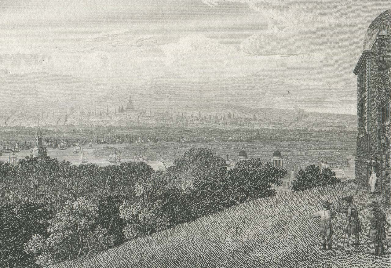
The same view about 10 years earlier. Here, the railings are clearly visible. View of London (from Greenwich). Engraved by George Cooke. Published by Longman, Hurst, Rees & Orme, 1 April 1809
The garden is lost to an extension of Flamsteed House
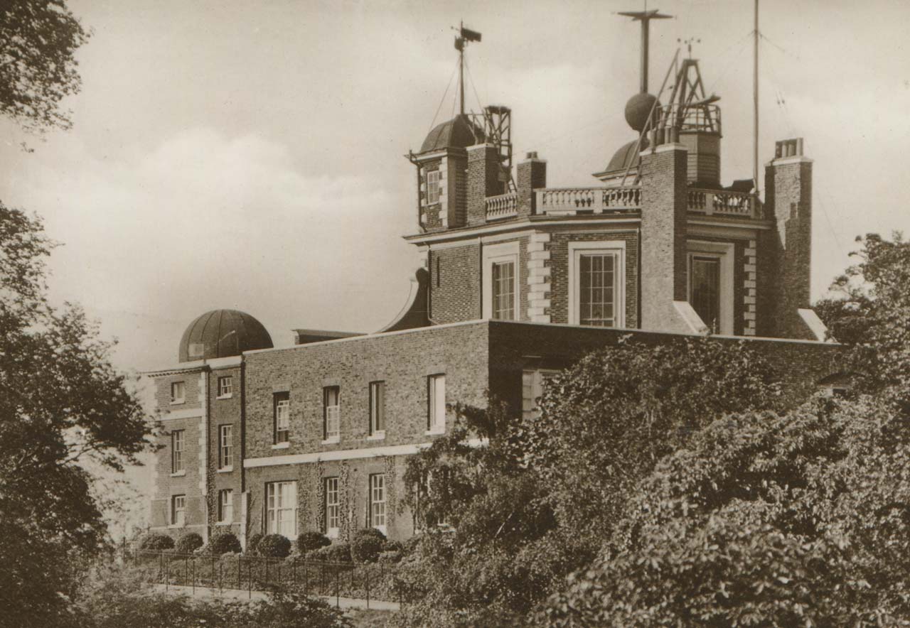
The whole of the extended garden was subsequently built over when a new wing was built onto Flamsteed House for Airy in 1835/6.
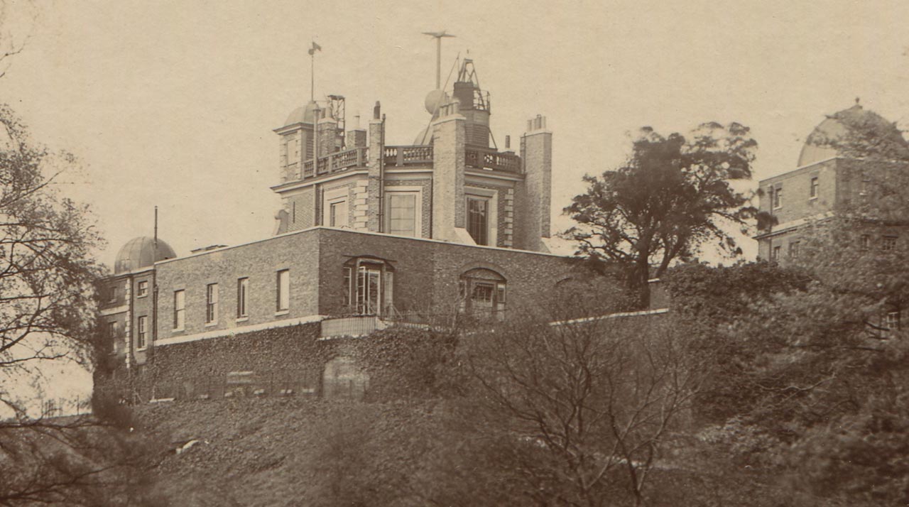
Taken at some point between 1888 and 1910, this image shows Airy's extension which was built on the strip of garden in 1835/6. Although the park still comes right up to the wall, there is now a fenced off path with seating for visitors to stop and admire the view. From a postcard published anonymously.
The boundary moves yet further west ... and a new garden is formed as a buffer from the Park
When Dyson was appointed Astronomer Royal in 1910, he required additional accommodation for his family. This was secured by excavating the basement below Airy’s extension. In order to secure a degree of privacy for the new basement rooms, Dyson negotiated a second boundary shift to the west. This is when the present slip of land was enclosed. Normally such an enclosure would have required the issuing of a Royal Warrant; on this occasion however, title to the land was retained by the Park and none was sought.
The same view in 1937–38. When the basement was excavated to create more living space in 1911, the Astronomer Royal was allowed to fence off an addition strip of land to protect his privacy by stopping people looking directly through the windows. Detail from a postcard published as part of the Excel Series
A question of ownership
In 1953, when a Royal Warrant was signed transferring most of the northern part of the Observatory site to the National Maritime Museum, this slip of land was, as before, retained by the Park. When additional lands on the south side of the Observatory site were later allocated for Museum use, the legal advice from the Treasury Solicitors (who dealt with such matters), was that a Royal Warrant was not needed to legitimise the transfer. None was therefore sought and none was issued. The view of the Treasury Solicitors was re-examined in 1978/0 when security issues relating to fencing and the possible erection of a security building for bag searches were under consideration. Again it was deemed that the Museum’s occupation of the land was legal and that the Warrant did not need amending. The Museum was never terribly happy with this arrangement, so when plans were being developed in the early 2000s to build a new planetarium on the southern part of the Observatory site, it wanted to make doubly sure of its legal right to occupy the land. In light of this, it was arranged for a new Royal Warrant to be issued that once and for all was supposed to adjust and clarify the boundary of the land that the Museum was entitled to occupy. Under the terms of this Warrant (which was signed in 2004), the slip of land transferred from the park to the Museum.
Cultivation of the Land
For the past few decades at least, the slip of land has not been cultivated, a dense undergrowth being allowed to build up (as a deterrent to intruders?). Things were rather different when Flamsteed House was still the residence of the Astronomer Royal when the gardens were planted with shrubs and routinely maintained.
© 2014 – 2026 Graham Dolan
Except where indicated, all text and images are the copyright of Graham Dolan