…where east meets west
- Home
- Brief History
- The Greenwich Meridian
- Greenwich
(1675–1958) - Herstmonceux
(1948–1990) - Cambridge
(1990–1998) - Outstations (1822–1971)…
- – Chingford (1822–1924)
- – Deal
(1864–1927) - – Abinger
(1923–1957) - – Bristol & Bradford on Avon
(1939–1948) - – Bath
(1939–1949) - – Hartland
(1955–1967) - – Cape of Good Hope
(1959–1971)
- Administration…
- – Funding
- – Governance
- – Inventories
- – Pay
- – Regulations
- – Royal Warrants
- Contemporary Accounts
- People
- Publications
- Science
- Technology
- Telescopes
- Chronometers
- Clocks & Time
- Board of Longitude
- Libraries & Archives
- Visit
- Search
The Meridian Garden
By the 1940's, the Observatory's main site at Greenwich occupied an area of 2.46 acres. This section deals only with the Meridian Garden. Other parts of the grounds are covered in the following sections:
The Courtyard
The Astronomers’ Garden
The Garden to the west of Flamsteed House
The Magnetic and South Grounds
The Observatory Garden (now part of the Royal Park)
The Christie Enclosure (now part of the Royal Park)
Location of the Meridian Garden
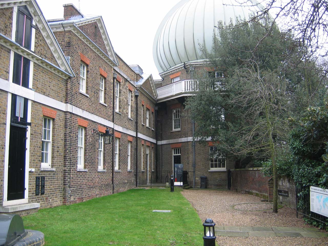
The Meridian Garden is the name that was given to the strip of land to the south (rear) of the Meridian Building following a major hard landscaping project that was completed in June 2009. It is where today’s visitors to the Meridian Line have to queue to pay their admission charge. The ground slopes upwards towards the west (the ticketing point). In days gone by, it sloped in the opposite direction.
Looking eastwards. June 2009
Looking westwards. June 2009
Origins and other names
The garden has its origins in a small thin flowerbed dating from 1676 that existed on the south side of the Observatory grounds beneath the retaining wall of Flamsteed’s Quadrant and Sextant Houses (the present ticketing point). In around 1749, additional land was enclosed to enable Bradley to build his New Observatory (now part of the Meridian Building) and the garden was much enlarged. It was extended further eastwards in 1791 when the Observatory Courtyard was enclosed. At this point, the garden was bounded by a retaining wall to the south a wall to the east, the Meridian Building to the north, and the stables (now a plant room) to the west. By the 1840s, the garden was being referred to as the Middle Garden, a name retained throughout Airy’s period of office and subsequently used by the National Maritime Museum from 1967 until the start of the 1990s.
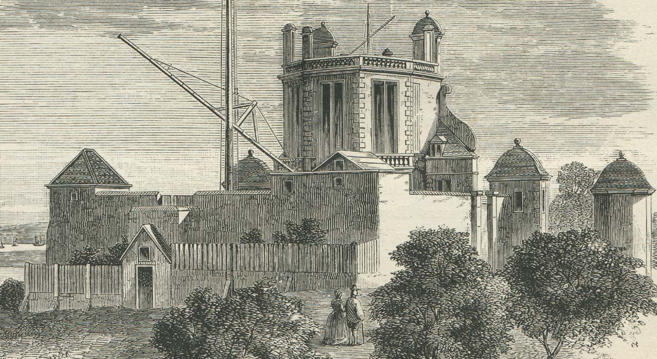
The Royal Observatory in Flamsteed's Time (detail). Flamsteed's Quadrant and Sextant Houses are in the south-east corner immediately above the two figures. The fenced off garden below them now forms the western end of the Meridian Garden. Redrawn for Dunkin from an engraving by Francis Place after Robert Thacker c.1676 and published in the 1862 volume of The Leisure Hour and in the 1891 edition of The Midnight Sky
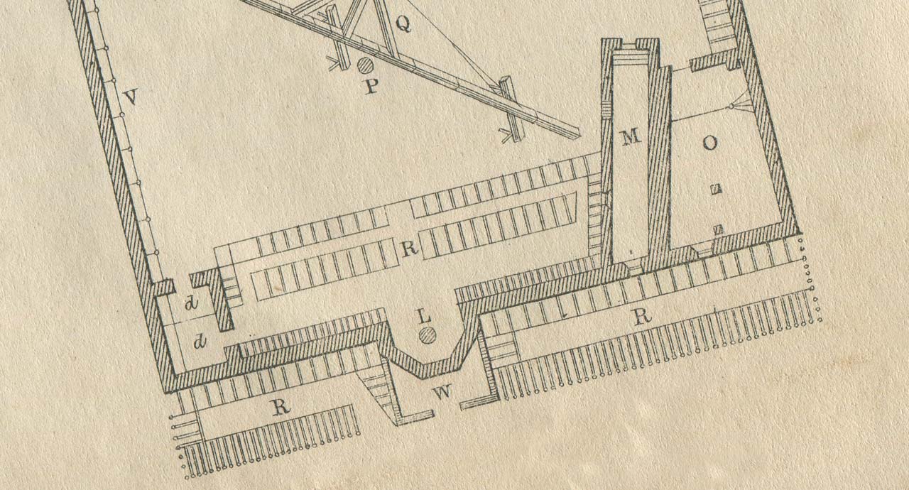
Plan of the Observatory c.1676 (adapted detail). Selected Key: (M) Flamsteed's Quadrant House, (O) Flamsteed's sextant House, (W) Garden Room / Potting Shed, (R) flower gardens. Redrawn by Airy from an engraving by Francis Place after Robert Thacker and published in the 1862 volume of Greenwich Observations
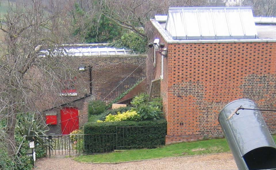
The red-brick wall on the right is the eastern wall of Flamsteed's Sextant House as restored to its original state in the 1960s. The right-hand section of the garden behind the fence to its left was enclosed in Flamsteed's time. The section to its left behind the gate is part of the additional land enclosed in 1749. The building with the red door is the former stable block that was converted into a garden room by Airy. The external steps running up its wall link the Meridian Garden to the Upper Garden (now called the Astronomers' Garden). They were in existence by 1836 but are not shown on Pond's plan of 1831 (RGO6/45/15). This shows a pair of outbuildings on the site of the single outbuilding shown on the eighteenth-century plan below. Photo: February 2005
As the route to the stables
After the 1749 extension, the garden had two levels, divided by a retaining wall that ran parallel to the Meridian Building. The upper level was planted out. The lower level had double gates set into the wall at its eastern end and gave access to the stables. The land sloped gently downwards towards the stables. The boundary wall to the south sloped likewise. The wall between the two levels was later removed – most probably when the garden was extended in 1791.

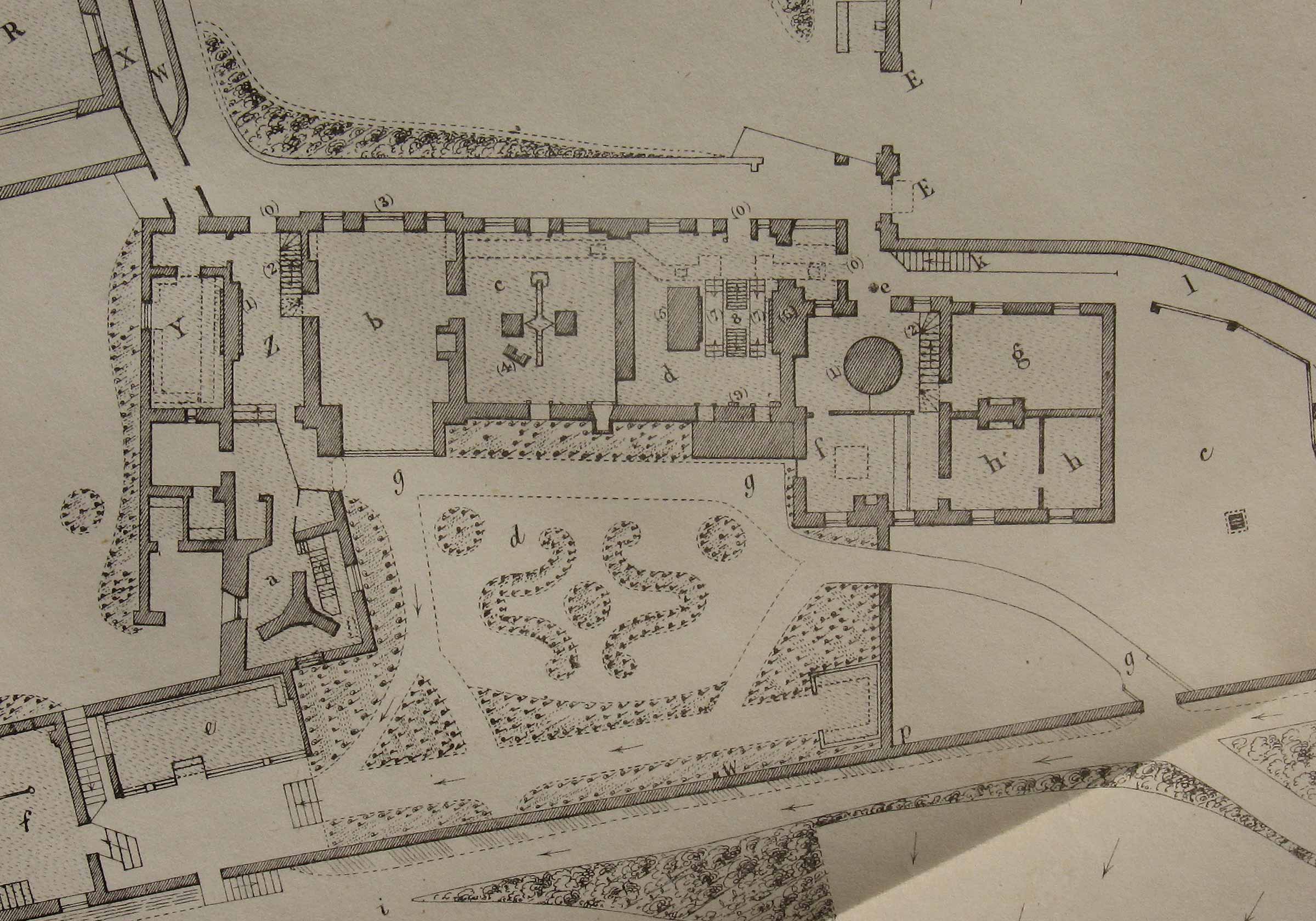
Plan by John Evelegh (annotated detail). Drawn between 1764 and 1773 and republished in QJRAS in 1963. Key: (Q) Bradley's Quadrant House, (T) Bradley's Transit House, (FQS) Flamsteed's Sextant House which had just been converted to house a 40-inch moveable quadrant, (G) kitchen? garden, (S) stables (two stalls), (E) entrance to the stables from the Park, (A) slope leading down to the stables, (O) an outbuilding, possibly a hot-house (on land enclosed in Flamsteed's time). G, O & A together formed part of what was later know as the Middle Garden
The Kitchen Garden and Drying Ground
A plan dated 1813 (Work16/126), indicates that at that time, the garden was in use as a kitchen garden. It was at this time, that a further piece of land was enclosed immediately to the east and the wall between them partially removed. The new piece of land became known as the Drying Ground. The following year, the first section of the Lower Garden was enclosed for use as a new Kitchen Garden.
A change of use in Airy’s time
With Airy’s arrival in 1835, the stables ceased to be used for horses and were converted into a garden-house. The Middle Garden was laid out with ornamental flower beds and a rustic looking gazebo at its eastern end on the site of Flamsteed’s well telescope. A new access point from the Upper Garden (Astronomers’ Garden) was created in 1835/6 by the building of a steep flight of steps on the east side of the stables. At the same time, a second set of steps was built from the Middle Garden down to the Lower Garden. Both still survive, though those to the lower garden are now permanently blocked. The ground at the entrance to the stable was leveled, and an old outhouse either converted into, or rebuilt as a hot-house (greenhouse). The creation in 1856/7 of the Tower Passage – a sloping passageway that Airy cut through the ground story and basement of the Altazimuth Tower (on the site of Flamsteed’s Observatory) to give easier access from the Upper Garden to the Middle Garden – required a reconfiguring of the paths and flowerbeds in the Middle Garden. This new layout appears to have remained unchanged until the 1960s, when the Meridian Building was adapted for museum use.
The Meridian Garden in 1847. Detail from a plan published as an addendum to the 1845 volume of Greenwich Observations. Selected Key: (c) Drying Ground, (d) Middle Garden, (e) hot-house, (f) Garden House (the former stables), (g) path, (p) site of Flamsteed's Well Telescope. Although the hot-house no longer exits, the steps into it shown on the plan do still survive
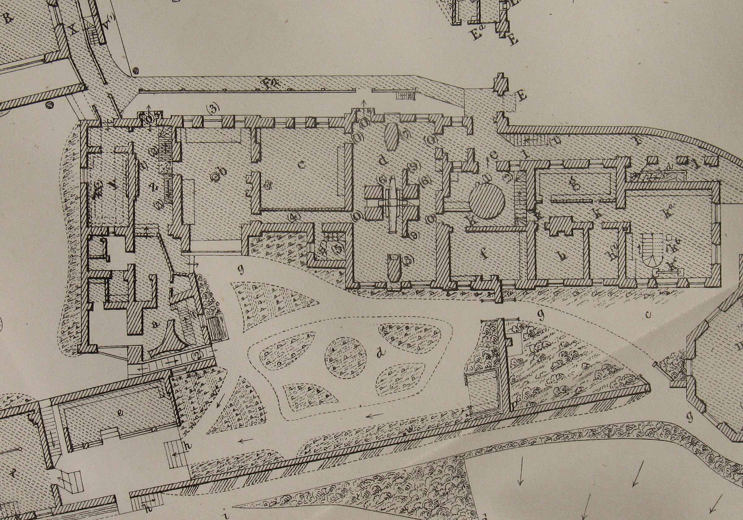
The Meridian Garden in 1863. Detail from a plan published as an appendix to the 1862 volume of Greenwich Observations. Selected Key: (c) Drying Ground, (d) Middle Garden, (e) hot-house, (f) Garden House (the former stables), (g) path, (p) site of Flamsteed's Well Telescope. The tower passage is located directly above the hot-house and is marked (2). Part of the Great Equatorial Building can be seen on the right as well as Airy's 1863 extension to the Meridian Building
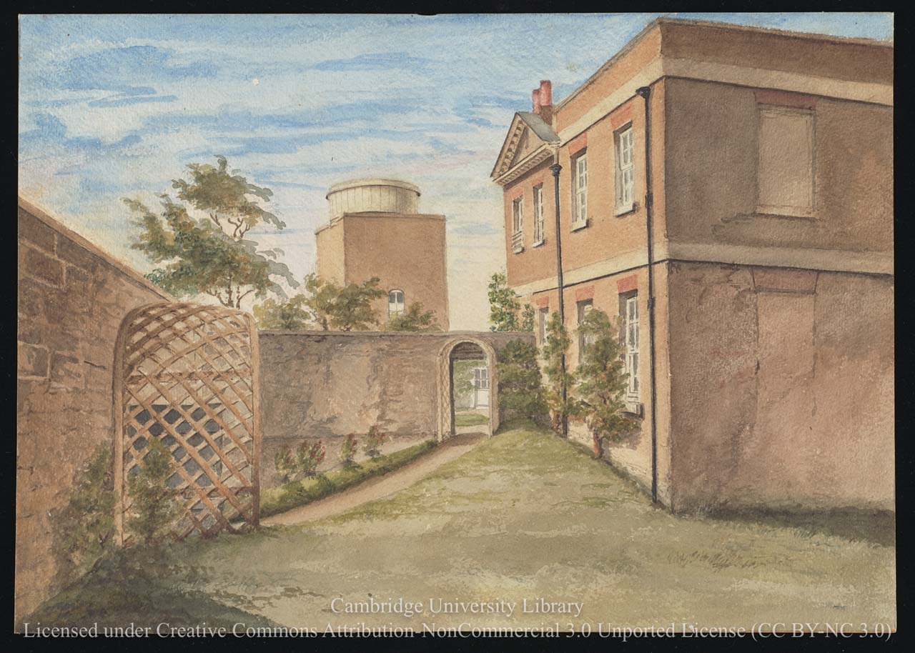
Looking westwards from the Drying Ground towards the South Dome which was erected in 1844 to house Airy's Altazimuth Telescope. A plan from 1831 (RGO/45) shows the wall in front of it with no opening in it. Three later plans, all dated 4 March 1836 (RGO6/45/9-11), show an opening in the centre rather than in the position shown here. The path though the opening led to the Middle Garden. If the new Magnetic Observatory had been built on the site originally selected by Airy, the left side of the wall would have had to have been demolished as one third of the proposed building would have been in the Middle Garden and two thirds in the Drying Ground (RGO6/45/9-11). The wall between the Middle Garden and the Drying Ground was erected when the garden was extended and the Courtyard enclosed in 1791. It marked the eastern boundary of the grounds until they were extended again in 1813. The building to the right is the Meridian Building before it was extended towards the viewer in 1863. The artist, (probably Airy's daughter Christabel), was standing on the site of the yet to be built Great Equatorial Building that was constructed in 1858. Watercolour painting dated 10 July 1847. Reproduced under the terms of a Creative Commons Attribution-Non-Commercial 3.0 Unported License (CC BY-NC 3.0) courtesy of Cambridge Digital Library (see below)
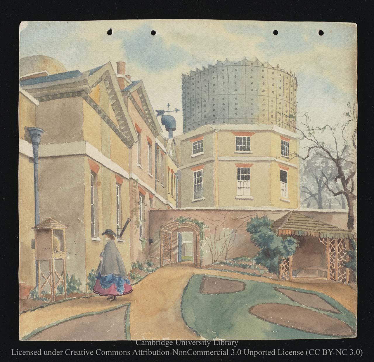
Looking eastwards from the Middle Garden towards the recently completed Great Equatorial Building. The archway led through to the Drying Ground. The summerhouse on the right occupies the western end of the site originally selected by Airy for his Magnetic Observatory. Watercolour painting by Chritstabel Airy, March 1863. Reproduced under the terms of a Creative Commons Attribution-Non-Commercial 3.0 Unported License (CC BY-NC 3.0) courtesy of Cambridge Digital Library (see below)
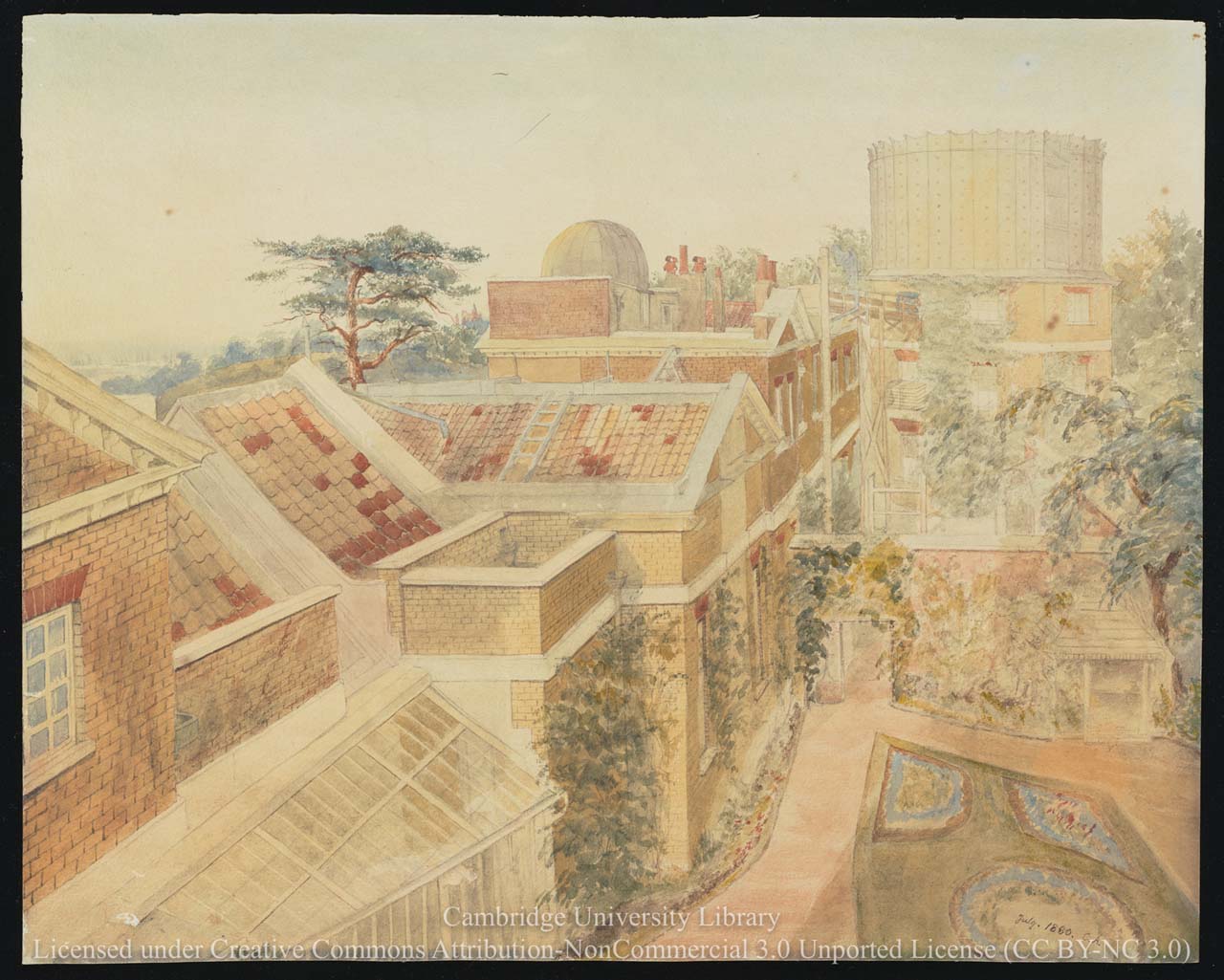
Looking eastwards across the Middle Garden towards the Great Equatorial Building from the South Dome. The hot-house is not shown in the plan of 1863 (above). Watercolour painting by Chritstabel Airy, July 1880. Reproduced under the terms of a Creative Commons Attribution-Non-Commercial 3.0 Unported License (CC BY-NC 3.0) courtesy of Cambridge Digital Library (see below)
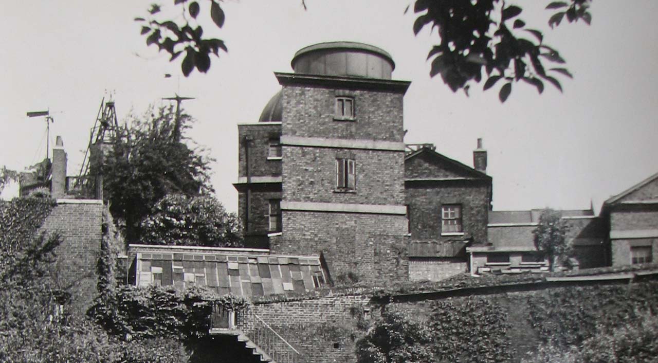
The hot-house in about 1944. The steps in front of it go down to the Lower Garden (now know as the Observatory Garden and from where the photo was taken). The garden-house (former stables) is located to its left. Although the photographer is not recorded, it is likely to have been Cecil Beaton who, at the request of the Ministry of Information, made a photographic survey of the Observatory and its departments in the reporting year 1944/5. Detail from Ministry of Information photograph D.24699, courtesy of Hillary Buckle
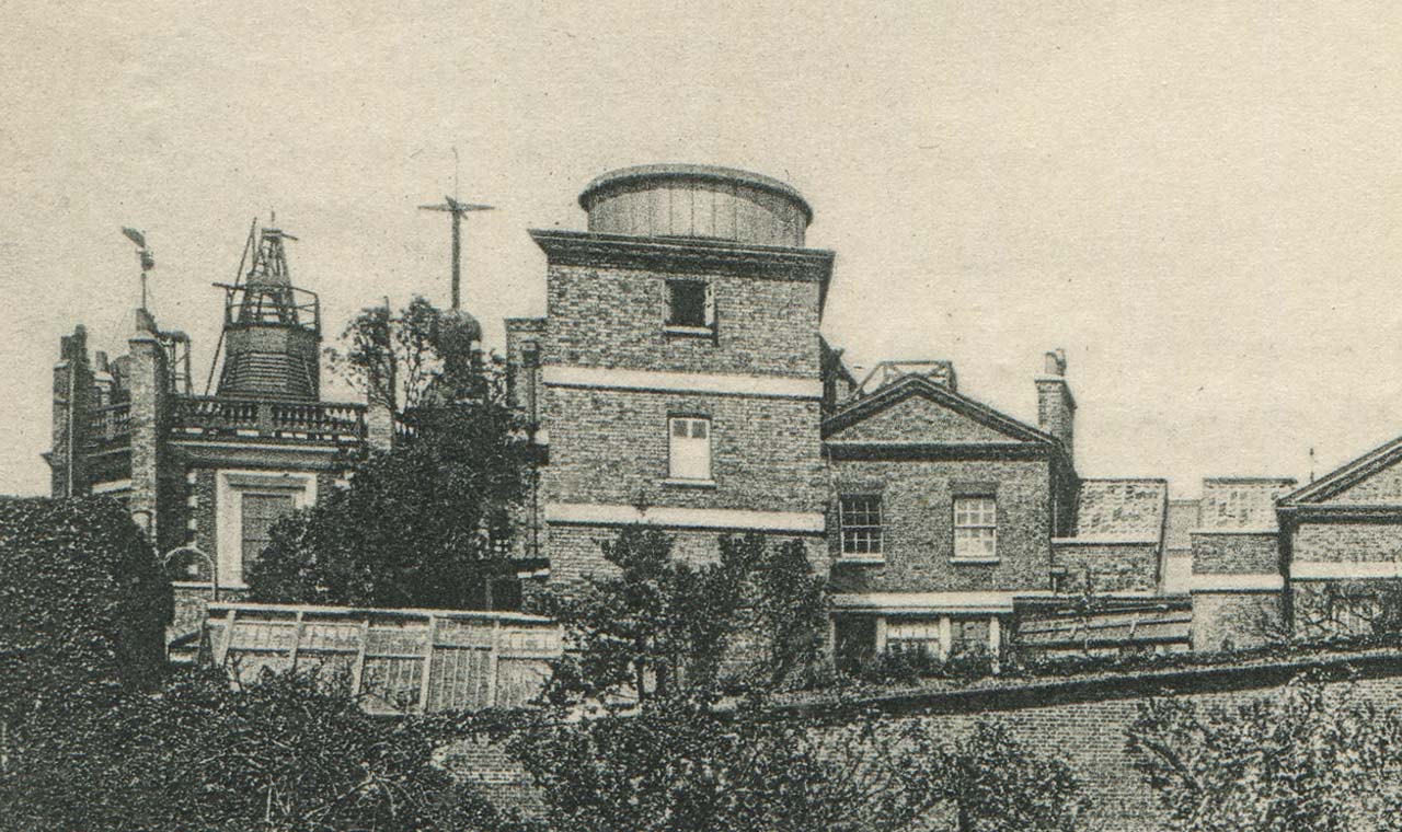
The same view in about 1893–97. Detail from a postcard published by Edmund Düsédau
Looking eastwards from the centre of the Middle Garden in about 1905. Photo courtesy of Hillary Buckle
The scaring left when the wall dividing the Middle Garden from the Drying Ground can be seen immediately to the left of the window. The top of the wall reached ¾ of the way to the top. July 2018
Changes instigated by the National Maritime Museum and the discovery of Flamsteed’s Well
In the 1960s, the wall between the middle garden and the drying ground was removed and the garden re-landscaped.
During these works, the site of Flamsteed’s Well Telescope (long a subject of conjecture) was discovered buried partly beneath the southern wall and partly beneath the wall that separated the Middle Garden from the Drying Ground. The area around the well was subsequently fenced in and a sign errected carrying the words:‘site of Flamsteed’s Well Telescope 1676’. A wide gravel path ran along the boundary wall on the south side a, whilst the north side was laid to lawn. The path of the Meridian across the garden and up the boundary wall was marked in a similar manner to the way it had been marked in the courtyard in 1960 – with a brass strip set into narrow stone slip. Public access to the garden was originally from the Meridian Building via the point at which visitors currently pay their admission charge. It was probably not always open.
In 1984, the Astronomer Royal and Prince Philip planted trees in the lawn on either side of the Line to commemorate the centenary of the International Meridian Conference in 1884. They either died fairly soon after, or were removed in 1992/3 when the buildings were refurbished and the courtyard closed to the public for the duration of the works. To reduce the disappointment of those visiting the observatory at this time, the Meridian Garden was opened so that the public could still take a photograph on the Line. It was probabaly then that the fencing around the site of Flamsteed’s Well Telescope was removed and the position of the well marked with a circle of bricks on the ground – not in the true position partly under the southern wall, but slightly to its north. It was probably after the Courtyard reopened that a railing and gate (since removed) were erected at the east end of the garden adjacent to the Great Equatorial Building.
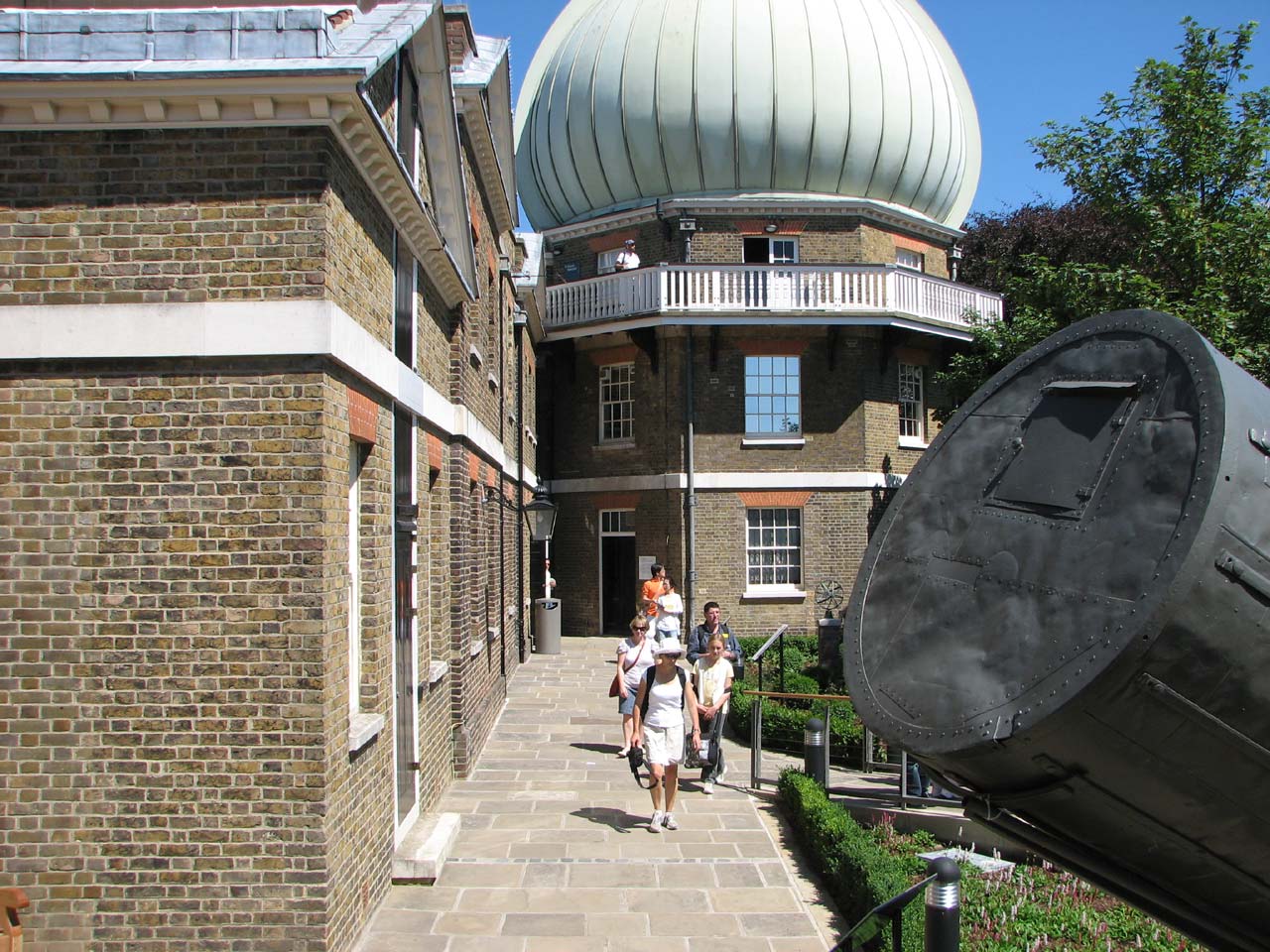
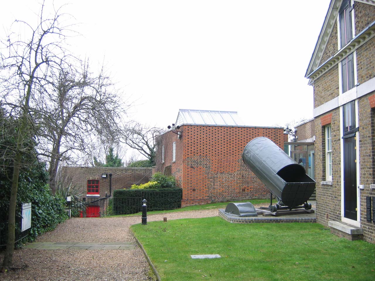
When the National Maritime Museum took over the Observatory site, its staff continued to make meterological measurements for the Met Office, some being made at the Observatory and others from a Stevenson’s Screen set up specially for the purpose in the Museum’s grounds close to the Queen’s House. In the 1990s, it was realised that placed as it was in the middle of the lawns, it was preventing the erection of marquees there for corporate and other events. The Stevenson’s Screen was therefore moved to the Meridian Garden – a less than ideal position due to the proximity of the buildings and trees. It remained until about 2004 when it was removed and Greenwich ceased to be a weather station. Its position was taken by the remains of Herschel’s 40-foot telescope which were moved there from outside the South Building to make way for the building of the Peter Harrison Planetarium.
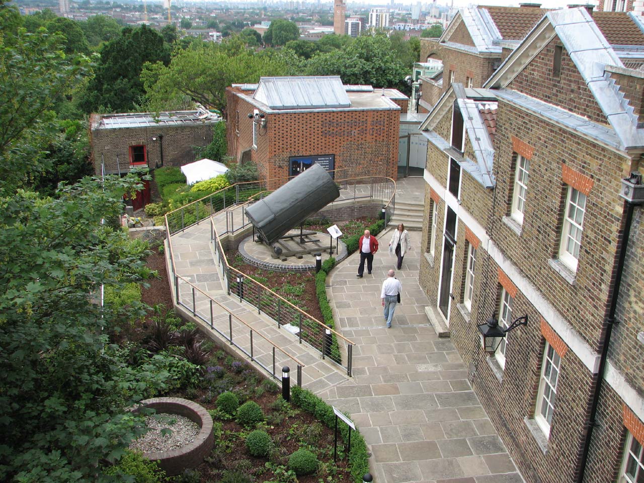
Looking Eastwards. February 2005
Looking westwards. February 2005
Concreting over of the garden
By 2007, visitor numbers to the Observatory were such that the existing entry point to the site was becoming congested. Rather than go back to the old ways and allow access to the Courtyard directly from the Park, the National Maritime Museum decided instead to experiment with what has become the present entry route via the Meridian Garden. After a trial, planning permission was sought to hard landscape the garden with a view to making the route permanent. This was granted on 13 November 2008 and works rapidly put in hand to reroute services, remove the lawn and create a new broad path in York paving, incorporating a heated ramp for disabled access. The one remaining tree was felled in March 2009. The building of the ramp reversed the slope of the garden. As a result, the ground adjacent to the central section of the southern boundary wall was to become so perilously close to its top, that the erection of new railings alongside it was required. But before they were installed, the upper section of the wall was rebuilt. The York Stone was recycled from the main site of the National Maritime Museum, where it was removed to make way for the Sammy Offer Wing.
The site of Flamsteed’s Well Telescope was remarked as was the line of the Meridian. The Meridian was marked across the new path in granite setts but an inch or so too far to the west. The old brass strip however was not removed. It remains buried under the concrete foundations of the path and under the plantings in the flower boarder. Click here to read more about the history of the marking of the Meridian Line in this garden.
A contribution of £163,000 towards the cost of these works and the hard landscaping that took place in the neighbouring Astronomers’ Garden at the same time, came from the reserves of the Friends of the Museum, a charitable organisation that was wound up in 2007 (Museum Report, 2009).
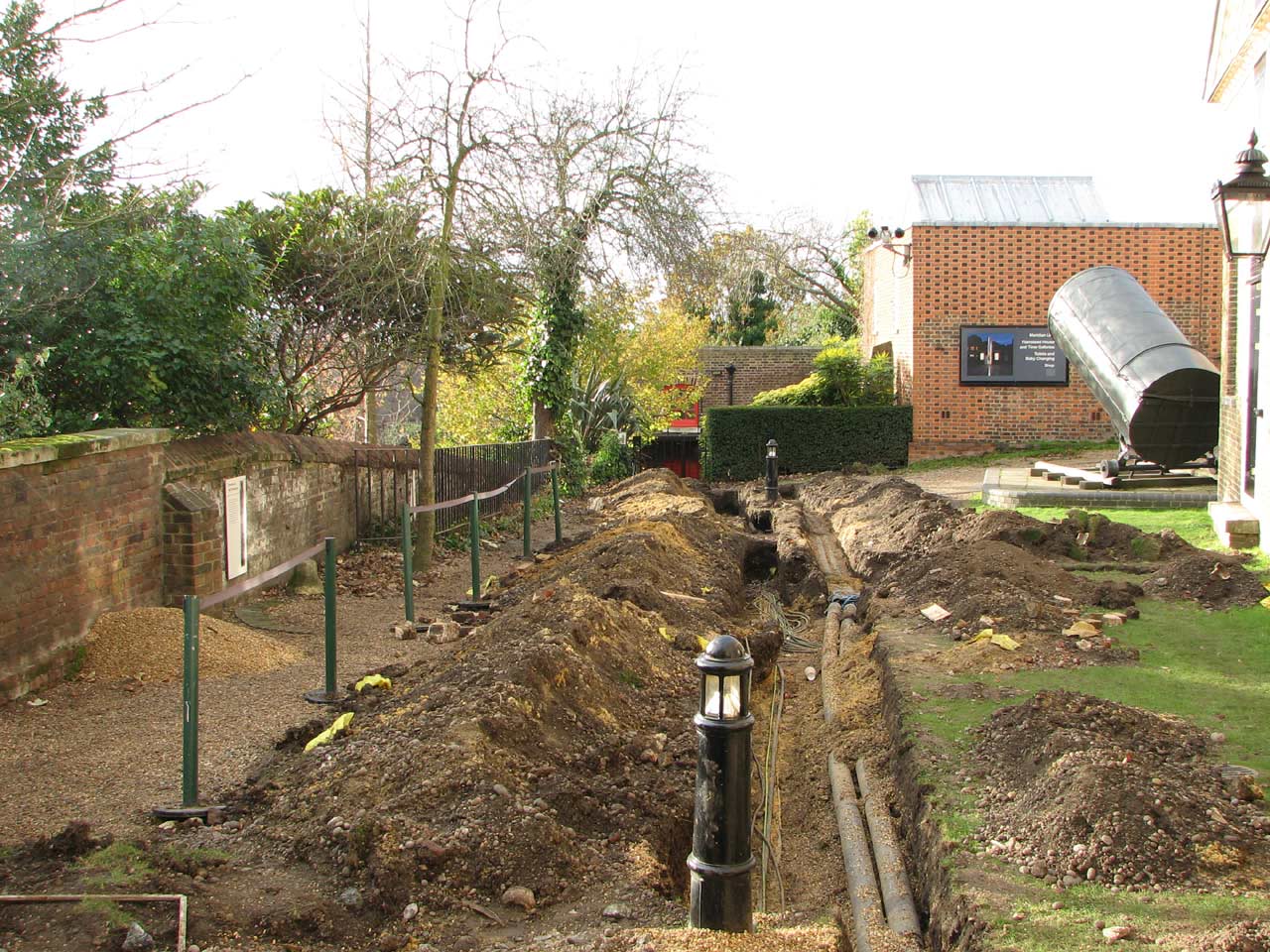
Re-routing the services. 27 November 2008
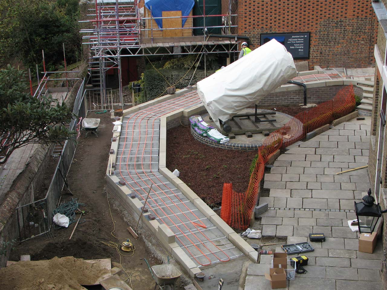
The heating cables under the ramp up to the ticketing point. 27 March 2009
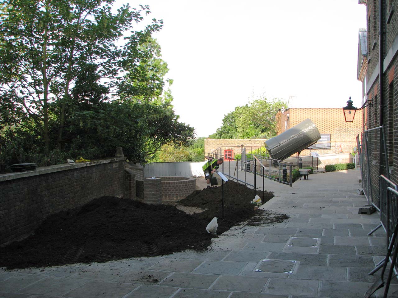
Filling the boarders with top soil. 4 June 2009
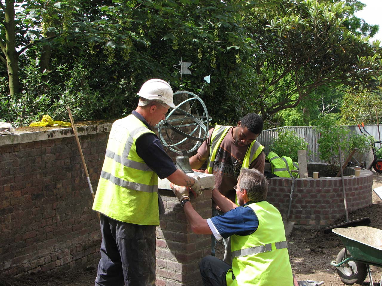
Placing the armillary sphere on its plinth. 4 June 2009
Image licensing information
The images reproduced courtesy of Cambridge Digital Library have been reduced in size and are more compressed than the originals and have been reproduced under the terms of a Creative Commons Attribution-NonCommercial 3.0 Unported License. Links to the individual images are as follows: image 1, image 2, image 3.
© 2014 – 2026 Graham Dolan
Except where indicated, all text and images are the copyright of Graham Dolan