…where east meets west
- Home
- Brief History
- The Greenwich Meridian
- Greenwich
(1675–1958) - Herstmonceux
(1948–1990) - Cambridge
(1990–1998) - Outstations (1822–1971)…
- – Chingford (1822–1924)
- – Deal
(1864–1927) - – Abinger
(1923–1957) - – Bristol & Bradford on Avon
(1939–1948) - – Bath
(1939–1949) - – Hartland
(1955–1967) - – Cape of Good Hope
(1959–1971)
- Administration…
- – Funding
- – Governance
- – Inventories
- – Pay
- – Regulations
- – Royal Warrants
- Contemporary Accounts
- People
- Publications
- Science
- Technology
- Telescopes
- Chronometers
- Clocks & Time
- Board of Longitude
- Libraries & Archives
- Visit
- Search
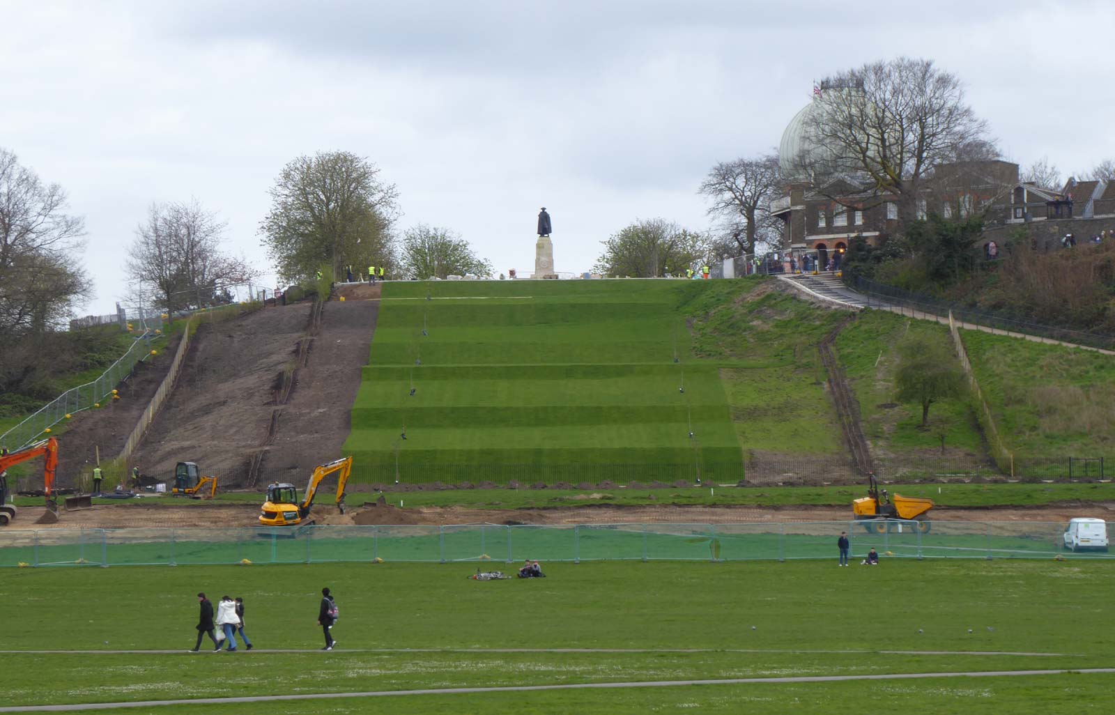
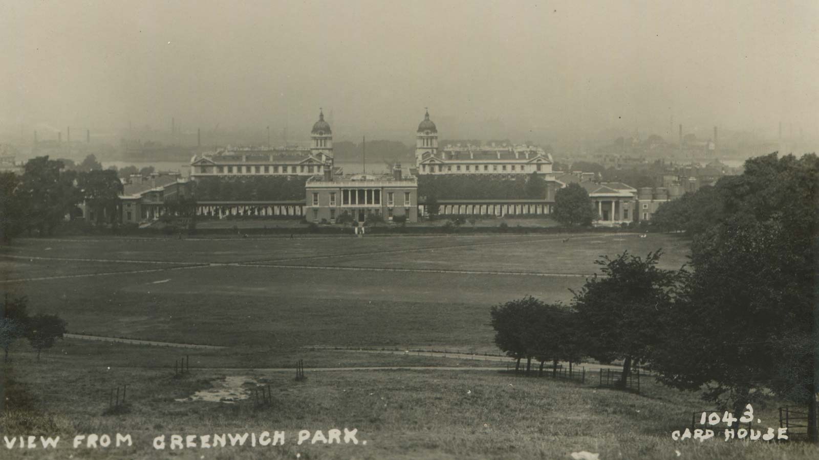
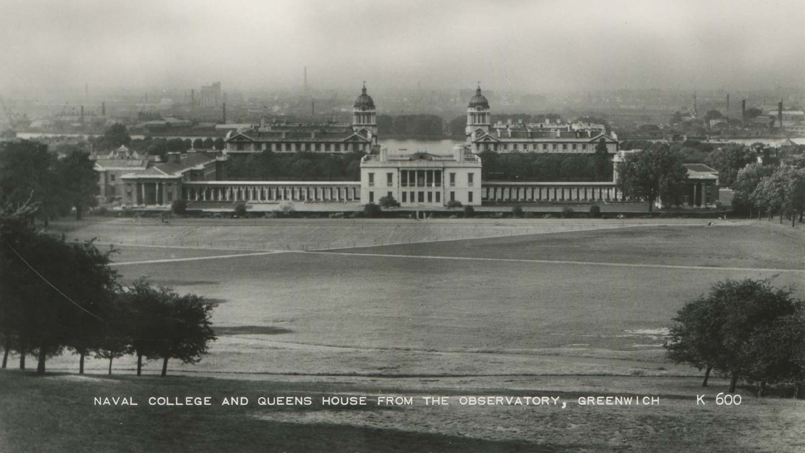
The Royal Observatory and the Giant Steps (the Grand Ascent)
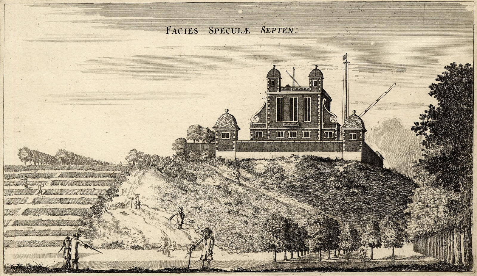
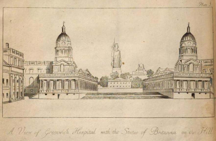
The Giant Steps (left) and the newly built Observatory (right). Facies Speculae Septen (North face of the Observatory), etching by Francis Place after Robert Thacker, c.1677. © The Trustees of the British Museum (CC BY-NC-SA 4.0). Museum number: 1865,0610.949
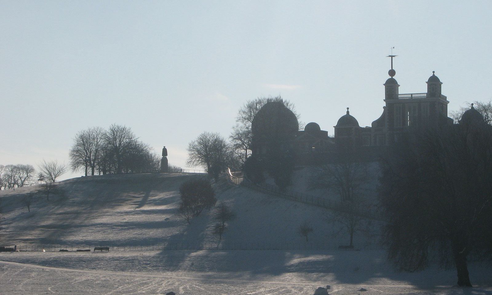
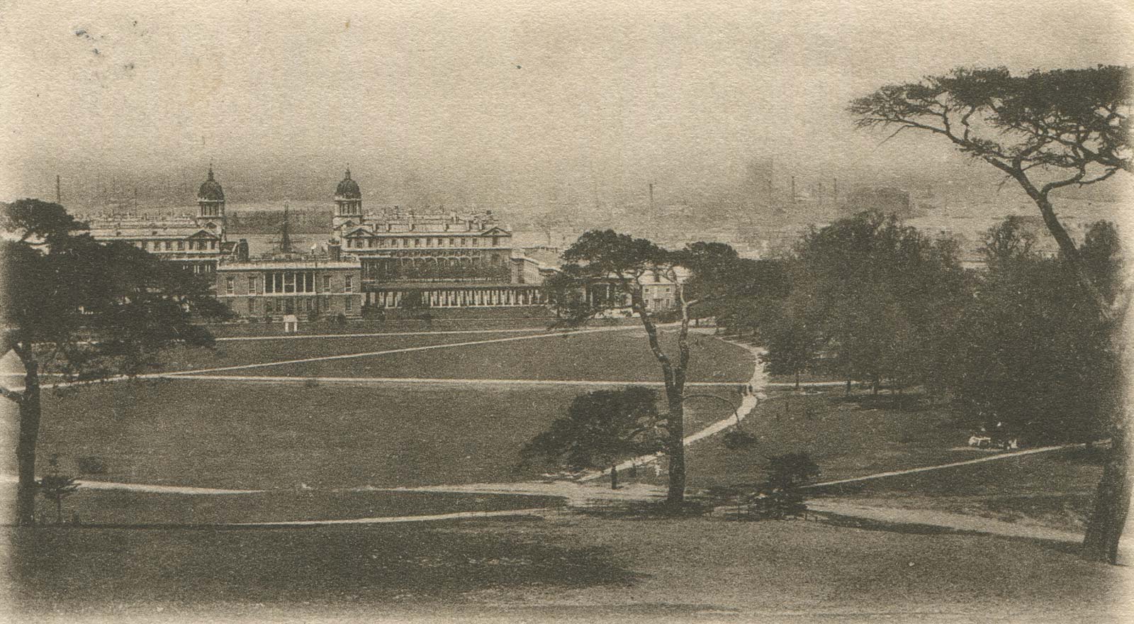
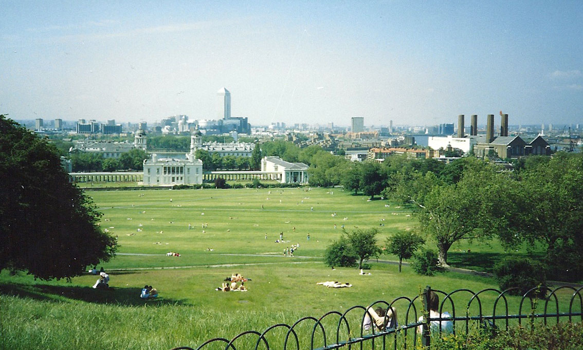
By the time this shot was taken from the grounds of the National Maritime Museum on 4 February 2009, just five steps were still visible. Also visible is the south embankment of the Parterre that ran beneath them (more on this below)
A brief summary of the Steps from the time of their creation to the present day
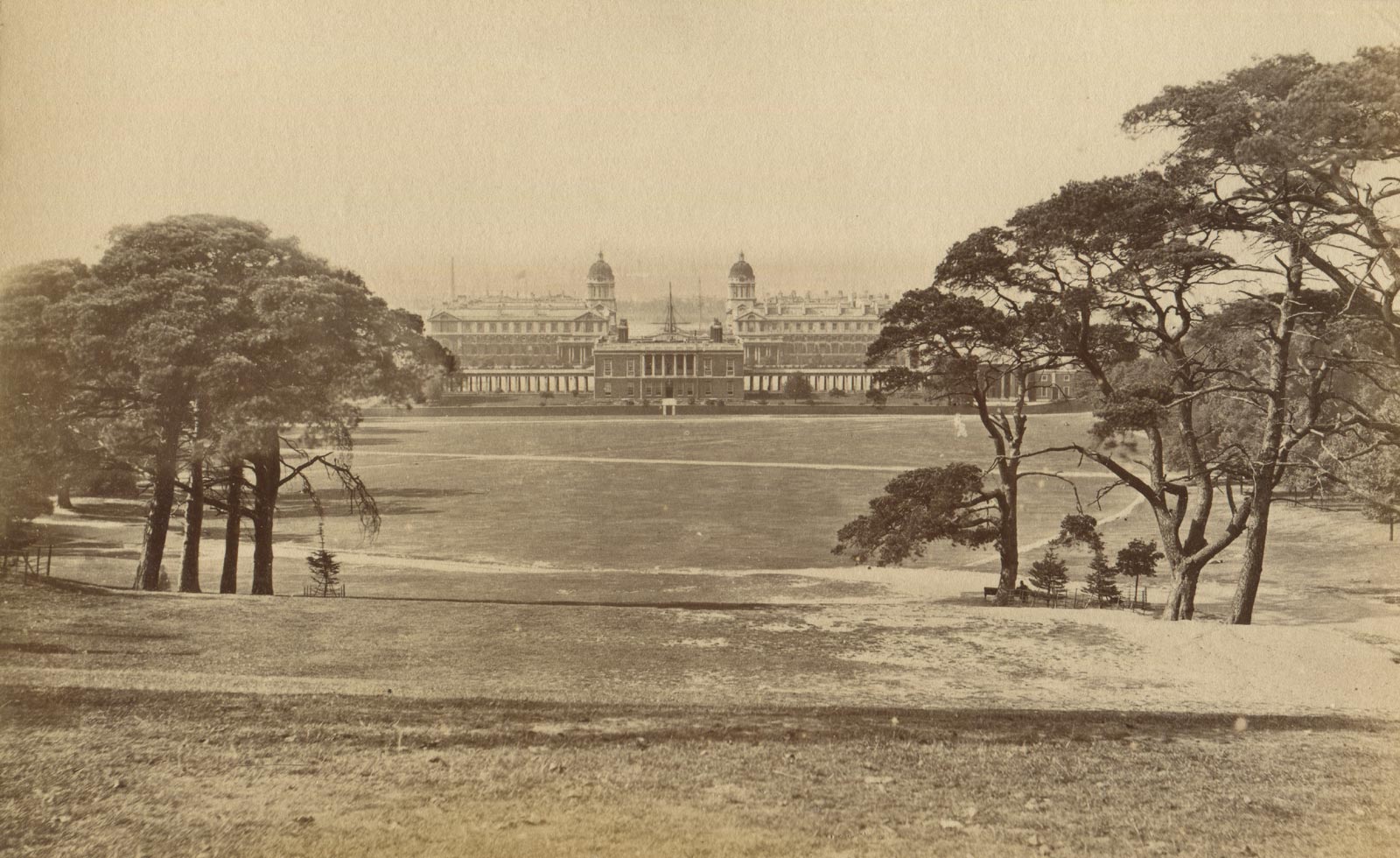
Greenwich has a long connection with Royalty. Henry VIII was born in the Tudor Palace, as were his two daughters Mary and Elizabeth. Construction of the Queens House began in 1616 and was completed in 1635 for Queen Henrietta Maria, the wife of King Charles I. Bridging over the London to Dover Road, it provided, for the first time, a direct connection between the Park (which had been created in 1433) and the Tudor Palace.
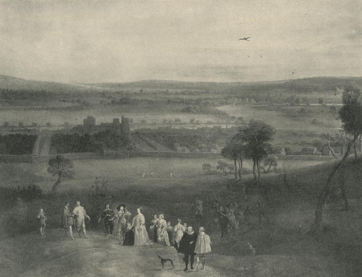
Charles I and Henrietta Maria with a group of courtiers in Greenwich Park in about 1632. The group are standing at the top of the hill near the Castle with the partially completed Queen's House behind them. From a photograph taken by the National Maritime Museum of a painting by Adriaen Van Stalbmt & Jan Van Belcamp in the Royal Collection and reproduced in George Chettle's monographThe Queen's House, Greenwich (c.1937). A link to the full colour version (RCIN 405291) on the Royal Collection Trust website is given below
Royal Collection Trust: RCIN 405291
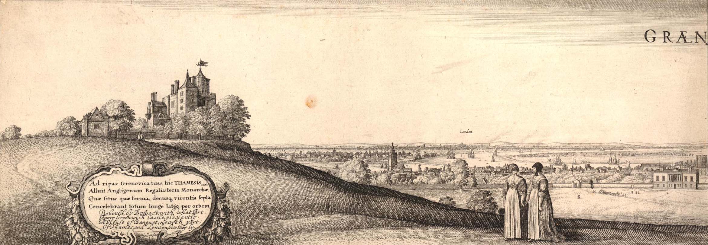
Detail from Wenceslaus Hollar's long view of Greenwich. Greenwich Castle can be seen on the left and the now completed Queen's house on the right. The etching was printed from two plates joined down the centre – a slightly cropped version of the left half being shown here. First published in 1637, this version (or state) was published in 1644 or after. © The Trustees of the British Museum (CC BY-NC-SA 4.0). Museum number: 1880,1113.5510 (see below)
Following the execution of Charles I in January 1649, Oliver Cromwell became Lord Protector, with the monarchy eventually being restored when Charles II returned from exile in 1660.
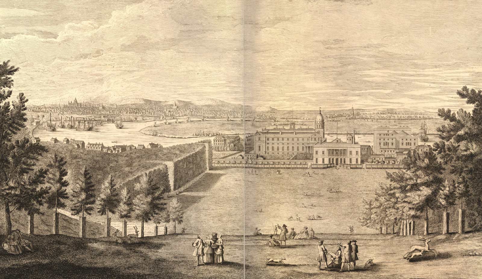
The 1660s were a hive of activity in and around the Park. In 1661, Charles II ordered the demolition of the now derelict Tudor Palace. John Webb was commissioned to design a new one and repair and enlarge the Queen’s House. Work started on the Queen’s House in August 1661 and on constructing the new Palace (now the Old Royal Naval College) in 1663. In 1661, work also began on re-landscaping the Park under the supervision of William Boreman. The following year, Pepys recorded in his diary entry of 11 April:
‘At Woolwich, up and down to do the same business; and so back to Greenwich by water, and there while something is dressing for our dinner, Sir William [Penn] and I walked into the Park, where the King hath planted trees and made steps in the hill up to the Castle, which is very magnificent.’
Six months later, the Dutchman William Schellinks also noted the steps in his journal, recording in the entry for 25 October 1662:
‘On the hill in the park behind the [Queen’s] house two avenues of trees had been planted from the bottom to near the top of the hill, where it was too steep to climb up, steps had been cut into the ground to walk up in comfort.’
The steps that both Pepys and Schellinks referred to were a series of grass terraces or ‘ascents’ which later became know as the ‘Giant Steps’. Directly in line with the centre of the Queen's House, they formed part of a grand axis about which the park was to be transformed from a place used for hunting to a park and garden in the French style to rival those of France. Although no plans or other records of their work survive, it is suspected that the two Frenchmen, André and Gabriel Mollet were involved in the early stages of the Park's redesign as there is a warrant from August 1661 that refers to them as the 'designers of all his [the King's] gardens for altering them and making them into the neatest formes'.

Andre Le Nôtre (1613–1700). Bronze copy made in 1913 by Adrien-Aurélien Hébrard from the original marble bust by Antoine Coysevox on the tomb of Le Nôtre in l'église Saint-Roch, Paris. Photographed October 2012 in the Jardin des Tuileries. Louvre inventory number: TU 108
Drake's footnote relating to the laying out of the Park
In May 1662, André Le Nôtre (who was designing the gardens for Louis XIV at Versailles), was asked to contribute to the designs. The only record of his input however is an annotated plan for a Parterre on the more level ground between the Queen’s House and the bottom of the Giant Steps (now often referred to as the Queen's field). Whether this was a new feature or a modification of a parterre designed by the Mollets is not known. As proposed, it was to have a large circular fountain at its southern end centred on the grand axis and two smaller octagonal fountains near the Queen's House symmetrically located on either side. In the event, the plan was abandoned, but not before the area had been levelled and the earth banks on either side and at the southern end had been constructed and avenues of trees planted on the eastern and western banks. Also abandoned, were plans to build a water cascade down the Giant Steps. The southern and western banks of the Parterre, the latter with its trees, can be seen (bottom right) in the etching at the top of the page.
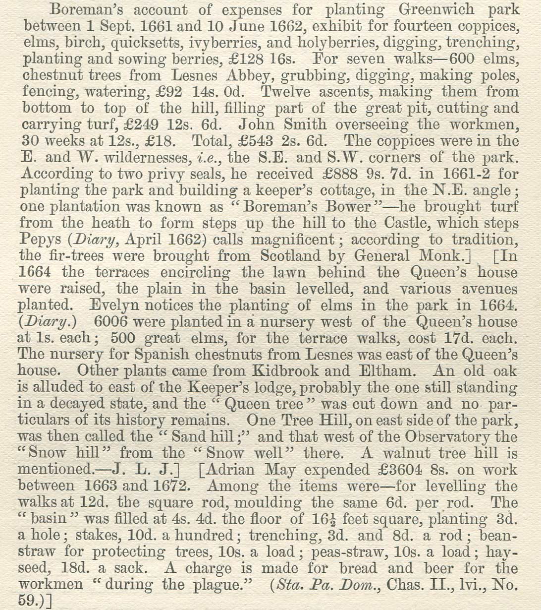
In 1886, in the first (and only) volume of his updating of Hasted's History of Kent, Henry Drake gives the following commentary about the setting out of the park in a footnote on p.66:
'Boreham's account of expenses for planting Greenwich Park between 1. Sept. 1661 and 10 June 1862, exhibit for fourteen copices, elms, birch, quicksetts, ivyberries, and holyberries, digging, trenching, planting and sowing berries, £128 16s. For seven walks - 600 elms, chestnut trees from Lesnes Abbey, grubbing, digging, making poles, fencing, watering, £92 14s. 0d. Twelve ascents, making them from bottom to top of the hill, filling part of the great pit, cutting and carrying turf, £249 12s. 6d. John Smith overseeing the workmen, 30 weeks at 12s., £18. Total, £543 2s. 6d. ... According to two privy seals, he received £888 9s. 7d. in 1661-2 for planting the park and building a keeper's cottage, ... he brought turf from the heath [Blackheath] to form steps up the hill to the castle ... '
A study of historic maps, paintings, prints and photographs suggests that over time the steps were repaired of rebuilt, their number seemingly being reduced to just five or six. By the start of the twenty-first century, although much eroded, traces of a few Steps were still visible as was the outline of the Parterre, which was still demarked by rows of trees – albeit not those originally planted.
Meanwhile, back in the 1980s, Land Use Consultants (LUC) had been commissioned by the Directorate of Ancient Monuments and Historic Buildings (DAMHB) to conduct an historical survey of the Park. Published in 1986, their study included several references to proposals from the 1950s onwards, for the reconstruction of the Giant Steps – none of which came to fruition.

Trees in Greenwich Park Seventh Report of the Advisory Committee on Forestry
In 1964, the seventh report of the Advisory committee on Forestry titled Trees in Greenwich Park was produced for the Ministry of Public Buildings and Works (which was responsible for the Park until 1970). It made a series of recommendations that included the restoration of the Giant Steps.
Finally, in 1970, a firm proposal to restore the Giant Steps in time for Easter 1975 for National Heritage Year was in hand with the appointment of Shepheard & Epstein to do the design. According to (LUC) their proposal was for 'a "modern interpretation" of the 17th century concept with '8 terraces and 9 slopes, a broad flight of steps on each side and a viewing platform at the top. Shepheard also proposed reinstating the lower terraces [presumably those around the parterre] and removing the paths that ran across them. In June 1973, the proposals were put on display in the Queens House. That some year, work on the Steps was 'postponed because of escalating costs' with just the the new viewing platform scheduled to go ahead. It is hoped to write more about this scheme as an appendix at a future date. The catalogue of Shepheard's archive can be viewed here.
Over 40 years later, in December 2017, the Royal Parks were awarded a grant (£282,600) by the Heritage Lottery Fund and the Big Lottery Fund under the 'Parks for People' grant programme to work out the detail of its 'Greenwich Park Revealed' project to restore the historic landscape, improve visitor facilities, and provide more opportunities for volunteering, learning and work experience.
Some fifty-five years after the 1964 report was published, a planning application was finally submitted to the Royal Borough of Greenwich on 13 December 2019 to improve the Park and reinstate some of the seventeenth century features, including the Giant Steps and aspects of the Parterre. On 15 January 2020, the Royal Parks issued a press release stating that a (further) grant of £4.5million (£4,517,300) had been secured from the National Lottery Heritage Lottery fund and the National Lottery Community Fund towards the total cost of Greenwich Park Revealed whose total projected cost was stated as £10,500,000. A later announcement of the Park's Facebook page gave the total cost of the project as £12,000,000.
This piece, which was written in 2024, explores how the visual relationship between the Ascent and the Observatory has changed over time by examining:
- The impact on the Steps of the two expansions of the Observatory site in 1791 and 1813
- When and why the rows of trees at the end of the steps were first planted and when they were subsequently replaced
- How the Steps changed over time and whether this was a result of erosion or reconfiguration
- How the grand axis with its newly recreated steps compares with what is known about the seventeenth century designs that were originally executed.
The following two planning applications lodged with Royal Borough of Greenwich are relevant to the reconstruction of the Giant Steps.
Reference |
Detail |
Approved |
|
| 19/4305/F | Various works to Greenwich Park including … landscaping and planting enhancements including the reinstatement of the Grand Ascent or Giant Steps and Parterre Banks ... |
4 Sep 2020 | |
| 23/2509/SD | Submission of details pursuant to the discharge of Conditions 8 (Giant Steps Final Details) and partial discharge of Condition 11 (Landscape Restoration Method Statement) of planning permission 19/4305/F dated 04/09/2020 | 14 Nov 2023 |
The above links time out after a while and need to be refreshed from time to time.
The intended viewpoint and the cutting of the grass
When the Queen's house was built, it had a loggia on the first floor from which members of the Royal party were able to observe hunting and other activities in the Park. The way that the Park was landscaped in the 1660s put the loggia at the very centre of things and would have provided the perfect spot to view the Parterre with its intended fountains as well as the Giant Steps beyond. The great unknown is how the steps would have originally appeared from this view-point especially as the slope of the hillside is not (and presumably was not) even. It is easy to imagine that they may have been made to have an even appearance when viewed from the loggia – a view supported by the fact that the treads of the steps are shown with different depths in the Francis Place etching below (Prospectus Orientalis), but have a uniform appearance in the Francis Place etching (Facies Speculae Septen) at the top of the page.
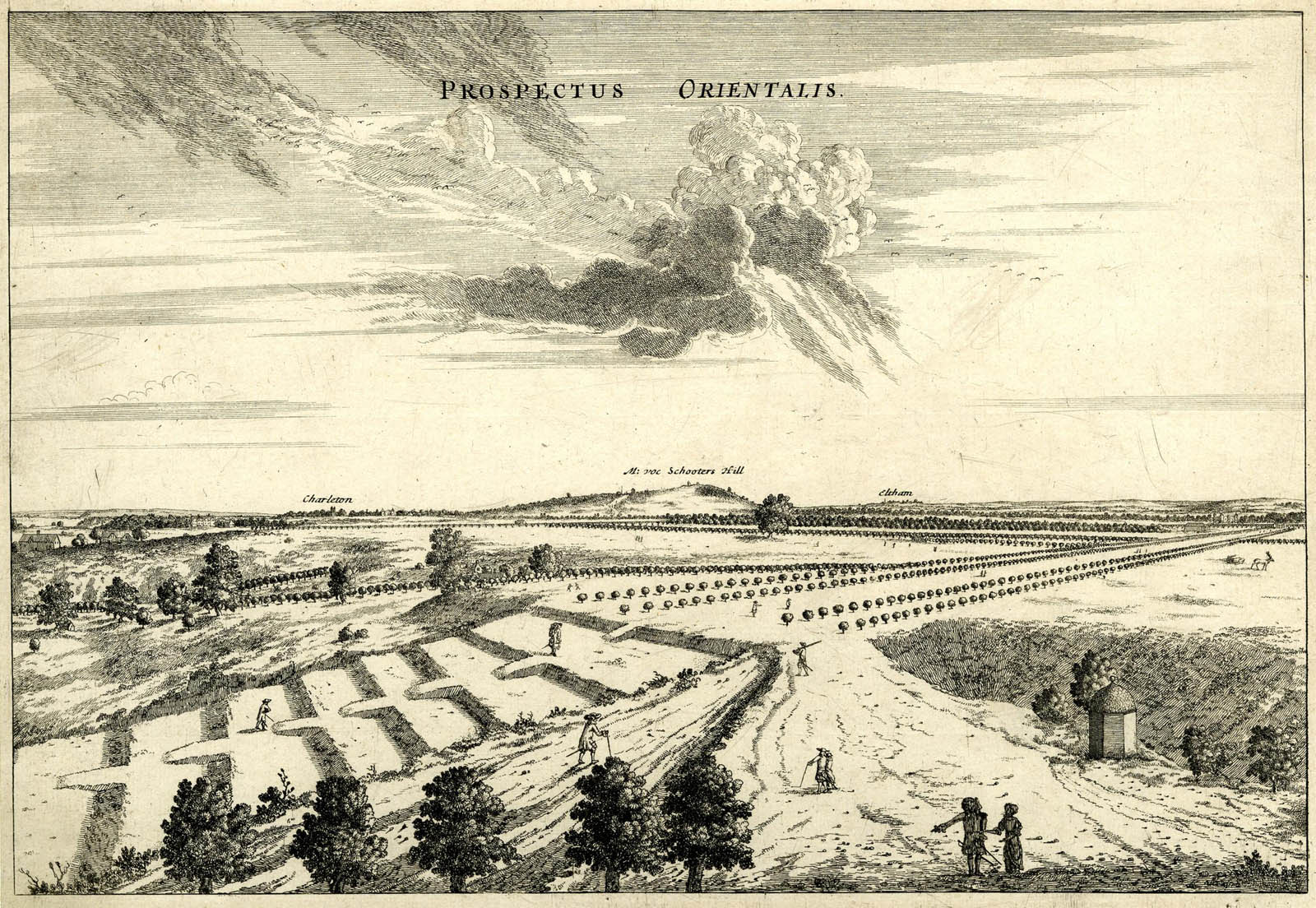
The Giant Steps as seen from the roof of Flamsteed House. To the right is the small building located outside the walled enclosure of the Observatory that housed Flamsteed’s Well Telescope. Note how the top step extends beyond it. Prospectus Orientalis (East Prospect), etching by Francis Place after Robert Thacker, c.1677. © The Trustees of the British Museum (CC BY-NC-SA 4.0). Museum number: 1865,0610.950
From private parkland to public park
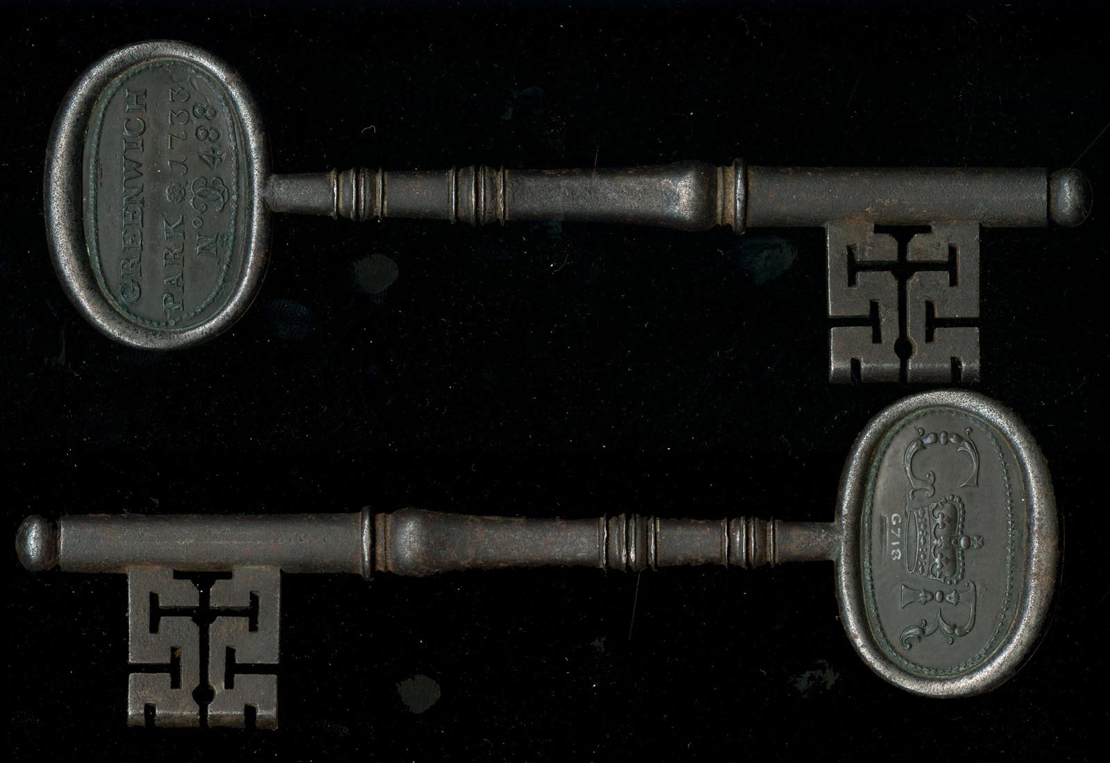
A photo of the two sides of an admission ticket / key to Greenwich Park. It is stamped with the serial number 488. © The Trustees of the British Museum (CC BY-NC-SA 4.0). Museum number: MG.718 (see below)
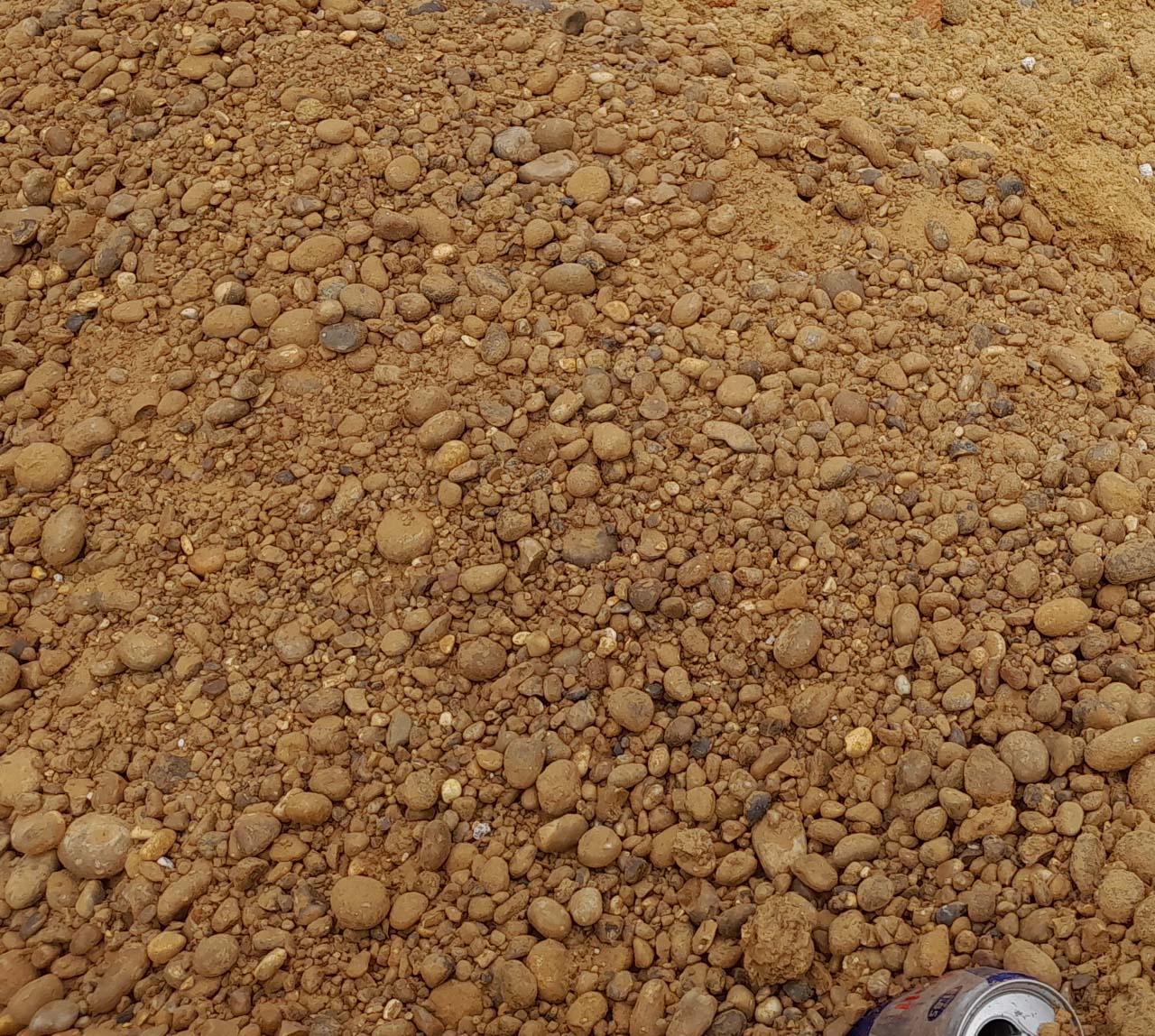
The Blackheath Gravels. The discarded drinks can (bottom right) gives a sense of scale. This sample was excavated from beneath a house in nearby Dartmouth Row in March 2024
According to John Bold, the pensioners from the Hospital and their relatives, together with a small number of locals were granted access in 1705 with the general public also being admitted during holidays from around the same date. However, while Bold states that the public were not given full access until the 1830s, an information board present in the Park in 2024 gives the date as 1820.
It would appear that prior to this date individuals were issued with numbered keys. Surviving examples are rare. Of those that are known to survive, all carry the date of 1733 and a serial number. An example is shown alongside. The key carrying the serial number 450 fetched £800 when sold at auction in 2014. Since no keys carrying a different the date are known, it is possible that earlier and later keys had no markings to identify them as being for the Park.
The geology of the hill on which the Observatory stands changes from top to bottom. The upper part consists of the Blackheath Beds, which are made up of a highly compacted and fairly homogeneous mix of small rounded pebbles and sand. Heavy footfall on the slopes exposes the beds which then rapidly erode as the sand washes out during heavy rain. The resulting surface can be hazardous to walk on as many an individual found out to their cost during the Greenwich Fairs which took place over several days at Easter and Whitsun.
In 1887, The Norwich Mercury contained, in a supplement, the following reprint of a piece of reporting from April 1730:
'On Tuesday last (31st) in Greenwich-Park great Numbers of People from London and the adjacent Parts, diverted themselves (as is common on public Holydays) with running down the Hill (formerly called the Giant's Steps) that fronts the Palace; but some others more venturous would run down the steeper Part of the said Hill, under the Terrace of the Royal Observatory, one of them, a young Woman, broke her Neck, another ran against one of the Trees with such Violence, that she broke her Jaw-bone, and a third broke her Leg.'
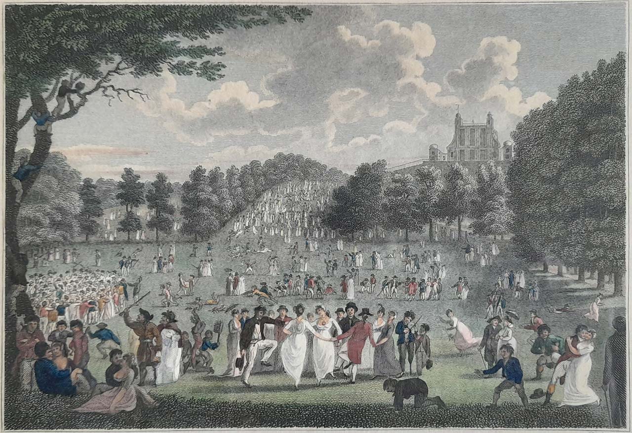
Greenwich Park with the Royal Observatory on Easter Monday. Note the large number of people crowded onto the Grand Ascent. Engraving by J Pass after Edward Pugh: published 20 April 1804 by Richard Phillips
The problem of erosion caused by visitors to the park was recorded by the Astronomer Royal, George Airy, in his 1840 Report to the Board of Visitors, where he wrote:
'Within the last year, the attention of the Civil Architect of the Board of Admiralty has been called to the state of the North Terrace wall. The wall, probably from an injudicious mode of building and from the effects of water and frost, has bulged out considerably; and the foundations, not only of the wall but also of the whole of the northern and western faces of the house and of the court-wall, have been completely exposed. This appears to have arisen from the gradual crumbling down of the steep hill, assisted as it is by the continual treading of the enormous number of persons, who, on every fine day, are walking beneath the terrace wall. The Civil Architect proposes, as I believe, to recommend that the wall be rebuilt, and that a portion of the walk below be completely paved, as the only way of preserving the foundation of this venerable building.'
From the start of the twentieth century onwards, a number of things have happened that have brought ever greater numbers of local, national and international visitors into Greenwich and the Park. They include:
- The opening of the National Maritime Museum in 1937
- The opening of the Royal Observatory to the public in the 1960s
- The celebration of the 300th anniversary of the Observatory's founding in 1975
- The centenary of the adoption of the Greenwich Meridian as Prime Meridian of the World in 1984
- Blockbuster special exhibitions at the National Maritime Museum such as Armada (1988) and Titanic (1994

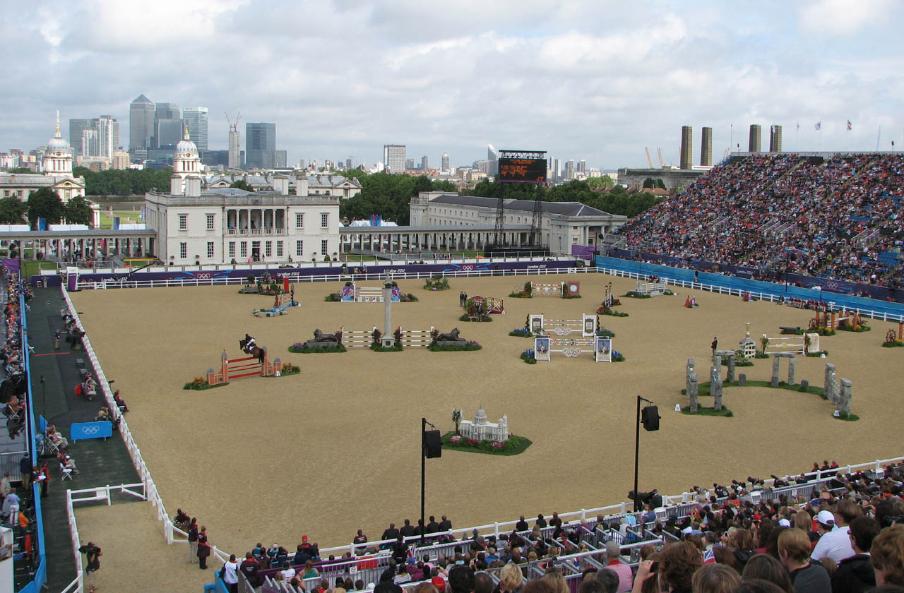
The 2012 Olympics. The stadium was erected in front of the Queen's House on the Parterre. Photo: 4 August
- The closure of the Royal Naval College and the creation in 1997 of The Greenwich Foundation. Since then, the grounds and some of the buildings have been opened to the public whilst other of the buildings have been put to use by the University of Greenwich University and Trinity College of Music. Also in 1997, the creation of The Maritime Greenwich World Heritage site
- The global celebration of the start of the new millennium with Greenwich as the home of the Prime Meridian and Greenwich Mean time at its focus
- The equestrian events of the 2012 Olympics which took place in the Park and were seen by a global audience on TV
- The residential development that has been taking place since the millennium, in particular on the Greenwich Peninsula and West-India Docks and the rest of the Isle of Dogs which sits on the opposite bank of the River.
Over the years, the rise in the number of visitors has taken an ever-increasing toll on the fabric of the Observatory, the viewing area outside at the top of the Grand Ascent (where the Wolfe Statue now stands) and on the Ascent itself.
Although today permission is only required for commercial filming and photography in the Park, in the past the Park bye-laws required visitors to apply for a permit in order to paint or take photographs. Sometimes people wrote in error to the Astronomer Royal rather than the Park authorities to obtain one. RGO7/58 contains some of these requests. Further research is required in order to understand how and when the earlier permit system operated and its impact on the images that have come to us today.
The earliest records – the financial accounts of Sir William Boreman
Information about the construction of the Ascents is preserved in the financial accounts of Sir William Boreman at The National Archives in the following two locations:
- SP29/56 (Secretaries of State: State papers domestic, Charles II. Letters and Papers)
- E351/3428 (Exchequer: Pipe Office: Declared accounts. Works and Buildings (Miscellaneous).: Sir William Boreman. Works in Greenwich Park)
SP29/56/39&39.1 are single page documents. The first is a covering letter from Boreman that begins 'May it please yor Majesty'. The second is an unaudited breakdown of the money expended on the redevelopment of the Park between 1 September 1661 and 10 June 1662. The account is presented in three sections under the following headings:
- 14 Coppices
- 7 Walkes
- 12 Assents
It ends with a table showing the grand total, the money already advanced and the remaining money due. A provisional transcript of the section relating to the Ascents reads as follows:
12 Assents
| ffor dayes worke and taske worke in making the Assents from the bottome to the topp of the hill, filling parte of the great pitt, cutting and carrying of turfe, and for moweing & keeping of them as by the pticulo [particulars?] in the Account it appear |
249: 12: 06 |
|||
| To John Smith for setting out the Worke of the Coppices Walkes and Assents, and for overseeing the Workemen for ye Space of thirty Weekes at 12s the weeke | 18: 00: 00 |
E351/3428 is a rolled parchment document consisting of two sheets written on both sides and stitched together along their top edge. It contains Boreham's certified accounts for the period 1 September 1661 – 10 June 1662. Not only are these more detailed than those in SP29/56, but the money is accounted for differently. Spellings are different too. For example John Smith's name is spelt Smyth. Of greater significance however is the fact that the stated number of Coppices and Walkes is different too (more on this later). The numbers recorded in the document are:
- Coppices: 16
- Walkes: 4
- Ascents: number not specified
A provisional transcript of the sections relating to the Ascents reads as follows:
| [From the section relating to the Coppices] | ||||
| The sayd John Smyth and Richard Nightingale for somuch by them payd Sundry Labourers at xvid the man p diem imployed in taking down ye banks at the Ende of the Ascents, throwing down and Levelling the Ditch bankes before the holes could bee made up, making some good ground and filling good earth into the Carts to bring to the trees and putting it under the rootes of the Trees at ye planting of them and for putting brakes[bracken?] about the rootes to defend them from the weather, with other neccie [necessary?] works there. In all. |
xlviii£. xviis. [£48.17s.0d.] |
|||
|
[From the section relating to the Walkes] |
||||
| And to Richcard Dorey for Moweing the walke between the Queenes house and Ascents according to Agreement |
xiis. | |||
|
[From the section relating to the Ascents] |
||||
| John Smyth Gardiner for somuch by him payd for cutting of xxvi acs of thyn Turfe upon Blacke-heathe at xviiid p C [26 acres at 18d per square chain, ie 0.1 acre] |
xix£.xs. [£19.10s.0d.] |
|||
| The sayd John Smyth for somuch by him likewise payd to sundry workmen and labourers imployed in digging, levelling, bresting[?] and turffing the severall Ascentes up the greate hill and makeing and turffing the Staires from one Ascent to another and doeing other services prtinent thereunto. |
cxlvi£.iis [£146.2s.0d.] |
|||
| William Wilby, Thomas Swift and John ffisher for fetching of Trees from Leezen [Lesnes] Abby at xiis p. load [,] Eltham and other places at viis per load, for as c/iiii xlv [ie ccccxlv – 445] loads of earth to put about the rootes of the Trees at vid p load and for all other woorke done by them with theire foure Teames about the Trees & Ascents during the whole time of this Account at vis p diem for each Teame. In all. |
xx/iiii£.viiid [£80.0s.8d.] |
|||
| And to John Carter for Moweing and Rowleing the Ascents and for lookeing to them by the space of vi weekes at xs p weeke |
lxs [£3.0s.0d] |
|||
| In all the sayd Charges for the makeing and Turffing the Ascents up the greate hill As by the sayd booke of Account delivered upon Oath as aforesayd and several arquittances of the partyes who received the sayd moneys hereupon examined and remayneing likewise appeareth the sume of |
ccxlviii£.xiis.viiid [£248.12s.8d.] |
|||
|
[From the section relating to sundry other expenses] |
||||
| To John Smyth Gardiner for setting out the worke and overlookeing and paying the workemen for the space of xxxty weekes within the time of this Account at xiis p weeke. |
xviii£. [£18.0s.0s] |
The section devoted to the Ascents clearly contains charges such as the fetching of Trees from Lesnes Abbey and Eltham that should have been placed in a different section of the accounts. Why they weren't can only be speculated upon. Of particular interest is the cutting of 26 acres of turf on Blackheath. The Ascents themselves have an area of about one acre. So where did the other 25 acres go? There are three possible explanations. Either they were
- used elsewhere in the park (perhaps in the construction of the 'Walkes'), or
- they were used to build up the Ascents by layering them one on top of the other, or
- they were used for both the above.
The first scenario seems unlikely, as if this was the case, the charges would presumably have been placed under a different heading. The second or third scenarios seem the most likely. Building with turf is a proven technique that was used by the Romans when building earthen walls and ramparts, the roots contained within the turf helping to keep the soil particles connected to one another. The findings from bore-holes 2 & 8 which were sunk on the east side of the Ascent in April 2022 (see 23/2509/SD, Civil engineering stage 4 report p06-part-1, pp.34–42) show the presence of rootlets and root hairs at depth, but there appears to have been no analysis to determine if they came from turf or from the later plantings of trees.
The natural slope of the hill cuts diagonally downwards across the Ascents from the west to east. Boreman's accounts record that digging took place during the creation of the Ascents, which suggests that they may not have been constructed from turf in their entirety. It is surmised instead that the risers were built up from turf and the eastern side of the treads back-filled with material dug out from the hillside on the western side and elsewhere.
As well as Boreman's accounts, for the period ending 10 June 1662, the National archives holds his accounts for the period 1662-1665 (SP29/116/14) and the certified accounts relating to the Park for the period 1663(?)–1670(?) that were presented by Hugh May on behalf of his recently deceased brother Adrian May. The latter can be found in the following two locations: E351/3431 & AO1/2481/292. Neither of these two documents makes any reference to the Ascents. The first is written on parchment. The second is written on paper and appears to be a duplicate copy of the first (though there is at least one unimportant difference). When Hasted wrote his footnote (above), he had clearly taken a look at all the Boreman documents and at least one of those relating to May.
Plans that show the steps
There are no known plans of the Park prior to 1660. Although there are many known later plans, apart from the Stanford's plans published in the second half of the nineteenth century, only the earliest of these show the Giant Steps.
Date |
Plan |
Number of risers |
Trees at the end of treads? |
||
| c.1677 |
Although often referred to as the 'Pepys Plan', this plan is believed to be one of the etchings done for Flamsteed by Francis Place. On this page it is referred to as both the Pepys Plan and the Francis Place Plan |
12a | No | ||
| 1693 | Said to have been drawn by Joel Gascoin and housed at the National Archives (MR1/329) this plan carries the title: An Actual Survey of the ground wereon their Majesties antient Palace at Greenwich (in the county of Kent) formerly stood ... | 10 | No | ||
| ?1695++ | The so called 'Woodlands Plan' |
7a | Nob | ||
| ?1714 | An exact Plan of Greenwich Park ... . Said to have been produced by/for the Royal Gardener Henry Wise (1653–1738). |
6 | Yes | ||
| 1862 | Stanford’s Library Map Of London And Its Suburbs | 6 | Yes | ||
| 1872 | Stanford’s Library Map Of London And Its Suburbs | 6 | Yes |
Footnotes:
a) Extracts from these plans showing the Grand Ascent can be seen in the document titled Written Scheme of Investigation for the Grand Ascent ‐ September 2023, which was deposited as part of planning application 23/2509/SD to the Royal Borough of Greenwich. Low resolution copies of the complete Pepys and Woodlands Plans are reproduced in the Greenwich Park conservation plan 2019–2029 (p.39). The same document also has a copy of the 1850 Sayer Plan (p.42) which is referred to later. A low-resolution copy of the Woodlands Plan is also reproduced on p.11 of the Design and Access Statement submitted as part of planning application 23/2509/SD
b) On this plan, the ends of each tread are marked with triangles as is the southern embankment of the Parterre immediately to the east and the west of the bottom Giant Step. Although they may signify the presence of conifers, their exact meaning is unclear as there is no key to the symbols
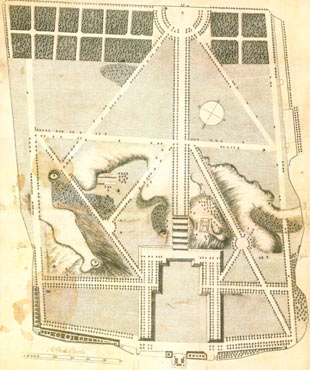
Only two copies of the Pepys Plan are known to survive. One is held by the Pepys Library in Cambridge. The other was discovered by Derek Howse in the collections of the Greenwich Local History Library (which was later merged with the Borough Museum to form the Greenwich Heritage Centre which was later reconstituted as Royal Greenwich Heritage Trust). The Plan is an unusual hybrid of plan view and bird's eye view, the viewpoint for the latter being an imaginary elevated position to the north of the Queen's House which is at the bottom. The Parterre is shown in perspective view and for this reason, the east and west Parterre banks do not run parallel to each other as might otherwise be expected.
The catalogue entry for the 1693 Plan states it was drawn by Joel Gascoin (Gascoyne?). Although his name does not appear to be present on the Plan itself, the form of the compass rose is similar to those on other plans he is known to have drawn. It also has a typically elaborate Cartouche.The Plan has misshapen features in common with the Samuel Travers Plan of 1695/7: the Parterre on both having been drawn lopsided and not properly centred on Blackheath Avenue. It would seem therefore that Travers copied some elements from the earlier plan.
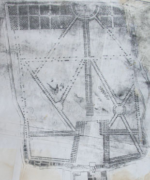
The Woodlands Plan came to the Borough of Greenwich in the early 1970s from the collection of the Blackheath antiquary Alan Roger Martin. It is the only known copy and is now in the care of Royal Greenwich Heritage Trust. Its earlier provenance is unknown as is the surveyor, purpose, date and meaning of some of the symbols used. It was labeled 'Woodlands Plan' by Land Use Consultants in their 1986 report on Greenwich Park as a way of identifying a nameless plan and the name has stuck. It takes its name from Woodlands House which is where the Local History Library was located at the time. The presence of the 'New Road' at the bottom of the Plan (cropped in the copy below) suggests a date of 1697 or later.
There are three key differences between the Pepys Plan and the later Gascoin and Woodlands Plans that are relevant here. The first is in the number of steps which are shown. The second relates to the avenues of trees. The Pepys Plan shows all the avenues completely planted. The two later plans show lots of gaps in the avenues in the southern half of the park with the exception of the southern boundary, the main avenue from the Blackheath Gates and the 'rounds' which were adjacent to the gate (were these prioritised in order to impress visitors arriving from Blackheath?). The gaps elsewhere, whilst substantial are not identical on the two plans. The difference between them and the earlier Pepys Plan is difficult to explain. A previous theory that the losses were due to storm damage in 1703 is clearly incorrect. Other possible explanations that need to be considered include felling for timber, premature death and a further scenario that is discussed below. The third difference is in the number of coppices shown at the south end of the Park.
In each of the five plans below, south is at the top. All have been cropped – The Pepy's and Woodlands Plans marginally so, the others rather more.
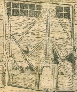
The Pepys Plan, c.1677. © Royal Greenwich Heritage Trust
The Gascoin Plan of 1693 (b/w copy). © The National Archives (MR1/329)
The later Woodlands Plan. © Royal Greenwich Heritage Trust

The Wise Plan (b/w copy)

Detail from the 1816 copy of the 1695 Plan by Travers. The fifteen green shapes in the Great and Little Wildernesses represent the coppices. In the earlier Pepys plan two fewer coppices are shown in the Great Wilderness. It is thought that the larger coppice containing the pond (which also appears in the Pepys, Gascoin and Woodlands Plans) was originally counted by Boreman as two coppices rather than just one.
As noted above, Boreman's unaudited financial accounts for the period 1 September 1661 to 10 June 1662 (SP29/56/39.1) state that seven walkes were constructed. The audited accounts (E351/3428) state there were four. Likewise, the unaudited accounts state that fourteen coppices were constructed whilst the audited accounts state there were sixteen. The number of sixteen is also appears in Boreman's second set of unaudited accounts (SP29/116/14) which begin as follows:
'The whole charges of keeping and planting Greenewch parke wth the 16 Coppices and dwarfe Orchard for the space of these years, beginning at our Lady day [25 March] 1662 & ending at our La:day [25 March] 1665 and building the gardenhouse.'
So why the discrepancy in the financial accounts? And why does the Pepys Plan show two fewer coppices than the later plans? Is it possible that fourteen were originally intended, but a decision was made soon after to increase the number to sixteen? This raises the intriguing possibility that the Pepys Plan was copied with some modifications from a now lost masterplan or artists impression that was drawn in 1663 or 1664 shortly after Le Nôtre became involved and that the masterplan itself was based on one of a couple of years before. This seems all the more likely as Sir Jonas Moore who commissioned the etchings from Thacker and Place was Surveyor General of the Ordnance and would almost certainly have access to any existing plans of the Park ... and why create an entirely new plan when an earlier plan could be easily adapted?
It would have been simple enough for Thacker or Place to copy the earlier plan, replace the Castle with the Observatory and scrub out the fountains from the Parterre. If this was the case, the failure to change the number of coppices from 14 to 16 requires explanation. Perhaps the exact number was considered unimportant. It is also possible, given their distance from the Observatory, that neither Thacker, Place nor Flamsteed realised that the number shown was no longer correct. Although it never happened, Flamsteed originally planned to publish all or most of the 12 Francis Place etchings in his Historia in the manner of earlier astronomers. As such, they were designed to show the Observatory in the best possible light. An earlier masterplan showing the avenues as complete would have suited Flamsteed's needs very well even if at the time of the Observatory's founding there were still many trees to be planted or re-planted.
Whilst the Thacker/Place topographical views are generally considered to be be accurate representation of what existed when they were drawn, there are unexplained inconsistencies between the two topographical views Facies Speculae Septen and Prospectus Orientalis and and the plan of the Park that was drawn to accompany them. The most obvious is that Facies Speculae Septen shows the presence of nine risers on the Grand Ascent, whilst the plan shows twelve. If the plan is based on one drawn in 1663 or 1664, and if, like the coppices, the number of steps constructed differed from the number originally planned, this could account for the discrepancy. It might also explain why the trees shown on the Parterre are not consistent with the layout on the plan (or indeed any of the later plans). Both topographical views show the presence of what appears to be a ramp in the centre of each step. These are not shown on any of the plans or in any other known images. They may have been preparatory works for the cascade that was abandoned. Alternatively, and more likely, they are the remnants of the 'Staires' mentioned by Boreham in his financial accounts. In Prospectus Orientalis, Snow Hill Walk (later called Brazen Face Walk, but now called the Avenue) has been omitted and the avenue that connects between Pauls Walk (now Lovers Walk) and Eltham Walk (now Blackheath Avenue) joins the latter short of the Great Cross Walk. We know from May's financial accounts that a great deal of earth moving was required to create Snow Hill Walk. We don't however have a precise date for when the works were completed. It may have been as late as 1670 with the trees on the avenue being planted at a later date.
There is no contemporary account in which the number of etchings completed by Place for Flamsteed is recorded. Given that there are only two known copies of the Pepys Plan, some have questioned whether it was really part of the set. The evidence that it is, is circumstantial but compelling. Firstly, when Pepys came to mount his collection of topographical prints in 1700, he mounted all the Francis Place etchings together (twelve in total), with the Title Plate being glued onto the rear of the Plan (which was folded in). More importantly, when writing to Abraham Sharp on 21 April 1721, Joseph Crosthwait (who was preparing Flamsteed's Historia for publication) wrote:
'There are about three sheets of the observations to print; which, as soon as finished, shall be sent you, with the pictures you desire. I should be glad to know whether you had ever the map of Greenwich Park, the plan of the Observatory, with the different prospects of it, sent: if you have not, I will send them, as soon as some few alterations are made in the plate of the Park.' (Baily p.343)

An uncropped version of the Wise Plan showing the empty text box headed The Explanation
The Wise plan is difficult to interpret. It is undated and has two text panels only one of which has been engraved (see complete version right). It is missing the new road which had been constructed by 1697 but does show the whole of Greenwich Hospital which was not completed until 1751. The Hospital design however had been finalised by 1699. Haynes (2023) suggests the Plan was drawn for Wise by Charles Bridgeman. Further research into the dates of the buildings shown elsewhere on the plan may help date it more precisely.
First published in 1862, the Stanford's map was updated and re-issued over the following decades. Stanford's mapping of Greenwich Park is at odds with that of the Sayer's maps of 1840 and 1850 and the Ordnance Survey maps from this period. Apart from being the only mid nineteenth century map to show the steps, the trees on the eastern Parterre Banks are shown on an entirely wrong alignment.
Before leaving this section, it is worth noting that:
- The Pepys, Travers, Woodlands and Wise plans have all been drawn with the Queen's House at the bottom and the southern end of the park at the top. In this orientation, the grand axis and the view from the Queen's House is brought to the viewers' attention. A modern equivalent is the way a Sat Nav orientates a roadmap when driving so that the direction of travel is always towards the top of the screen
- The number of coppices planted was probably related to the fact that trees were typically coppiced for wood (i.e. cut to ground level and allowed to regrow) on a fourteen year cycle. On this basis, the plan would have been for one coppice to have been cut each year.
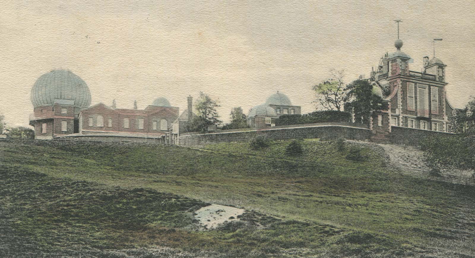
Late 17th & 18th century images showing the steps
In the late seventeenth century, three Dutch artists all painted views looking outwards from Greenwich Park. They were Johannes Vorsterman, Jan Griffier and Hendrik Dankerts. All three are credited as having painted views that include: the Queen's House, the Parterre, the Giant Steps and the Observatory. None are understood to be signed or dated. Both Vorsterman and Dankerts are said to have had paintings commissioned by Charles II.
Vorsterman, produced a number of versions of the same painting which vary slightly in detail. Copies are held by the Yale Center for British Art (YCBA) and the National Maritime Museum. Both have been digitisied. The Spread Eagle Art Collection (now on display at the Trafalgar Tavern in Greenwich) has a view by Dankerts that is very similar to the Vosterman views (not digitised). All appear to capture the scene as it existed in the 1680s. Each shows the completed King Charles Block of the new palace together with the partially demolished Tiltyard Tower of the old Tudor Palace.
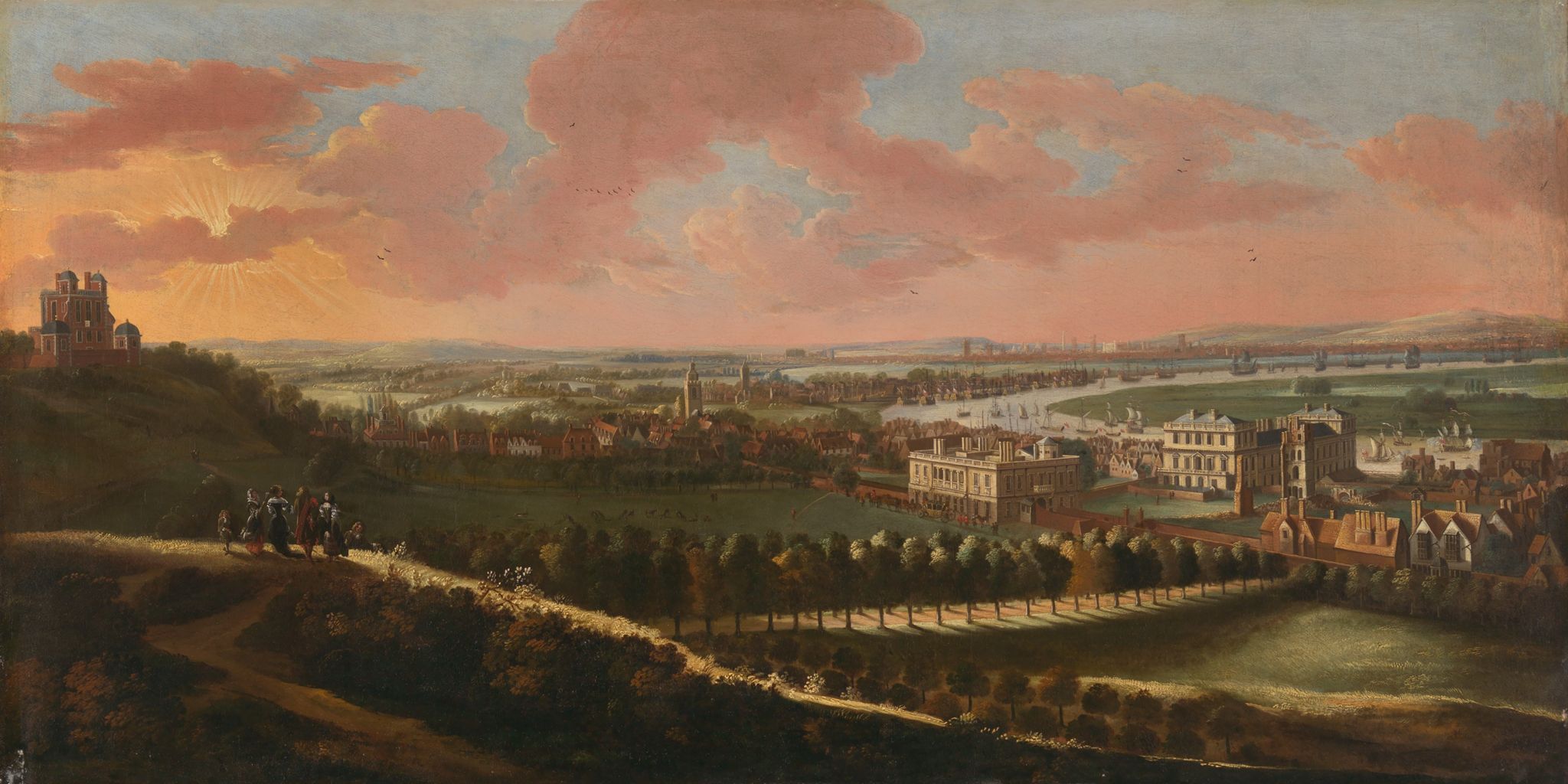
In this view from about 1680, the Observatory can be seen on the top of the hill on the left, whilst the Queen's House with the partially redeveloped Tudor Palace can be seen on the right. Note how the the path that can be seen in Hollar's view of 1637 appears to have become re-established and runs diagonally across the Parterre in front of the Queen's House (It does not however appear in the two slighly later Griffier paintings owned by the National Maritime Museum to which links are given below). Johannes Vorsterman, oil on canvas, Yale Center for British Art, Paul Mellon Collection, B1976.7.112. (see below)
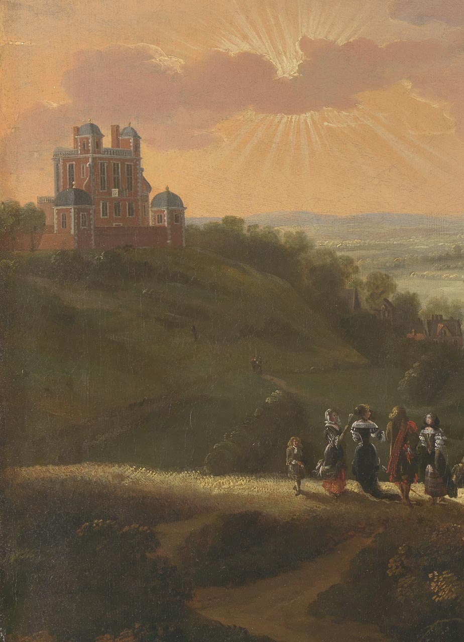
Digitally lightened detail from the Yale Vorsterman showing the Grand Ascent on the left
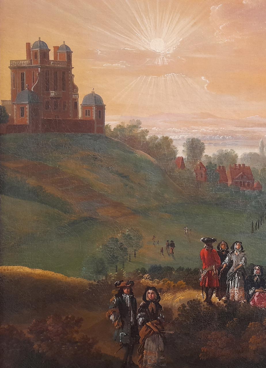
The same detail from the Vorsterman in the National Maritime Museum's collection
Griffier's paintings are slightly later as the Tiltyard Tower is in a greater state of decay. Topographically speaking, his paintings are inferior to those of Vorsterman. Not only are the views strangely distorted, but the east side of the Observatory is incorrectly shown and the towers of the medieval St Alfege, Greenwich, and St Nicholas, Deptford churches (which can be seen in the mid-distance) have been painted somewhat oversize. Despite all this, the Giant Steps are much more clearly defined than in the Vorstermans. The NMM has two copies. A third was sold by Sotherby's (Lot 41, Sotherby's sale, 30 June 2005, when it was said to be by Vorsterman. All three copies have been digitised.
In addition to the views of Vorsterman, Griffier and Dankerts, there are three eighteenth century views that are known. The first is an engraving published in 1739 by Samuel & Nathaniel Buck. The second is a drawing by A.J. Sweate and is signed and dated 1746. The second is an undated drawing by John Charnock.
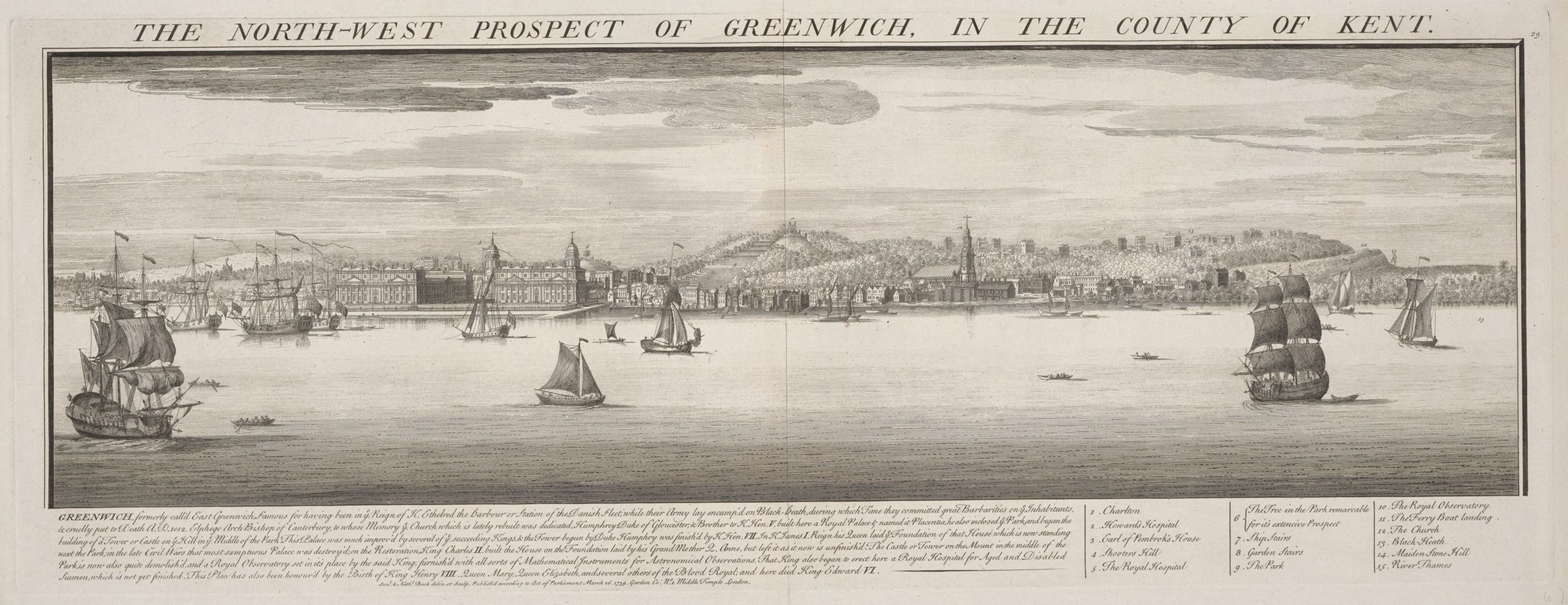
Published in 1739, four steps can be seen in this view. Samuel & Nathaniel Buck, Engraving, The North West Prospect of Greenwich in the County of Kent, Yale Center for British Art, Paul Mellon Collection, B1977.14.19080. (see below)
The North Prospect of Dr. Flamsteed's house in Greenwich Park in Kent. Drawing, pen and ink on paper mounted on wood panel, signed and dated A. J. Swete, 1746. In this view four, possibly five risers are visible. Note the presence of the path on the hillside immediately to the right of the Ascent. © Victoria and Albert Museum, London, Accession Number 7-1891 (see below)
The table below gives details of the various images together with links to digital images that can be viewed online.
Date |
No. of risers 1 |
Artist |
(Digitised) image |
|
| c.1677 | 9 | Thacker/Place | Facies Speculae Septen (above) |
|
| 8 + (7? +) | " | Prospectus Orientalis (above) |
||
| c.1680s | 5+ | Vorsterman | YCBA (above) | |
| 9+ | " | NMM (Object ID: BHC1808) | ||
| 12+ | Dankerts | Spread Eagle Collection 2 | ||
| c.1690? | 6+ | Griffier | NMM (Object ID: BHC 1833) | |
| 9? | Griffier | NMM (Object ID: BHC 1817) | ||
| 9? | Griffier/Vorsterman | Sotherby's sale, 30 June 2005 | ||
| 1739 | 4 | Samuel & Nathaniel Buck | YCBA (below) |
|
| 1746 | 4 (5?) |
Sweate | V&A (Accession No: 7-1891) |
|
| c.1780? | 13 | Charnock | NMM (PAF 2865) |
Footnotes:
1) In the paintings by Vorsterman Griffier and Danckerts, the steps are not always very distinct. Nor is the complete flight always shown (hence the +)
2) Digital image not currently available
Taking the images together with the plans, it would appear that the number of steps decreased from the original 12 recorded in Boreman's accounts to around five by the mid eighteenth century. However, no evidence has been found to establish how, why or when this happened. Was it because some steps wore away and others didn't or was it because the steps were reshaped or reconfigured at some point?
The thirteen steps shown in the later Charnock view are problematic and difficult to explain. The NMM owns a second view by Charnock, but from a different angle, as well as several views of the instruments drawn by him. All are considered to be topographically accurate and can be corroborated. By comparison, the drawing showing the steps is rather crude. It appears to have been drawn after the summerhouses were enlarged in 1773 but before the Courtyard was enlarged in 1791. There are three ways of explaining the presence of the thirteen steps. Either there were more than five steps present when Sweate and the Buck did their drawing, but many of them were indistinct and not included, or the steps were recreated after 1746 but quickly disappeared (they do not appear in any other view), or Charnock sketched what the Observatory might have looked like if the twelve steps in the Francis Place Plan had still existed. Although the Observatory did not at that time own any of the Francis Place etchings, it is possible that Charnock had seen the set owned by Pepys, as he had volunteered with the Royal Navy and researched historical and contemporary naval affairs. His book An history of marine architecture (which he also illustrated) was published in 1801.
The planting of the trees on the ends of the treads
As noted above, the first plans that shows trees planted on the ends of the treads of the steps date from the early eighteenth century some 40 plus years after the steps were created. Despite this and the evidence of all the seventeenth century images above, Drake has been mistakenly taken to imply that they were planted from the start as seems to have been the assumption of A.D. Webster (the Superintendent of Greenwich Park) in his book Greenwich Park: Its history and associations (1902). It also appears to be the prevailing and mistaken view of the Royal Parks at the present time (2024).
The first trees to have been planted were Scots Pines and the earliest view located to date that shows them is dated 1731 and reproduced below.
Urbis Londiny Fluvy Thamesis, Templi Palaty, Viridary Greenovicensium ab Austro Conspectus engraved by Claude Dubosc after Alexander Gordon and published in 1731. Note the newly planted trees on the edge of the steps whose trunks have been encased to protected them from the deer. Note too the pleaching of the trees on the edge of the Parterre and the groups of people sitting on the top of some of the steps on the lower part of the slope. © The Trustees of the British Museum (CC BY-NC-SA 4.0). Museum Number: 1880,1113.5519 (see below)
As well as not knowing when the trees were planted it is also not known why they were planted or why Scots pines were chosen as they can grow to a height of 35m with a spread of 6–12m. In the early days of their existence, the sides of the steps would have become less well defined over time, so maybe the trees were planted to help prevent erosion at the edges whilst at the same time providing (at least when they were young) a clear visual boundary that reflected the original linearity.
As the trees on the edges of the Giant Steps matured, they began to obstruct the view of London from the top of the Ascent. It was possibly for this reason that the trees towards the middle of the western row had been felled by 1840. 1842 Lithograph by Thomas Shotter Boys. © The Trustees of the British Museum (CC BY-NC-SA 4.0). Museum Number: 1880,1113.5546 (see below)
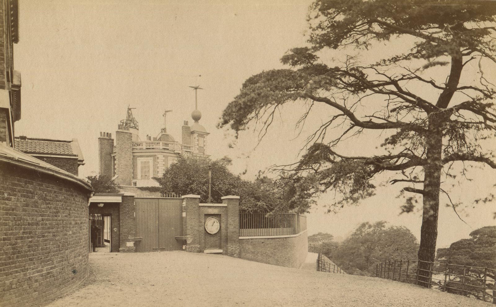
Taken around 1880 (between 1873/4 and 1884), this photo shows one of the pines outside the Observatory gates. The date a fence was first erected at the top of the Ascent has yet to be established, but was possibly in the mid 1850s. It was changed for one of a different design in about 1890. Albumen Print
Thought to have been taken by the same photographer on the same day as the shot above, this photo shows the pines at the bottom of the Ascent. Several trees have been replaced with new plantings. Note the bare area on the right where a broad path ascends the Ascent. Albumen Print
Webster says of the trees:
'The terraces were forty yards wide, and planted on either side with a row of Scotch fir trees, which were brought from Scotland by General Monk, in 1664. These trees were planted twenty-four feet apart, and in continuation of the outer lines of those forming the Blackheath Avenue. As late as forty years ago the lines of fir were quite complete, the gravelly soil and airy situation having been conducive to their rapid growth and perfect development, for we find that many of the stems measured four feet in diameter at ground level. With the impurities of the atmosphere, which have become very pronounced during the past half-century, the Scotch pines gradually gave way, and the last were felled about eight years ago [i.e. in 1894].'
Probably taken in about 1890, the decayed state of the Scots pines on the outer edge of the Grand Ascent is clearly visible. On the west side (closest to the Observatory), four recently planted Scots pines can be seen. One recent planting is also visible on the east side. To protect the new trees from the deer (which at that time still roamed the whole of the Park), they were enclosed by metal fencing, each panel of which has five horizontal rungs. The enclosures on the east side consist of four such panels whilst that on the east side is made up of six. The original glass plate from which the image is taken was, and probably still is, in the Observatory archives (now at Cambridge). The image as reproduced here has been taken from Hutchinson's Splendour of the Heavens (1923) where a large erosion channel with near vertical sides as much as a foot or more deep was cropped from the bottom edge
When this shot which was taken, all the old pines bar one on the western side of the Ascent had been felled. What look like stumps can be seen to the left of the tree still standing. Note the otherwise unrecorded presence of a path rising diagonally across the Ascent and passing behind the large pine. Given that the Great Equatorial Dome was completed in April 1893 and Webster seemed to think all the pines had been felled by 1894, it seems likely that the photo was taken in 1893/4. Albumen print published by the London Stereoscopic and Photographic Company
Apart from being wrong about when the trees were planted, Webster is also wrong about when they began to be felled, which was somewhat earlier than he states as can be seen from the photo in the Royal Collection to which a link is given in a later section as well as in paintings and engravings from the 1860s. Perhaps this is because he ignored the images and relied instead on the 1867 survey carried out by the Ordnance Survey, which seem to have stylised and incorrect representations of where the trees were on the Ascent.
What Webster also failed to say was that some of the felled trees had been replaced by young trees of the same variety (as can also be seen in the images immediately above) and that these too were removed. For several years there were no trees on the slope. The photographic evidence suggests that during their absence the ground was smoothed over, probably by the addition of new soil from elsewhere. Two rows of trees were eventually replanted in the winter of 1903/1904. They are all believed to have been hawthorns.
Taken between about 1900 and 1903, this shot captures the period after the clearance of the Scots Pines but before the planting of the hawthorns. Detail from a postcard published by H. Howard, Greenwich / Madame Hansford, Greenwich
The newly planted trees surrounded by their protective metal barriers in about 1908–09. Three risers can be clearly made out in the lower half of the Ascent, with two more just about being visible in the top half. Note too the contouring of the hillside where it falls away to the east of the eastern (left-hand) row of the newly planted trees. Detail from postcard number 3609 by Card House
A second view from a year or two earlier, but this time looking across the Ascent. The scaffolding on the roof of Flamsteed House suggests a date of 1907. Detail from a postcard attributed to C.W. Green, Plumstead
Over the years, the hawthorns disappeared, the last ones being removed at the end of 2023 when work started on recreating the six steps (six risers and five treads) and planting the new hawthorns for which planning permission had been given. By the 5 February 2024, the heavy ground works necessary to create the new steps was nearing completion and several of the new trees had been planted. However, rather than being planted according to the approved plan in line with the pre-existing inner rows of trees in Blackheath Avenue, they were planted in line with the newly planted inner rows of trees on either side of the Wolfe Statue, which are offset inwards by around a yard from the alignment of the rest of the trees in the avenue. The end result is that the actual separation of the lines of trees on the steps is roughly half of what is was in the previous two plantings.
The re-created steps with their eight hawthorns photographed from the entrance doors of the Queen's House on 25 March 2024. The Wolfe statue at the top of the steps closes the view and was erected in 1930 (more on this below). Due to the shallow angle of its slope, the third (middle) tread is almost hidden from view
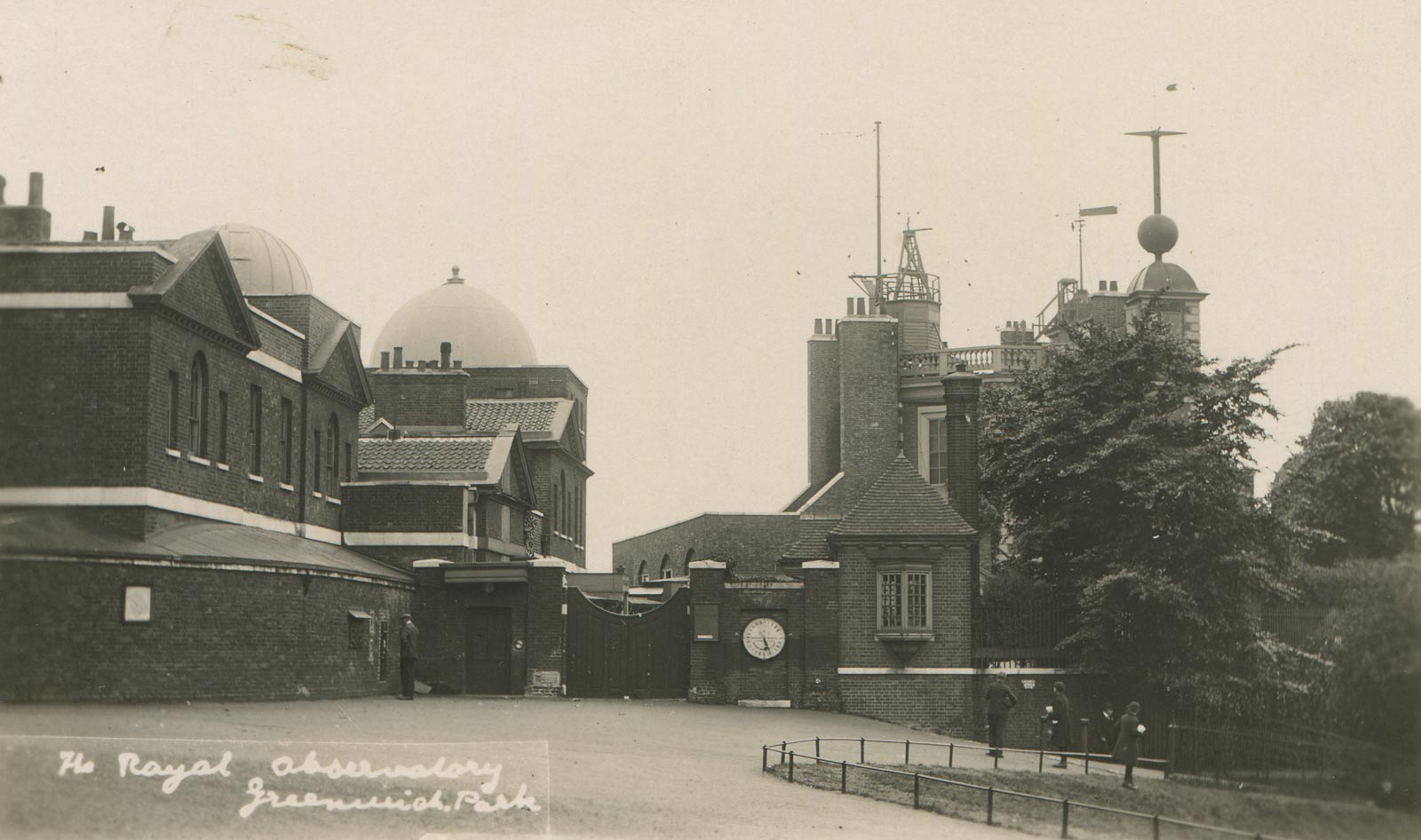
The impact of the Observatory expansion on the upper steps
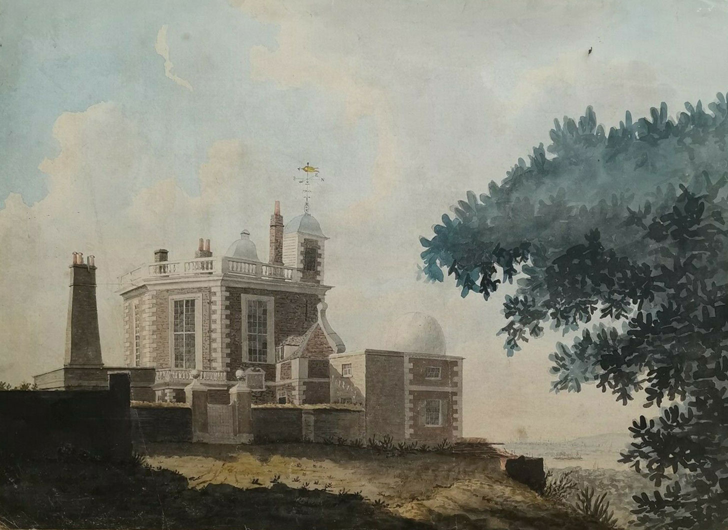
The Observatory from the east before the Courtyard was enclosed in 1791. Bradley's 'New Observatory' (now part of the Meridian Building) sits behind the wall in the shadow on the left. Thought to have been painted in the 1780s, the artist was recorded by Margaret Maskelyne as Mr S[?]inley'. Watercolour reproduced courtesy of The Petersfield Bookshop
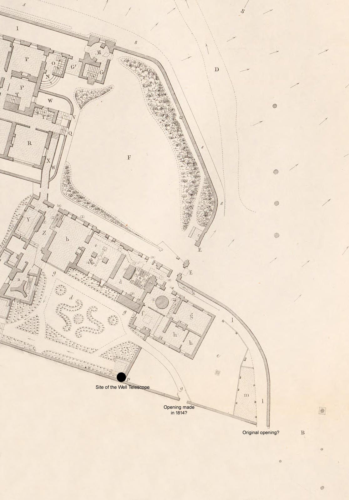
Detail from the plan of the Observatory grounds as they existed in December 1846 showing the eastern extent of the enclosures of 1791 and 1813. Modified from the plan published in the 1845 volume of Greenwich Observations. Reproduced courtesy of Bayerischen Staatsbibliothek under a No Copyright - Non-Commercial Use Only license (see below)
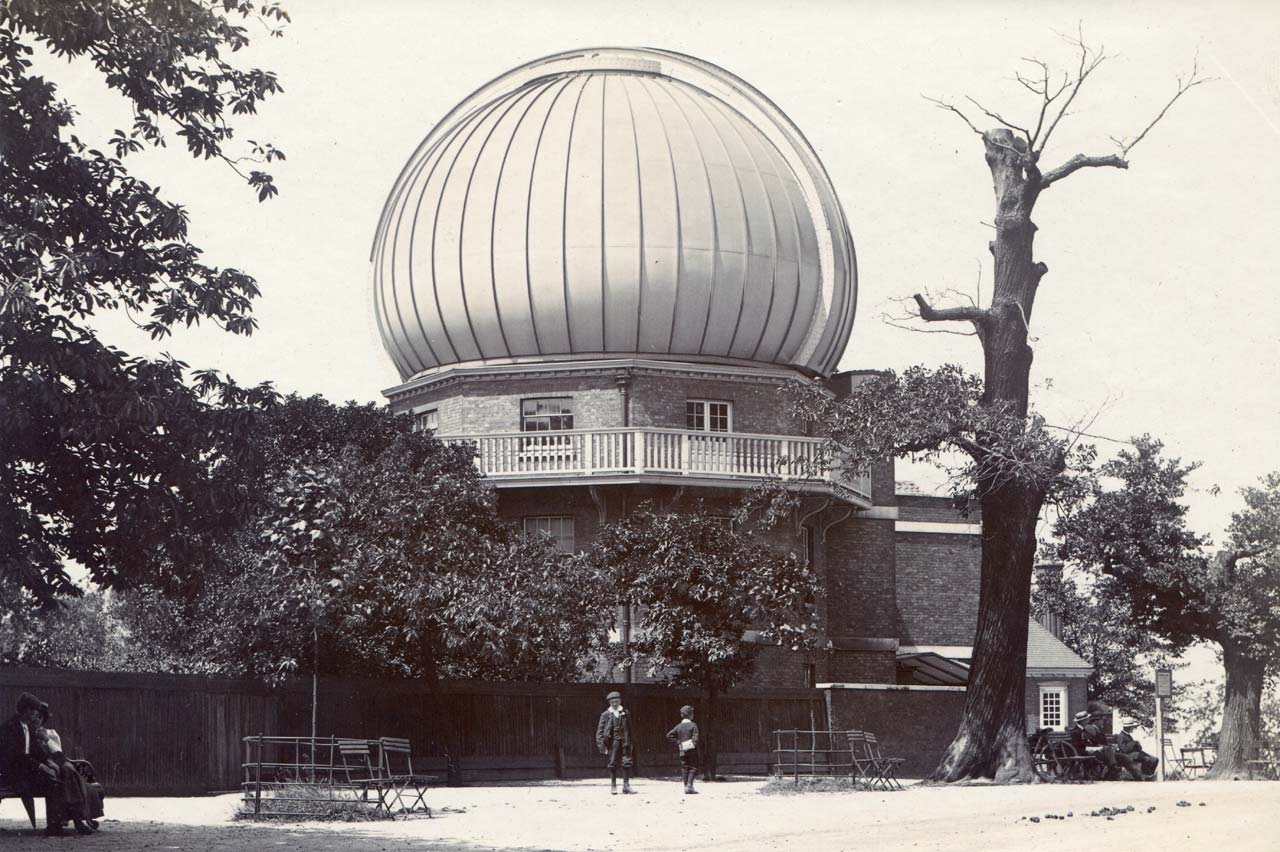
The Great Equatorial Building was built on part of the land enclosed in 1813. Its position is marked on both of the maps below. Note how the Observatory boundary hugs the outer edge of the avenue. Also note the four replacement trees towards the centre of the photo and the pile of horse droppings (bottom right). From an albumen print made in about 1903/4
The north-east corner of the courtyard where the tree now stands, consists of made-up ground, 124 loads of gravel having been recorded by Maskelyne in his journal as having been brought in from Blackheath. Since there was roughly level access into and from the courtyard, it seems likely that some amount of infill was also necessary outside the boundary in the Park, something that was confirmed in April 2022 during a ground survey when a localised thickness of at least 1.75 m of made ground was encountered in a borehole near the top of the Ascent on the western side (See Civil engineering stage 4 report p06-part-1).
Whilst the creation of the Courtyard brought the eastern boundary of the Observatory closer to the Grand Ascent, the enclosure of the Drying Ground brought it right up against the top of the steps. Both alterations, and particularly the second, must have had an impact on the topography outside, not least because following the second extension, anyone entering the courtyard from the south would have had to cross the corner of the Grand Ascent to reach it. In the adjacent plan, the positions of the trees on the west side of the Ascent (single row) and Blackheath Avenue (double row) have been marked as grey circles of varying sizes. As can be seen, four? of the pines originally planted at the top of the Ascent are missing, presumably having been removed to allow better access to the Courtyard.
The Ministry of Works file Work16/464 contains information about the gas mains passing though the Park to the Observatory from the 1849 when the first main was being planned up until 1959. In 1850, gas pipes were laid to connect the Observatory to the Phoenix Works (in Thames Street?). Although the proposed route was via the George Street gate on Crooms Hill and up the path that still exists today on the west side of the Ascent (1850 Report), it is not clear if this was the actual route followed. This is because in 1891, a request was made to 'open up a trench through the park form Park Row Gates to Royal Obsy, for the purpose of removing a defective main and to lay a new one in a similar position'. When this work was eventually carried out in 1894 an electric cable in a 1½-inch pipe was also placed in the trench. Its purpose however is unknown as the Observatory generated its own electricity from 1894/5 until 1912/13. When in 1909, the gas main needed upgrading from a three-inch to a four-inch one, the plan was to follow the route of the earlier 3-inch main which followed the pedestrian path down from the Observatory before turning off northwards and exiting the Park though the Park Row gate along a route that does not appear to have crossed the Ascent at any point. For reasons not explained, the pipe was routed instead straight down the western side of the Ascent (close to the hawthorns, and on an alignment parallel to and between the inner and outer rows of trees on the western side of Blackheath Avenue), before crossing the Parterre on its way to the Park Row gates. A memorandum dated 8 June 1909 states that the trench was to have a maximum width of two feet and a depth of two and a half feet.
The top of the Ascent also slightly disturbed in 1852 when galvanic wires were laid. Airy described their routing as follows in his 1852 Report:
'four insulated wires are laid in the ground, at depths varying from three to five feet, on a line commencing at the ground-floor of the North Dome (now called the Galvanic Room), across the Front Court, along the centers of the great avenues of the Park to the southern gate in the western wall of the Park, and by the south-east side of the road leading thence across Blackheath to the Lewisham Station; from which point two wires are carried, sometimes on poles and sometimes in grooved boards, to the London-bridge Terminus, where the connections will be made, either with the long Dover wires communicating with the Continent, or with the wires which extend to the Central Telegraph Station.'
The route is shown marked on a copy of the 1850 Sayer Plan (RGO6/610) and shows the route of the cables clipping the top of the ascent before proceeding up the centre of Blackheath Avenue.
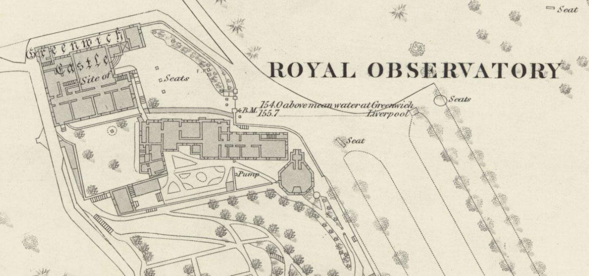
Map showing the top of the Ascent as it existed in 1867. Although the east side of the top of the Ascent is still in its original location, the top of the west side has had a large chunk cut out of it. Detail from the 1:2500 Ordnance Survey map: London - Middlesex & Kent XII.22 (surveyed: 1867, published: 1871). Reproduced with the permission of the National Library of Scotland under a (CC-BY) license
By the time the survey for this map took place, the Wolfe Statue had been erected and the Avenue extended northwards onto ground formally occupied by the steps. Detail from the 1:1250 Ordnance Survey map TQ3877SE – A (surveyed: 1950, published: 1951). Reproduced with the permission of the National Library of Scotland under a (CC-BY) license
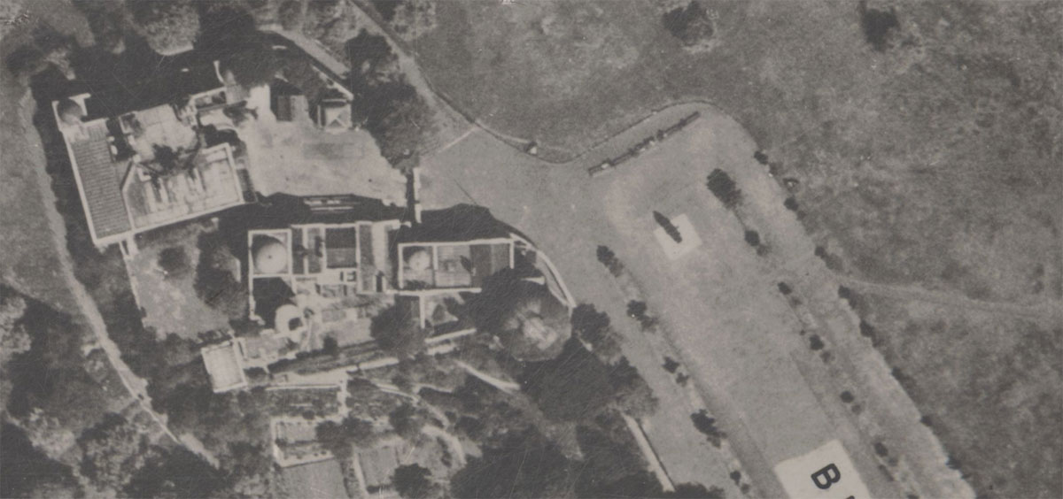
This 1947 aerial view used by the Ordnance Survey to assist in the production of the map above. Detail from Ordnance Survey Air Photo Mosaic Sheet (1:1,250 scale): 51/3877 S.E. / TQ 3877 S.E. Prepared from Air Photos taken: May, 1947. Reproduced with the permission of the National Library of Scotland under a (CC-BY) license

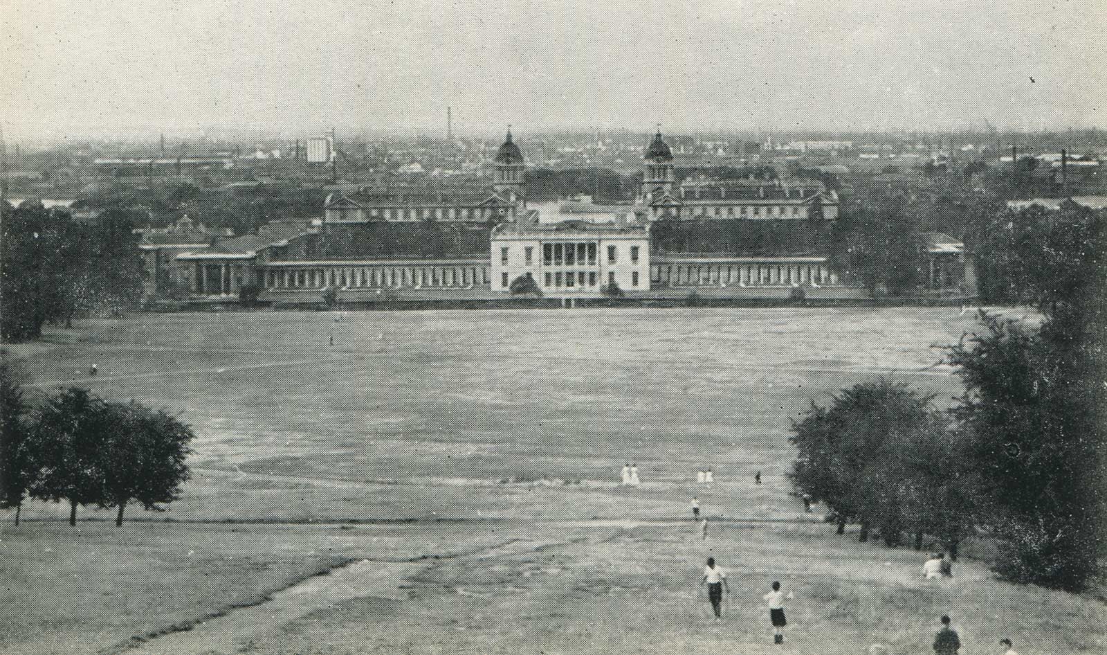
Looking down the Ascent towards the Queen's House in the late 1940s. During the war and for a while afterwards, a large part of the Parterre was used as allotments. They were still there when this picture was taken. From a postcard published by F. Frith & Co., Ltd
In 1979, work began on re-landscaping the area around the Wolfe Statue to the form shown here. The important thing to note, is that the hard-landscaping did not extend as far northwards as before, its northern edge having been moved back towards the Statue. It consisted of a low stone wall in front of which there was a row of Berberis (which developed into a hedge) in front of which was a low fence. Detail from a postcard showing the 28p stamp issued by the Post Office on 26 June 1984 to celebrate the centenary of the International Meridian Conference that lead to the adoption of the Greenwich Meridian as the Prime Meridian of the world. © Post Office

The same hard-landscaping as in the image above on 23 February 2021. In the 1980s, neither the black railings (left) nor the stainless steel railings (inserted in the stone-work) were present. The date when the Berberis and low fence in front of the wall were removed has yet to be established but is thought to have be when the stainless steel railings were installed and to have been around the time of the millennium. The black fence (left) was erected in 2008 (see below). The whole of the hard- landscaping around the Wolfe Statue was removed at the end of 2023 and reconfigured as part of Greenwich Park Revealed. This involved pushing the boundary forward again to the position shown on the 1950/1951 map i.e. to roughly the edge of the grassless area on the right – some twelve to thirteen metres forward of the 1670s position
Before concluding this section, it is worth recording that when the New Physical Building was erected, its east and west wings broke though the boundary by a few inches, whilst the southern wing went right up to it. This was both detrimental to the appearance of the building and inconvenient in terms of access to the outside spaces. Quite how or why the building came to be positioned so that it protruded marginally beyond the Observatory’s boundaries is unclear. To resolve the situation, it was put to the Treasury Solicitors that ‘In a matter like this which affects two departments of the Government and involves only a slight encroachment’ that the contract for the building works should be allowed to proceed. The Treasury Solicitors subsequently wrote to the First Commissioner of Works (in whose jurisdiction the Park fell) on 17 December 1897, authorising him to settle a new line for the boundary with the Admiralty (WORK16/139). Various options were considered to solve the problem of the eastern side of the building which included the whole of the Observatory's eastern boundary adjacent to Blackheath Avenue further into the park. A marked-up plan shows three alignments at these distances from the fence:
- 2.5 feet – by the First Commissioner
- 7.5 feet – proposed by the Superintendent (presumably Webster)
- 12.5 feet – proposed by the Secretary (
The first of these would have pushed the boundary right up to the outer row of trees in the Avenue. The second would have placed the outer row of trees just within the observatory's boundary. The third would have placed it in the middle of the path that now exists between the inner and outer rows of trees. Fortunately, none of the above were adopted. Instead, the boundary was made to do a wiggle around the edge of the protruding wing.
The Observatory and Wolfe statue in 1933. From a postcard published by Valentine & Sons Ltd
Flaxman's visualisation of his statue of Britannia at the top of the Grand Ascent which was included in his letter. Digitsed by Google from the copy in the British Library
Closing the view
The Wolfe statue has stood guard outside the Observatory and closed the view at the top of the Ascent since 1930. The gift of the Canadian people to the people of Britain, it was sculpted by Robert Tait McKenzie and unveiled on Thursday 5 June by the Marquis de Montcalm a descendant of Louis-Joseph de Montcalm whom Wolfe had fought at the Battle of Quebec. Wolfe, whose parents lived in Macartney House on the western edge of Greenwich Park, died in the battle as did Montcalm. After the battle, Wolfe’s body was repatriated and is buried nearby in St Alfege Church. The north side of the plinth on which it stands suffered shrapnel damage during the Second Word War, which remains visible today. Click here to read about the unveiling of the statue.
The Wolfe statue was not however the first statue proposed for the site. Back in 1799, John Flaxman in A letter to the committee for raising the naval pillar, or monument, under the patronage of His Royal Highness the Duke of Clarence proposed the erection of an enormous statue of Britannia. Click here for a more detailed view of the proposed statue. Flaxman's proposal came to nothing, as did a proposal a few years later to erect a pillar on nearby One-tree Hill to commemorate the naval heroes and victories of the French Wars
Erosion, picnics and the ever-shifting paths and fences – a chronological selection of pictures of the Grand Ascent from 1840–2023
The Francis Place etching from the 1670s at the top of the page (Facies Speculae Septen) shows three routes up the hill. A gently climbing path on a similar alignment to the present path, an angled path that hits the Grand Ascent about half way up before continuing steeply upwards along its western edge and a little used path up the centre of the Ascent itself.
The Griffier paintings show a well worn path rising steeply up the hill on the western side of the Ascent. None of the early plans of the Park show the location of any paths. The first plan so far identified that shows them is the Sayer Plan of 1840, which was republished at a reduced scale in 1850 (RGO6/610). At that time, the path running immediately below bottom step did not exist. What did exist however were two paths crossing the Parterre which crossed over each other just below the site of the bottom step. The first came from the vicinity of St Mary's Gate and crossed the banks of the Parterre twice, the second crossing being on the south bank (the section crossing the Parterre was removed in 2024). The second came directly from the Park Row gate and crossed the Parterre banks in no less than four place before rising up the centre of the Grand Ascent. The same path is also shown on the following Ordnance Survey map, but here it rises up the hill on the eastern side of the steps.
but not on this later one:
Ordnance Survey: London - Middlesex & Kent XII.22, Surveyed: 1867, Published: 1871
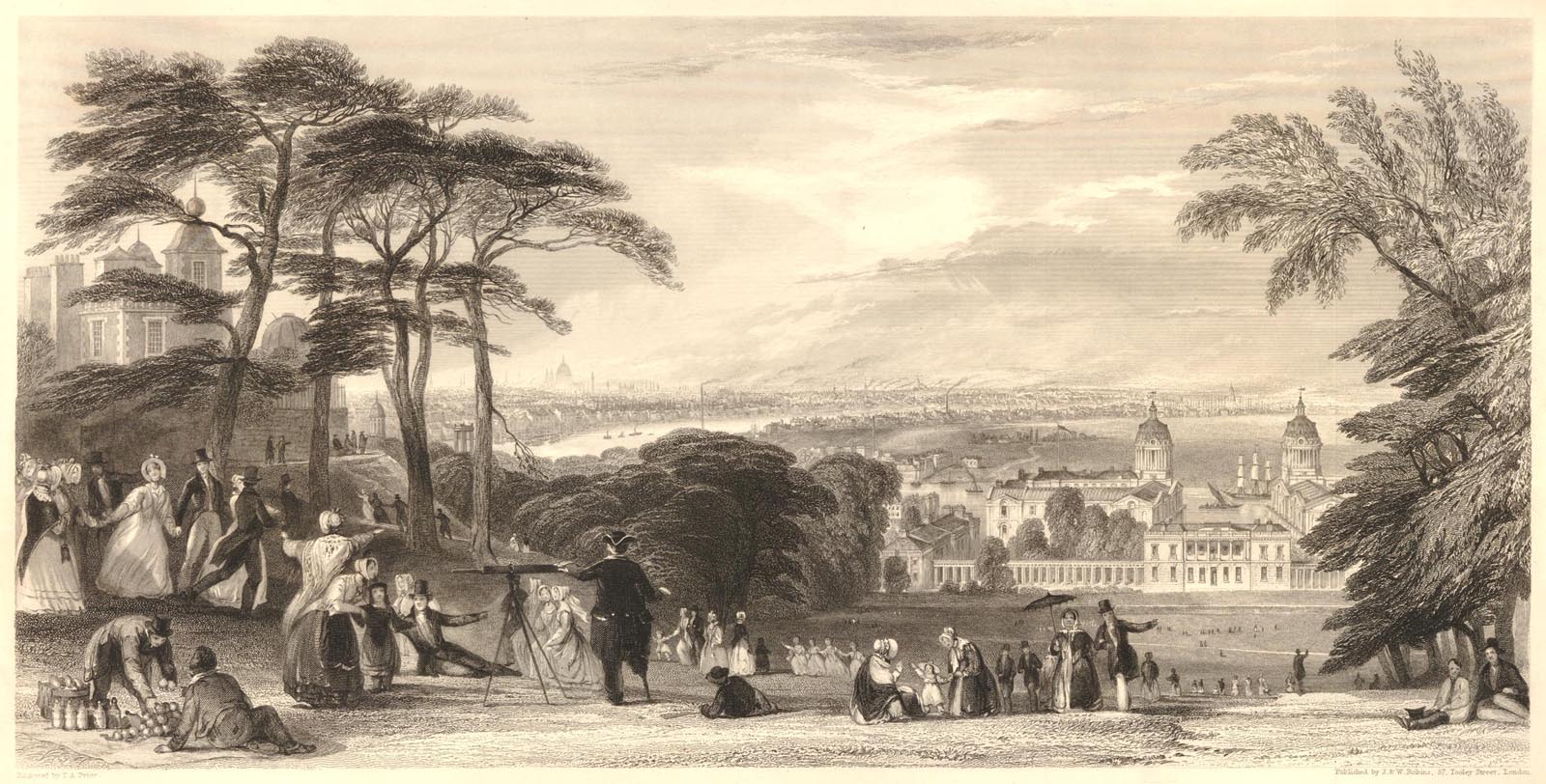
In this etching, which was published in 1840, a well worn path can be seen on the east side of the ascent (right). London from Greenwich Park, engraved by T. A. Prior and published by J & W Robins. © The Trustees of the British Museum (CC BY-NC-SA 4.0). Museum Number: 1944,0704.12
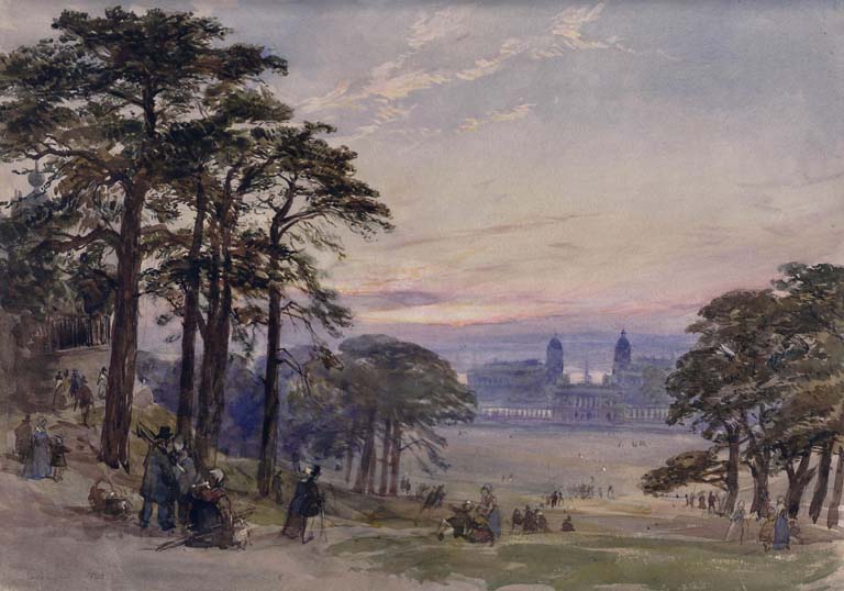
This watercolour by William Collingwood (signed and dated 1840) was painted from closer to the middle of the Ascent from where the view of London was less good. The path leading from Park Row to the bottom of the Ascent can be seen behind the trees on the right. Greenwich Hospital from the Observatory. © Victoria and Albert Museum, London, Accession Number P.9-1928 (see below)
As well as the Scots Pines obstructing the view of London from the top of the Ascent as they matured, the trees also blocked the view looking up to the Observatory from the north-east. Images looking across the Ascent towards the Observatory are thin on the ground from around 1750 until 1850. So too are images of Flamsteed House from the north that include the Grand Ascent. Things changed with the advent of photography and in particular stereo-photography. For a stereo-view to produce a good 3-D image, it needs objects in the foreground, objects in the in the distance and ideally objects in between. The two rows of trees with the Observatory behind were ideal – even if a large part of the Observatory was obscured!
The Royal Collection has a copy of the earliest known photograph showing the Grand Ascent.
Royal Collection Trust: 1893 photograph copy after an 1853 original (RCIN 2906076)
A large gap in the western treeline can be seen as well as a large amount of erosion on the slope. Of particular interest is the series of what look like railway sleepers on the eastern side (left). Nine can be made out and there were no-doubt others further up the slope. Their purpose is unclear but they could have used in an attempt to prevent further erosion of this part of the slope by stopping people from walking here. To the right of the bottom tree on the left, two paths are visible crossing the northern bank of the Parterre. The one heading off on a slight diagonal towards the bottom right hand is the path that was removed in 2024. The other, leading towards the photographer, is the path that ran directly towards this point from the Park Row gate (as shown on the Sayer plans). Also visible bottom right are some of the Scots Pines that were planted on either side of the terrace located between the bottom of the Ascent and the south end of the Parterre.
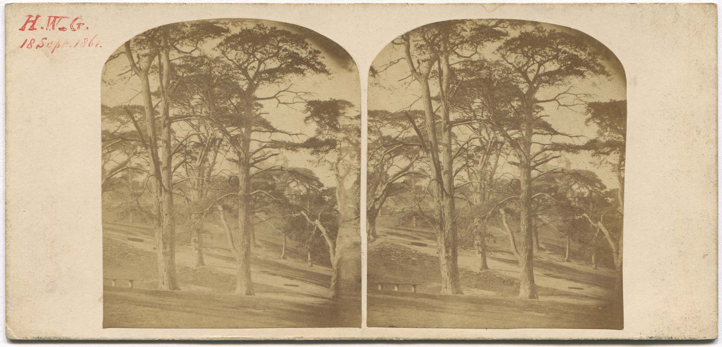
Carrying the date of 18 September 1861 and the initials HWG on the front, two of the 'sleepers' can be seen in this stereoview. It is not known if HWG was the photographer, the owner or both. Nor is it known if the card was published commercially. Flamsteed House is visible behind the trees (centre-right)
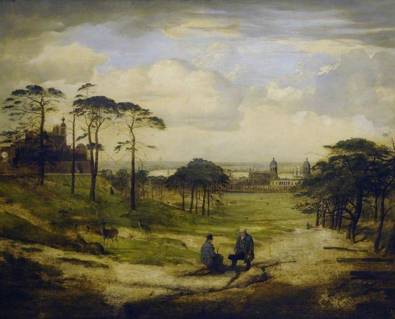
1857 Oil paining by George William Mote, Reproduced under a Creative Commons Attribution-NonCommercial licence courtesy of The Cooper Gallery (Reference Number CP/TR 299) and Art UK (Reference: 68902) see below
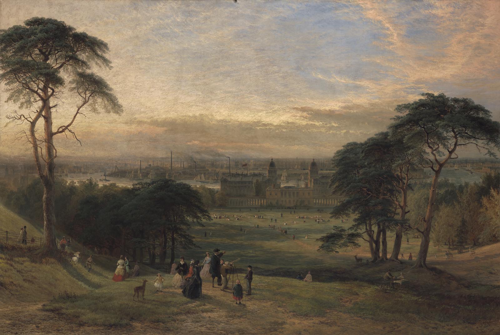
A later view from 1869 painted from further down the slope. Note the couple with their picnic table (bottom right as well as the couple who appear to be sitting on one of the steps. London from Greenwich Hill by Henry Dawson. Oil on canvas, 1869. Yale Center for British Art, Paul Mellon Collection, Accession number: B1981.25.216. Public Domain
Although the 1867/1871 OS map shows the path leading from the Park Row gate to the bottom of the Giant Steps as having been extinguished, the painting immediately below and early postcards show that the section crossing the Parterre banks was still in existence in the 1890s before finally being extinguished around the turn of the century.
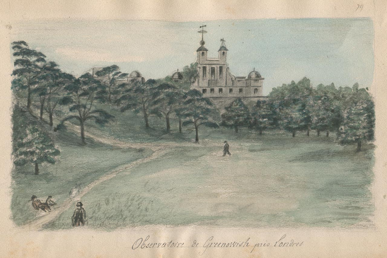
The path rising up the eastern side of the ascent is clearly visible in this illustration which is thought to date from 1879. Observatoire de Greenwich pres Londres by an unidentified artist. Mixed media on paper
In this photo from the 1890s, the path coming from Park Row can be clearly seen. However, rather than ascend the hill, it appears to terminate near the tree in the centre of the picture. its onward path being blocked by a short section of fence. Note too the presence of a new path running along the bottom of the ascent (not shown on the 1:1056 Ordnance Survey map which was revised in 1893 and published in 1895 (link below). Detail from a postcard by Perkins, Son and Venimore
Ordnance Survey: London - London XII.22. Revised: 1893, Published: 1895
This view, which dates from around 1890, shows the second fence to be erected at the top of the Ascent. It remained in place until just before the erection of the Wolfe Statue in 1930. From a multi-view postcard published by the Chaucer Postcard Publishing Company
In this view from about 1904, the short section of fence at the bottom of the Ascent has been removed and the path from Park Row finally extinguished (though its ghost-like former presence can still be seen). The pines have also been felled and the new trees planted. Note the group of deer (bottom left). From a postcard published anonymously
Thought to have been taken two years later in 1906, this shot shows some people are enjoying the view, whilst others are intrigued by the photographer. It also captures phase one of Greenwich Power Station (top right) that had just been completed. From a postcard by Perkins & Son
Looking back across the Ascent towards the Observatory at around the same date (1906). From a postcard published anonymously
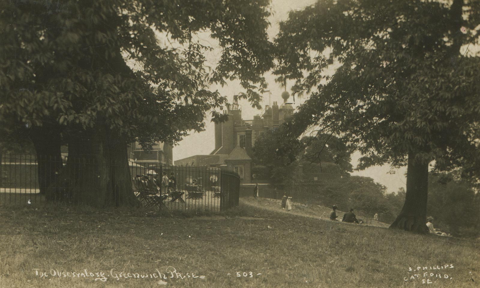
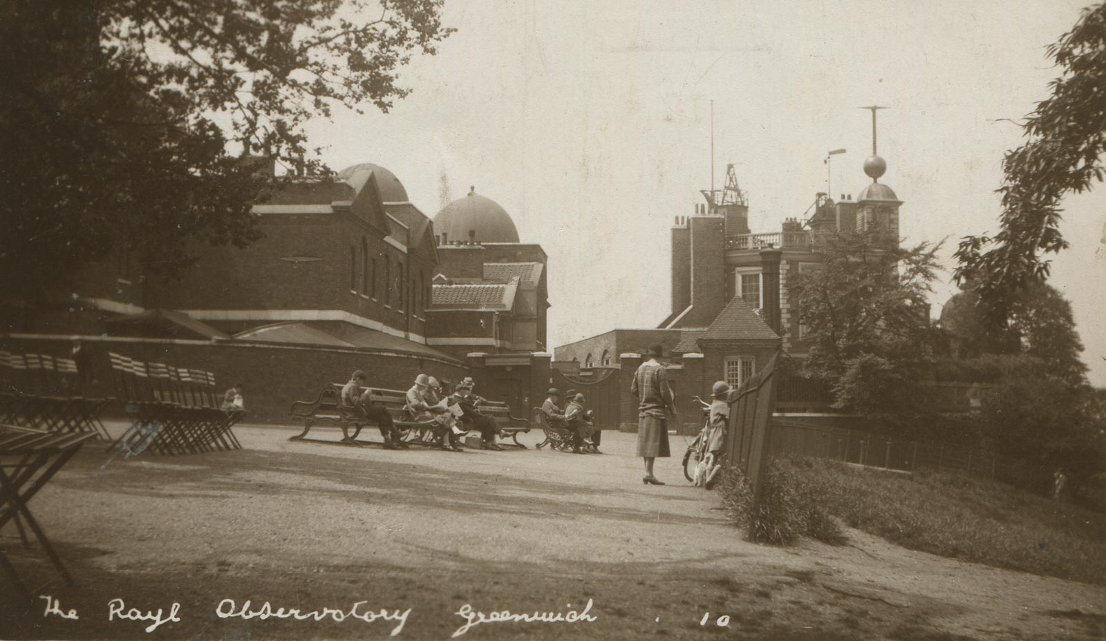
A second view of the fence at the top of the Ascent, this time from around 1911–15. From a postcard by S. Phillips, Catford
Taken by Phillips around the same time as the photo above (1911–15), this shot looks back across the Ascent towards the Observatory. Phillips was a prolific postcard publisher. Unlike most other publishers he didn't make duplicate negatives to print from. By the time this postcard was printed, the negative showed considerable signs of damage. From a postcard by S. Phillips, Catford
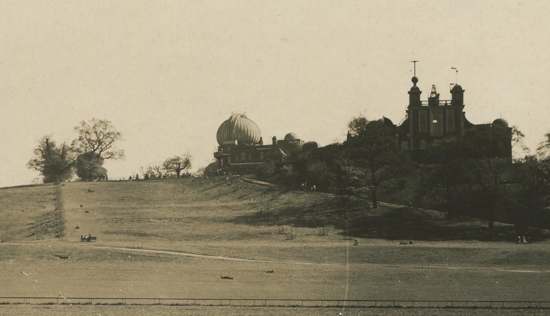
Thought to have been taken in the 1920s, the hillside shows no signs of erosion in this shot. Detail from a postcard published by C. Degen, London
By the time this photo was taken in 1925–27, part of the railings had been removed and a new path down the Ascent was beginning to form. From a postcard attributed to C.W. Green, Plumstead
By the mid 1920s, a bare patch had started to open up towards the bottom of the slope. The photo is thought to have been taken between 1925 and 1928. Detail from a postcard by Card House
To make room for the Wolfe Statue the area in front of the Observatory gates was enlarged by moving the fence at the top of the Ascent northwards. Rather than re-erect the old fence, which would have partially obscured the statue's plinth from the bottom of the hill, a new much lower fence, (similar to those that existed on the edges of the paths crossing the Parterre in the image above), was erected instead. It is thought to have remained in place until at least the 1970s. This image is thought to date from 1929–30 and comes from a postcard attributed to C.W. Green, Plumstead
Looking up the Steps in 1938. Note the scaffolding on the Great Equatorial Building that had been erected to allow the dome to be painted. Photographic print by an unrecorded photographer
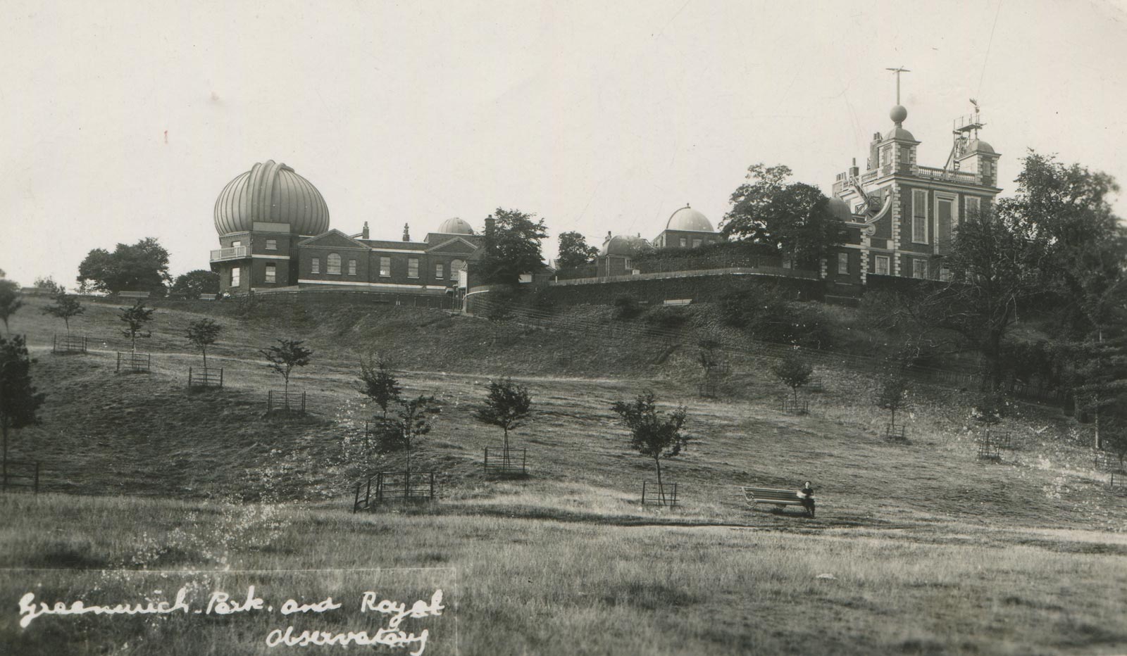
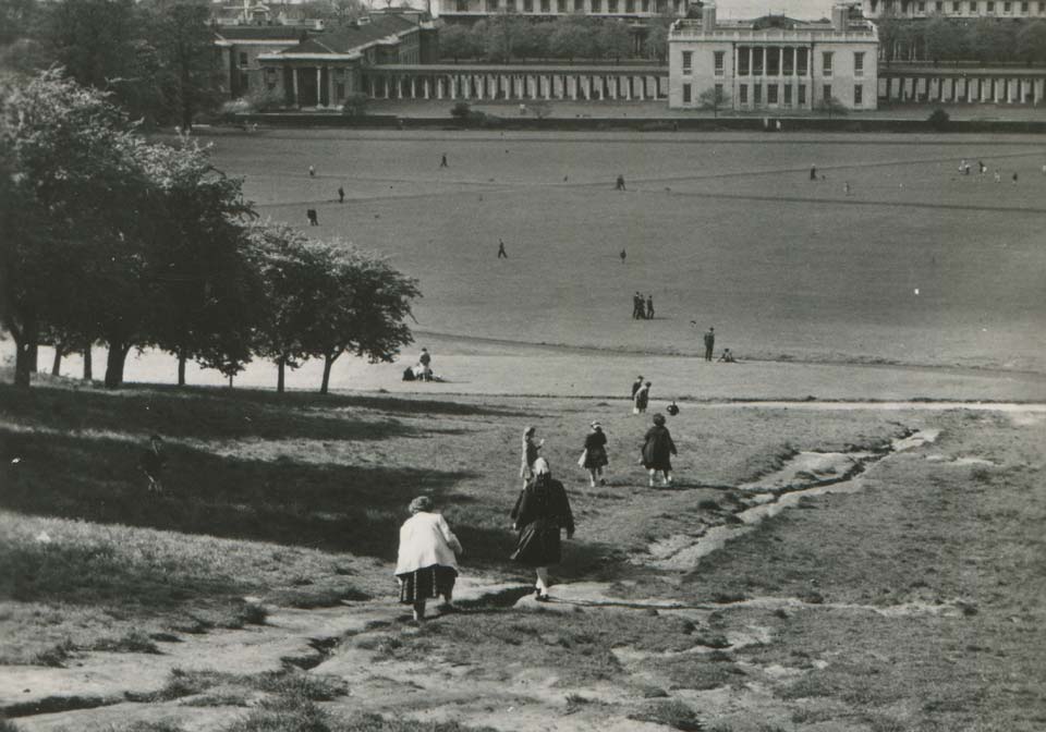
Probably taken in 1950, this photo was entered by Valentine in their card register on 13 February 1951. The allotments have gone and there is no obvious signs of erosion on the slope. Detail from a postcard by Valentine & Sons Ltd.
A few years later, a new well worn path has become established. The image is thought to date from about 1955. Detail from a postcard published by Wilson College
By around 1958 when this shot is believed to have been taken, a deep rut had opened up in the middle of the path. Although remedial work was later undertaken, some sort of path continued to exist on the slope until at least the start of the 1970s. Detail from a postcard published by Gordon Fraser. Photo by by H. Luckyn-Williams
The Ascent on 21 July 1975. At this point there was no fence at the bottom of the Ascent and only the very low fence at the top. Photo © Peter Shimmon. Reproduced under the terms of a CC-BY-SA 2.0 license (see below)
By the time this photograph was taken on 28 October 1981, a fence had been erected across the bottom of the Ascent. Note the manhole cover (bottom left), which is believed to be related to a soak-away system that is thought to have been installed in the 1960s or 70s. It was covered over in 2024. The grass where the earlier path had been looks greener than that on either side. Photo © David Dixon. Reproduced under a CC-BY-SA 2.0 license (see below)
In this shot taken in May 1994, the fence at the top of the Ascent can be seen as well as the fence at the bottom. Immediately in front of the top fence is the Berberis hedge. Although determined people were still able to find a way onto the grass, there is little sign of erosion. © Gordon Beach. Reproduced under a CC-BY-SA 2.0 license (see below)
In this later view taken on 18 October 1998, the grass shows bare patches, but the Ascent is still free of a path to the top. © Nick Macneill. Reproduced under a CC-BY-SA 2.0 license (see below)
The unofficial path that existed on the hillside just to the east of the Grand Ascent. It started where the fence at the bottom of the ascent came to an end. In order to try and stop people from using it, in 2008 a new and extended fence was erected at the bottom and the fence at the top extended. Unlike the old fence, the new one was rather easier to climb over. Photo: 22 May 2007
The fence nearing completion at the bottom of the Ascent. Photo: 21 May 2008
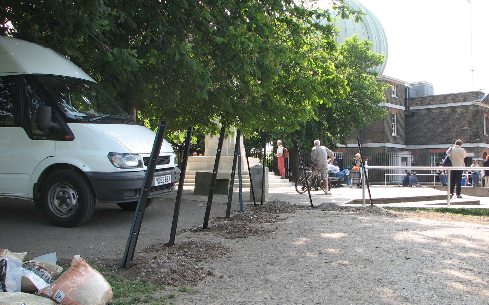
Extending the fence at the top of the Ascent. Photo: 21 May 2008
Looking down the Ascent at sunrise on 4 February 2009. Note the straw bails that have been placed in front of the fence to protect tobogganists from injury. Note also the ridging on the slope that the previous days sledging had revealed. It is likely to have been caused by small scale slumping in the upper layers over a long period of time
By the time this photo was taken on 16 June 2010, a new path down the centre of the Ascent had become established and the new fence damaged by people climbing over it. © Robert Lamb. Reproduced under a CC-BY-SA 2.0 license (see below)
By the time this photo was taken just a few weeks later on 22 July 2010, the damaged section of fence at the bottom of the Ascent had been removed
By the time this photo was taken on 30 April 2011, a new fence had been erected with vertical rather than horizontal rails. In an attempt to stop people walking and sitting on the Ascent several temporary barriers were also erected at various points across the width of the Ascent
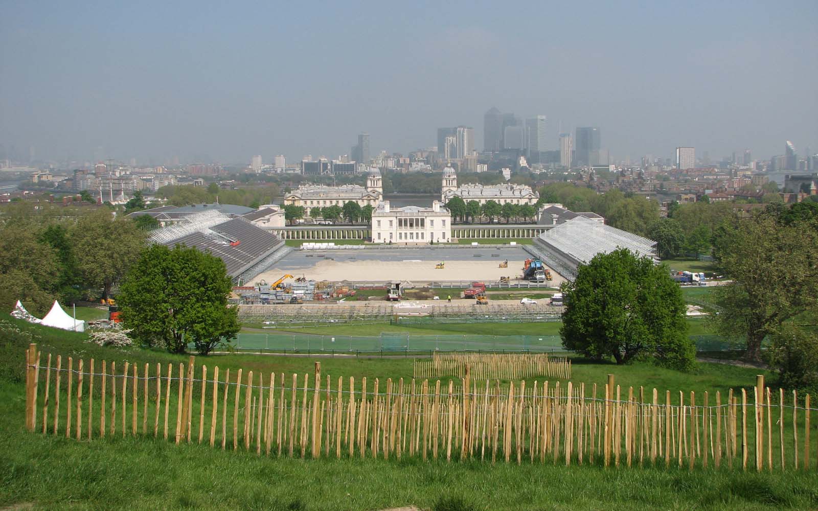
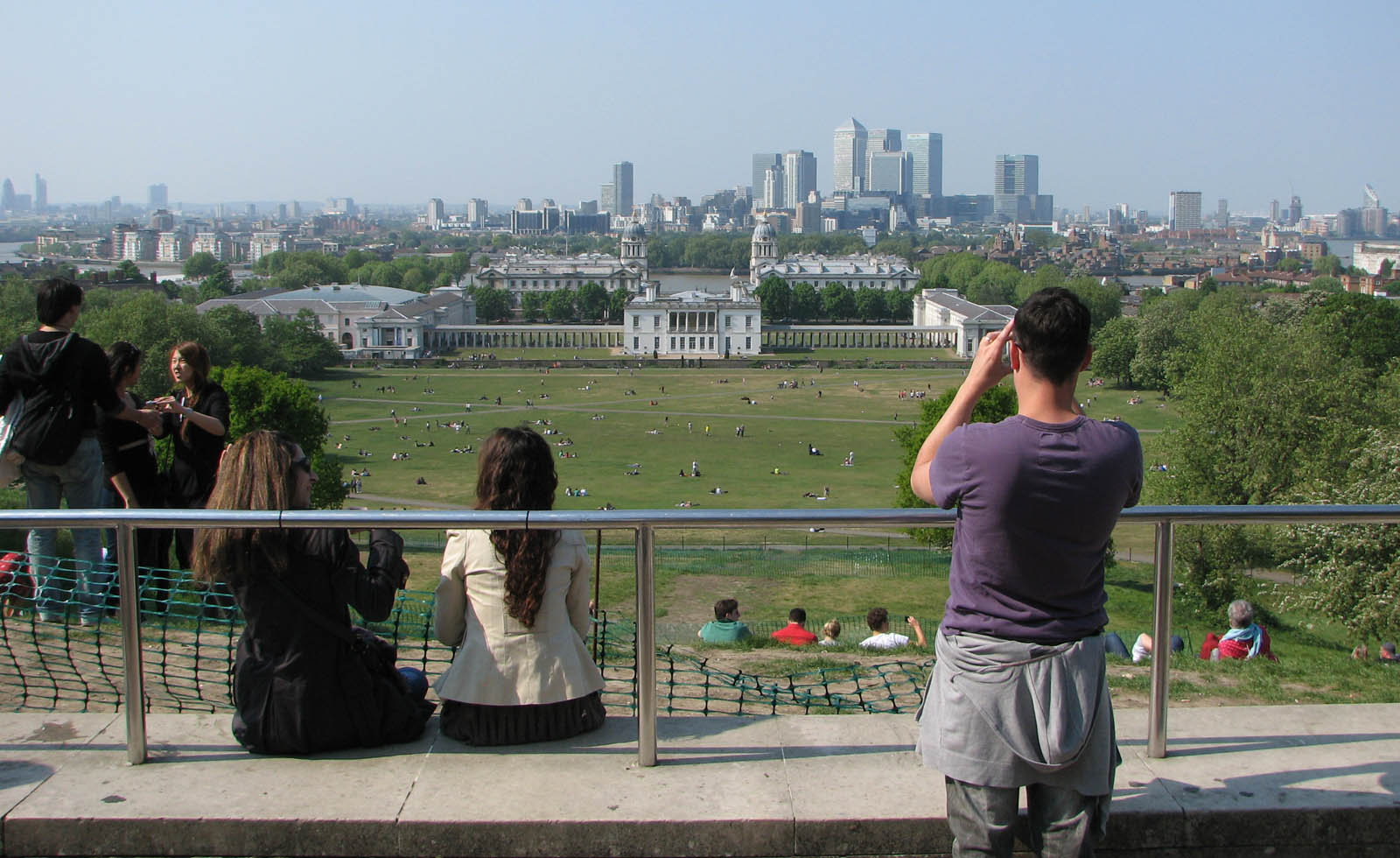
When this photo was taken on 22 May 2012, the stadium for the equestrian events for the 2012 Olympic Games was under construction. Given the global TV audience and the fact that aerial shots would include the Ascent and the Observatory, an attempt was made to eliminate the path up the Ascent by erecting numerous short lengths of fencing (chestnut paling) across it. Although they are difficult to count here, satellite images on Google Earth suggest that nine lengths were erected in total
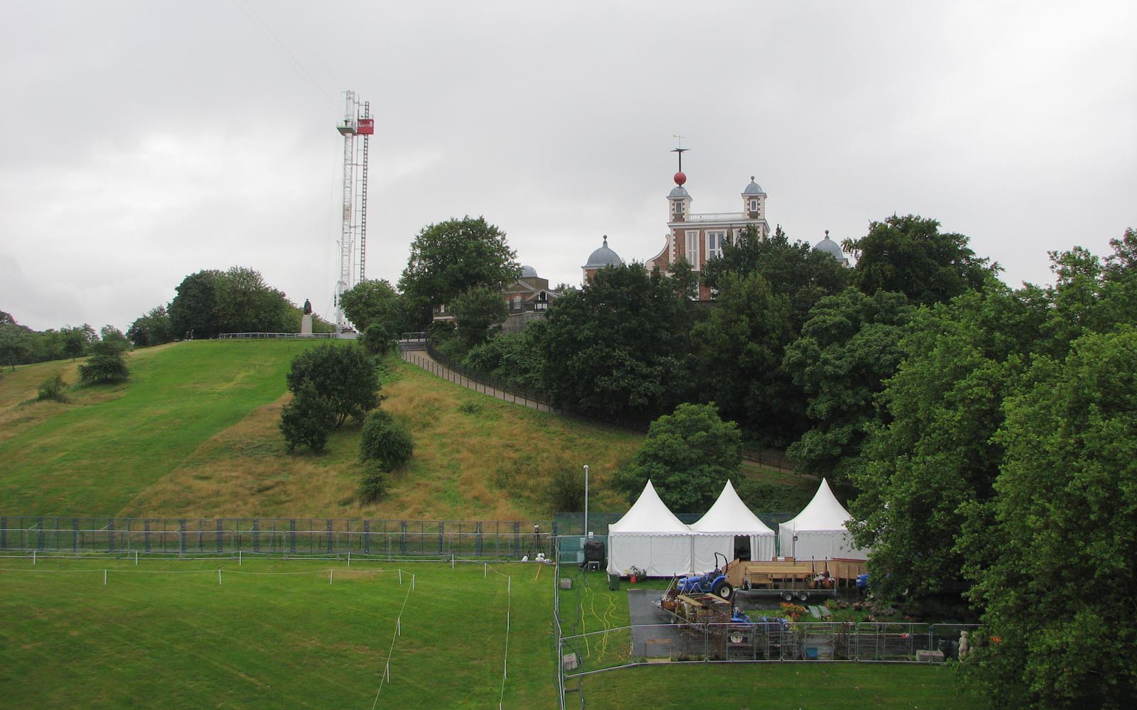
Taken during the games on 4 August, this picture shows that the chestnut paling had done its job and allowed the bare area where the path was to have been successfully reseeded. The tower behind the Wolfe statue supported three wires carrying the traveling camera which was used to film above the stadium
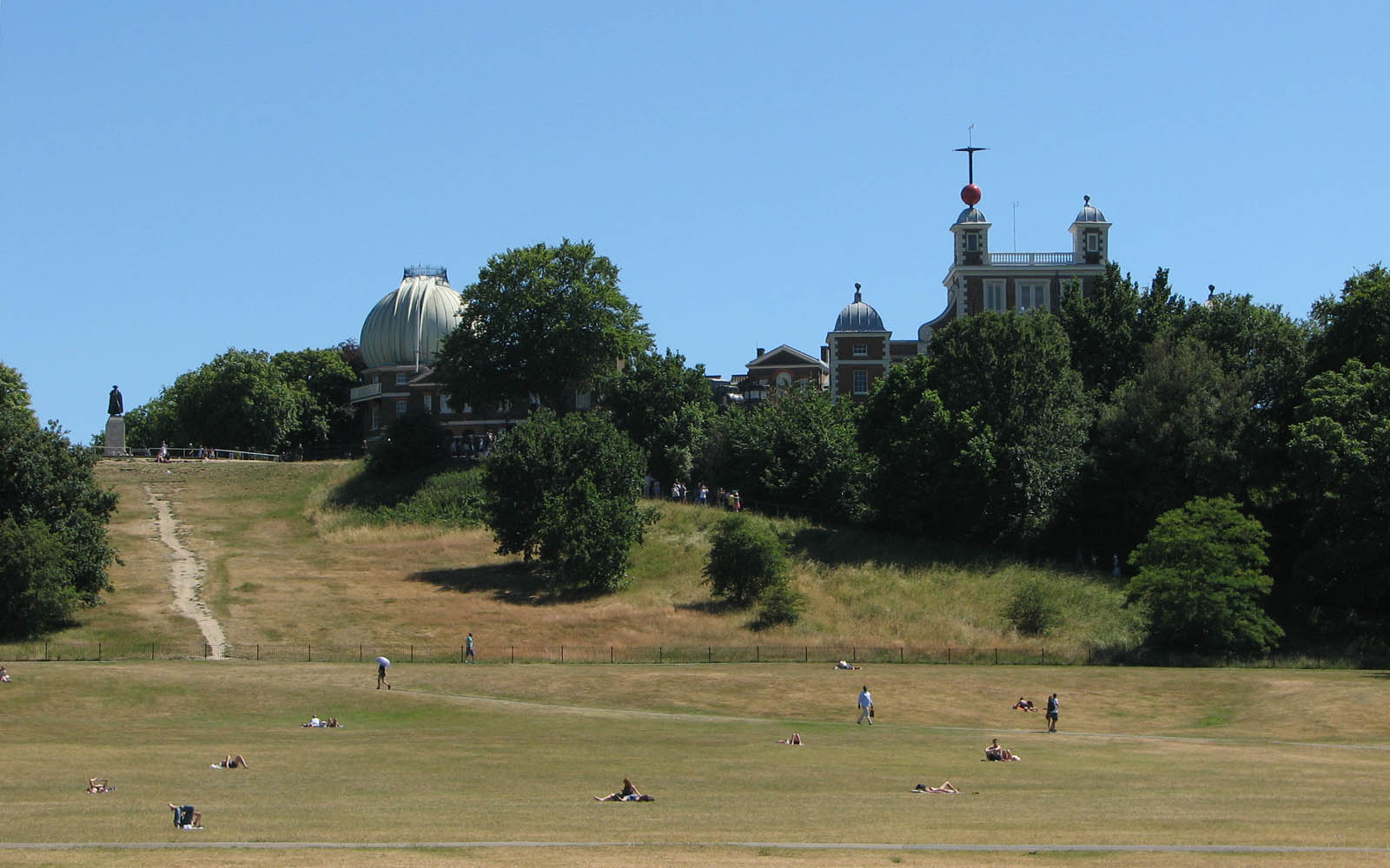
By the summer of 2013, the path down the centre of the Ascent had become re-established. This photo captures it on 30 June 2015

By the time this photo was taken on 24 September 2016, lengths of chestnut paling had been erected at different points across the path running down the centre of the Ascent. An unfortunate and unintended consequence was the appearance of not one but two new paths – one at either end of the fencing. Over the next few years, various arrangements of the chestnut paling were installed in an attempt to prevent new paths from opening up. © Richard Cooke. Reproduced under a CC-BY-SA 2.0 license (see below)

An archaeological dig took place on the Ascent at the end of 2023. The photo was taken on 6 November 2023. A few days later, contractors moved in to start recreating the Giant Steps
Summary of the known and inferred facts relating to the Giant Steps
- In 1661 Charles II began re-landscaping the Park, the construction of the Giant Steps being overseen by William Boreman.
- The earliest reference to the Steps' existence is the 11 April 1662 entry in Pepys's diary. A few months later Schellinks also noted their presence in his journal. Neither writer gives any information about the number of Steps.
- Boreman's unaudited financial accounts state there were 12 Giant Steps and 14 coppices (SP29/56/39.1). However the audited accounts for the same period (E351/3428) state there were 16 coppices as do a second later set of Boreman's accounts (SP29/116/14). Of the three sets of accounts only the first gives any information about the number of Steps constructed.
- The Pepys Plan is thought to date from around 1677 and is the earliest known plan of the Park. The next oldest plans are the Plan of 1693 and the later Woodlands Plan.
- Like Boreman's unaudited accounts, the Pepys Plan indicates that 12 Steps were created – but were they?
- As well as showing the Observatory and the 12 Giant Steps, the Pepys Pan also shows 14 rather than 16 coppices. Both the 1693 and the Woodlands Plans however show the correct number. This impies two things. Firstly that 14 Coppices were planned but 16 were actually built. Secondly, the fact that the Pepys Plan only shows 14 suggests it derives from a masterplan plan originally drawn prior to any landscaping works commencing but partially modified a couple of years later to include Le Nôtre's Parterre and the associated avenues, the number of Coppices remaining uncorrected from those originally drawn.
- The Francis Place etching Facies Speculae Septen shows just nine Steps rather than the 12 shown in the Pepys Plan. The etching also shows the presence of what appears to be a ramp in the centre of each step as does the etching Prospectus Orientalis. These are not shown on any of the plans or in any other known images and may be the remnants of the 'Staires' mentioned by Boreham in his audited accounts. Given that Facies Speculae Septen and the Pepys Plan were both created at about the same time, they can't both be correct. Given that the unaudited accounts and the Pepys Plan are both in error on the number of Coppices, are they wrong about the number of Steps that were constructed too?
- The balance of evidence suggests that Facies Speculae Septen with its nine Steps is more likely to be correct that the Pepys Plan. The case for the Plan being correct is not only weakened by the fact that it shows the wrong number of Coppices, but that in 1721 there were plans to make 'some few alterations' to the plate from which the plan had been printed. Although there is no record of what these changes were, it is likely that one was to the scale which had been incorrectly labelled. It is quite possible that it was also planned to change the number of steps from 12 to nine. It would seem that whilst it was originally planned that 12 Steps would be built the number was altered to nine during their construction.
- Boreman's audited accounts imply that the Steps were constructed from layered turf.
- How the Steps appeared from the Queen's House is not known, but it is likely that from this view-point they had the appearance of rising evenly. Taken together the two Francis Place etchings Facies Speculae Septen and Prospectus Orientalis would seem to support this view.
- The underlying geology of the Ascent changes from top to bottom.
- Plans, prints drawings and paintings suggest that the number of steps gradually diminished over time to four or possibly five by 1745. Under the right conditions, five risers remained visible into the twenty-first century. It is not known how why or when the reduction in number happened. Nor is it known if this was a result of natural erosion or deliberate re-landscaping (possibly on more than one occasion), or a combination of both.
- The width of the steps was the same as the width of the avenue above (as measured between the outer rows of trees)
- Initially there were no trees planted at the end of the steps. Scots pines were first planted at the end of the steps in the early eighteenth century, possibly in the 1720s. It is not known why they were planted. Some were replaced in the nineteenth century with all being felled by the mid-1890s. Some on the western side had been permanently removed by the 1840s, possibly because they blocked the view of London from further up the Ascent. Hawthorns were planted on the same alignment as the pines in 1903/4. Some survived until felled at the end of 2023.
- The expansion of the Observatory site eastwards in 1791 and again in 1813 resulted in the permanent loss of the top part of the Ascent on the western side.
- Proposals to build a statue of Britannia at the top of the Ascent were put forward in the late eighteenth century but came to nothing. The Wolfe Statue (now grade 2 listed) was erected at the top of the Ascent in 1930. The formal landscaping works at the end of the Avenue at the top of the Ascent probably began in the mid nineteenth century. The top twelve to thirteen metres of the Ascent disappeared under the hard landscaping which was extended northwards when the Wolfe Statue was erected.
- Erosion due to people walking on the hillside has always been a problem. This became ever more serious over time as greater and greater numbers of people visited the park. The archaeological survey carried out in 2023 indicates that in the past, a layer of clay was spread over the Ascent to address the erosion problem. It was thicker at the top than at the bottom.
The Greenwich Park Revealed planning documents approved in September 2020
(Reference 19/4305/F)
Planning application details:
Reference |
Detail |
Approved |
|
| 19/4305/F | Various works to Greenwich Park including … landscaping and planting enhancements including the reinstatement of the Grand Ascent or Giant Steps and Parterre Banks ... |
4 Sep 2020 |
The online planning portal lists 54 documents associated with the application. In total, they run to 1153 pages. With so much documentation, there are inevitably inconsistencies, factual errors and omissions. To what extent these were accidental or deliberate is difficult to judge. According to the planning portal 386 neighbours and representatives were consulted and three comments were recieved, all of which were objections.
The key documents relating to the steps are:
- Heritage statement parts 1, 2 & 3 (107 pages)
- Design and access statement (57 pages)
- Giant steps, grand axis etc combined (5 pages)
- Archaeology desk based assessment (31 pages)
- Statement of community involvement (38 pages)
- Proposed masterplans and ga drawings (9 pages)
- Proposed levels and cross sections combined (11 pages)
The Heritage Statement is a key document whose purpose is set out in paragraph 128 of the National Planning Policy Framewrrk (NPPF), which states:
'In determining applications, local planning authorities should require an applicant to describe the significance of any heritage assets affected, including any contribution made by their setting. The level of detail should be proportionate to the assets' importance and no more than is sufficient to understand the potential impact of the proposal on their significance. As a minimum the relevant historic environment record should have been consulted and the heritage assets assessed using appropriate expertise where necessary'
Although the Heritage statement runs to a total of 107 pages, it comes as a surprise to find that it has nothing whatever to say about William Boreman and the fact that there were originally twelve steps. Nor does it have anything to say about the Pepys Plan and the other Francis Place etchings, nor the 1693 Plan or any of the Vosterman or Giffier paintings. Instead the statement says the following (pp.20 & 66–67).:
'In the late-17th century, Charles II commissioned Andre le Notre (Louis XIV’s gardener at Versailles) to re-plan Greenwich as a formal, landscaped parkland, with grand avenues of trees, and a flight of giant steps up the escarpment between the Queen’s House and the Royal Observatory. ...
In developing the design of the Grand Ascent and Parterre Banks, Jon Sheaff & Associates has referred to the ‘Woodlands Plan’ of 1706, which closely-reflects the landscape of Greenwich Park that was created in the late-17th century. That approach is supplemented by analysis and comparison with the current site levels and layout, which, when overlaid with the Woodlands Plan [not shown], closely reflect the historic layout and topography. This approach has been supported by Historic England and the local authority, during the preceding stage of stakeholder and pre-application engagement.
... As well as the topographical works, the landscape proposals also include the selective removal and replacement of later trees on the Grand Ascent. In particular, Scots Pines will be planted on the treads of each step, to reflect the planting scheme of the original 17th century formation. In addition, copses of hawthorn will be positioned informally to either side of the steps on the escarpment, and the steps themselves will be seeded with acid grassland to reinforce the existing habitat and biodiversity of Greenwich Park.'
The Heritage statement is in marked contrast to what is said in the Archaeology desk based assessment (pp.12 & 13) and the Greenwich Park conservation plan 2019–2029, both give a rather more complete history. It should be noted however that the conservation plan did not form part of the planning application.
The Design and access statement runs to 57 pages. No artist's impression was included despite the fact that one had been used during the community consultations which took place prior to the planning application being submitted. Page 12 of the statement has the following about the Grand Ascent.
'Proposals for the Grand Ascent are concerned with the north-facing escarpment of Observatory Hill to the east of the Observatory Hill footpath and the north of the Wolfe Statue dais. Historical records (plans and illustrations) suggests that this area was set out with giant grass steps but sources differ in respect of the number of steps that were originally created. Vestigial evidence of three steps at the foot of the slope remains.
Analysis suggests a strong correlation between the current topographical levels of the Parterre banks and the layout depicted in the Woodland Plan of 1706. This plan suggests that six steps were created on the escarpment.
The intention is to restore the layout of six giant grass steps suggested by the Woodlands Plan and to align this with the outer tree avenue running south from the Wolfe Statue dais to Blackheath Gate. The steps will be created symmetrically on a line running from the centre of the Queens House to the centre of Blackheath Gate.'
Whilst it is true that the form of the steps in the early twenty-first century was most similar to that shown in the Woodlands Plan, if the aim of the Greenwich Park Restored project was to reinstate the steps as originally created, this was most definitely not the Plan to use. In fact, given the degree of uncertainty as to whether twelve or nine steps were actually created in the 1660s, it would perhaps have been better to conserve the remains of those that still existed rather than attempting any kind of reinstatement.
The document Giant steps, grand axis etc combined contains five plans. The fourth is dated 14 November 2016 and shows the Parterre and Grand Ascent from the Woodlands Plan superimposed onto a modern plan with both the existing and proposed contours shown. There is a major discrepancy between the proposed contours shown on this plan and with those shown on the following three plans.
- Greenwich Park Revealed Masterplan (Reproduced in Heritage statement part 2)
- Plan 5 of the Proposed masterplans and ga drawings and
- Plan 6 of the Proposed levels and cross sections combined.
Unlike the Giant steps, grand axis etc combined plan, all three of the above show the steps the same width as they had in the 1660s (but tapering inwards on the western side from the third tread upwards). They also show a total of eight Scots pines (Pinus sylvestris) planted on the ends of the five treads in line with the two outer rows of the pre-existing trees in the avenue above – one on each of the treads on the eastern side and one on the lower three treads only on the western side with an additional pair of trees to be planted on the terrace immediately below the bottom riser.
When permission was given for the plans to proceed in 2020, the following condition was applied (Decision notice, condition 8):
'Prior to the commencement of works in the relevant part of the site, final details of the proposed design for the Giant Steps shall be submitted to and approved in writing by the Local Planning Authority, in consultation with Historic England. The development shall be carried out in accordance with the approved details.'
The Greenwich Park Revealed planning documents approved in November 2023
(reference 23/2509/SD)
Planning application details:
Reference |
Detail |
Approved |
|
| 23/2509/SD | Submission of details pursuant to the discharge of Conditions 8 (Giant Steps Final Details) and partial discharge of Condition 11 (Landscape Restoration Method Statement) of planning permission 19/4305/F dated 04/09/2020. | 14 Nov 2023 |
The online planning portal lists 63 documents associated with the application. In total, they run to 262 pages. According to the portal no neighbours and representatives were consulted and no comments on the plans were received.
The cover letter submitted with the application reiterates what was stated in the Heritage and Design and access statements submitted as part of 19/4305/F:
'Historical records (plans and illustrations) suggests that the Grand Ascent was set out in a series of banks and terraces, also referred to as ‘giant grass steps’ although historic sources differ in respect of the number of steps that were originally created. Vestigial evidence of three steps at the foot of the slope remains. Analysis suggests a strong correlation between the current topographical levels of the Parterre banks and the layout depicted in the Woodland Plan of 1706. This plan suggests that six steps were created on the escarpment.
The intention is to restore the layout of six giant grass steps suggested by the Woodlands Plan and to align this with the outer tree avenue running south from the Wolfe Statue dais to Blackheath Gate. The steps will be created symmetrically on a line running from the centre of the Queens House to the centre of Blackheath Gate'
In terms of how the steps were designed to appear, two key documents illustrate this:
- Grand ascent proposed contours (30109/7001 Rev P03)
- Grand ascent - general arrangement plan - revised drawing (TRP-DR-PGA-007-004 Rev 02)
Although Historic England are reported in various of the documents as having been consulted, there is no published record of the scope of the content of those discussions nor why Historic England supported reconstruction on the basis of the Woodlands rather than the Pepys plan or better still the Francis Place etching at the head of this page.
As with the earlier application, no artist's impression of the steps was submitted. Nor does any consideration seem to have been made about how the finished steps would appear from different view-points – particularly the Queen's House. Disturbingly, the contours shown on the two approved plans Grand ascent proposed contours and Grand ascent - general arrangement plan (revised drawing) are not identical.
What became clear as the plans were developed was that it would not be possible to recreate even the lower steps with a uniform profile across their entire width. Had the Scots pines been planted as originally suggested the lack of uniformity of the profile would have become immediately apparent.
The finalised plans for the Ascent differ from those submitted previously in three key respects:
- Firstly, the contouring of the new steps: although their overall width remained unchanged, only the central part of each tread was now to be both level and have a uniform gradient across its entire depth
- Secondly, common hawthorns (Crataegus monogyna) were substituted for the pines (presumably on the basis that these are the trees that were planted at the edge of the Ascent in the early 1900s).
- Thirdly, rather than being planted at the end of the steps the trees were to be planted in line with the inner rows of trees that were being retained in Blackheath Avenue.
Once the steps had been recreated, it became apparent that their contours did not conform to either of the above plans. Nor were the hawthorns planted in the positions shown (more on this below).
Expectations versus reality
Although no artist's impressions showing how the steps might appear were included with either of the planning applications, at least one artist's impression was shown in the community consultations prior to any planning application being submitted. A copy of this was reproduced on p.30 of the Statement of community involvement included with the first application (19/4305/F). The Statement also included (pp.36–37) the views of 27 members of the public about their proposed re-reinstatement. Of these, eighteen were deemed positive, three neutral and six negative.
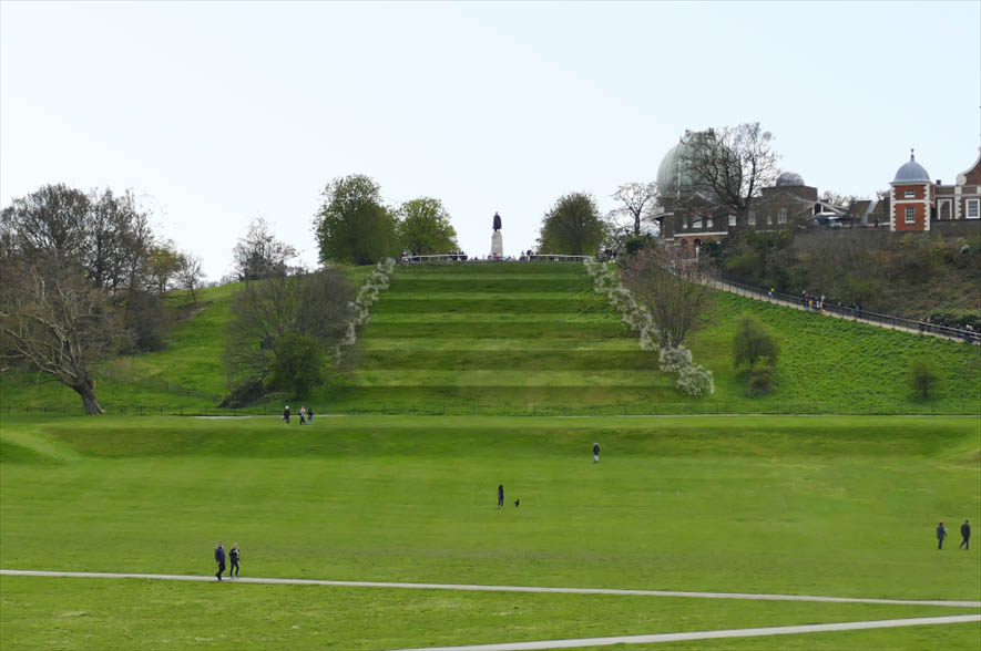
The artist's impression of how the reinstated Giant Steps would look that was used during the public consultations prior to a planning application being submitted. © Royal Parks
It was possibly in 2022 – perhaps earlier – that a second artist's impression was released. It appears to have been more widely circulated. Unlike the first artist's impression, this one included the Scots pines at the end of the Steps that were proposed in the initial planning application.
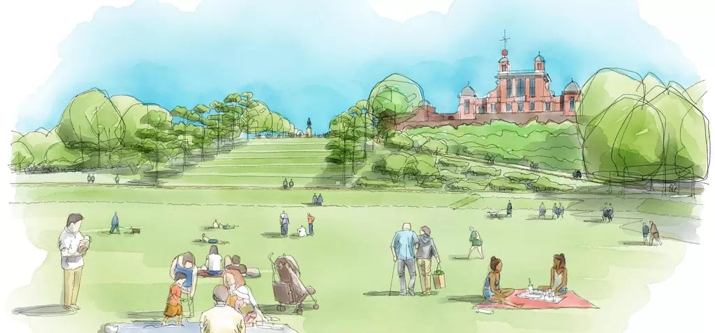
The artist's impression of the Giant Steps included in the Royal Parks press release of 4 August 2022. Note the absence of any form of fence at the bottom of the steps, despite the fact that it was planned to have one. © Royal Parks
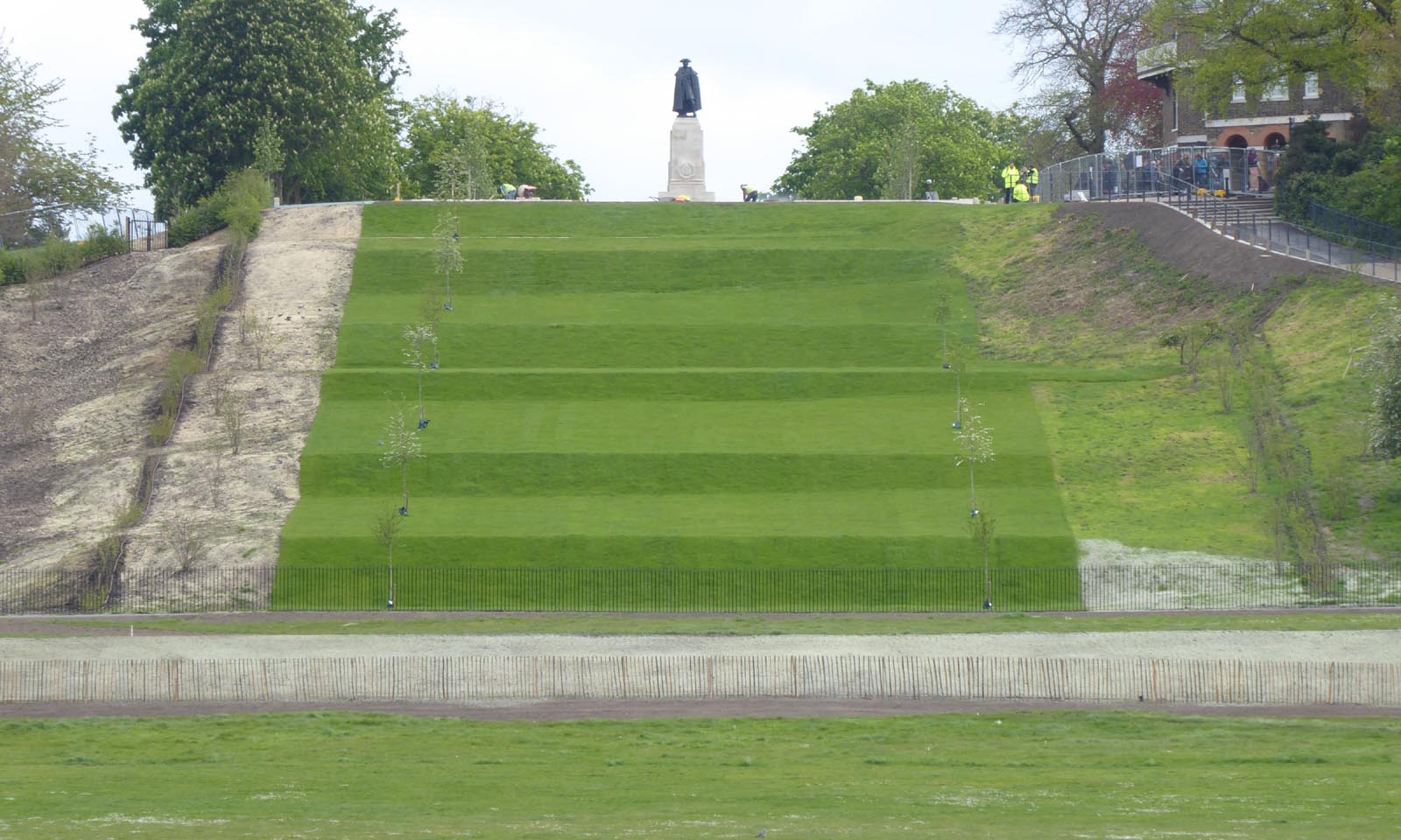
The steps as re-constructed. The middle (third) tread, which is actually the largest, cannot be seen from most of the Parterre. In this picture, which was taken from the entrance doors at the centre of the Queen's House on 23 April 2024, it appears as the thin green line about half-way up. The risers are all of different sizes. On the Woodlands Plan (on which they were modeled), the first, second, third, fifth and sixth risers are all the same size, with the fourth riser being larger and the seventh (which was not re-constructed) smaller
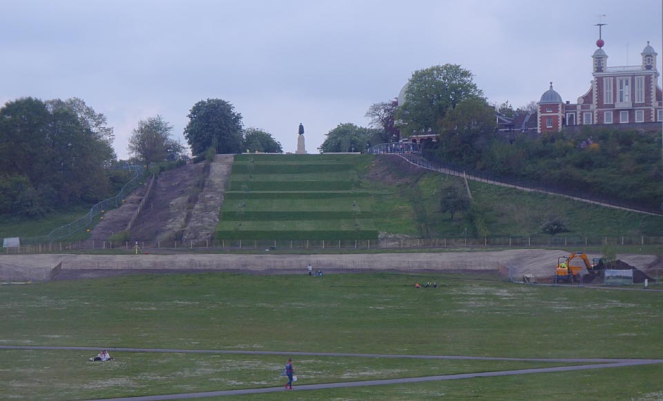
Even from the elevated viewing point of the loggia of the first floor of the Queen's house, the middle tread appears much thinner than any of the others. The bluish hue is caused by the protective film on the windows at the rear of the loggia. Photo: 1 May 2024
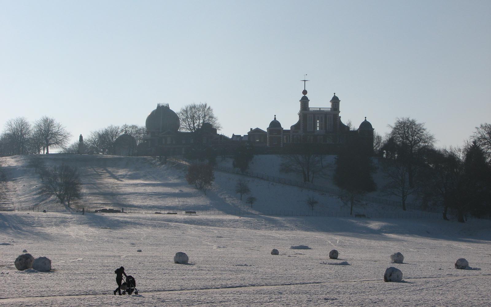
And finally, a second shot from 4 February 2009 as a reminder of how the steps occasionally appeared prior to their reconstruction. Like the previous snow shot, this one was taken from the grounds of the National Maritime Museum, but from the east rather than the west side of the Parterre
Deviations from the agreed pan
As mentioned in the two sections above, once the steps had been recreated, it became very clear that their contours did not conform to the approved plans. Although the bottom two treads between the two rows of hawthorns tread was supposed to be both level across their entire width and have a uniform gradient across their entire depth, this was not the case as can be seen from the two images above in which the back of the treads can be seen to rise up towards the right. Although the fourth tread was supposed to rise in this way, it was supposed to be from further to the right than it actually is. There are other deviations in the contouring too, but these are less obvious.
When the new trees came to be planted, rather than being planted according to the approved plan they were planted in line with the newly planted inner rows of trees on either side of the Wolfe Statue, which are offset inwards by around a yard from the trees in the inner rows that were retained. The end result, is that the actual separation of the lines of trees on the steps is roughly half of that in the two earlier plantings.
For reasons that will be explained in a later section, rather than just treads four and five and risers five and six being turfed as per the approved plans, all the treads and risers ended up being turfed.
There is no documentation included in the planning application to suggest that these alterations were approved by the local authority.
The acid grassland conundrum – to mow or not to mow?
Heritage statement part 3 (19/4305/F) states:
'... copses of hawthorn will be positioned informally to either side of the steps on the escarpment, and the steps themselves will be seeded with acid grassland to reinforce the existing habitat and biodiversity of Greenwich Park.'
This intent appears to be confirmed by Ecological Appraisal document where the following is stated:
'... the restoration of the Parterre Bank and Grand Ascent works will enable subsoils to be brought to the surface and retained within these features, again encouraging acid grassland to establish from the seed bank or through sowing with an appropriate seed mix.'
Exactly what the mix was that was seeded and later turfed over on the Grand Ascent has not been made public. What is clear however, is that the grass on the risers which has been allowed to set seed seems to contain very few varieties and has the appearance of the kind of turf that might be used to turf a garden lawn.
Acid grasslands require careful management if a diverse collection of insects and other animal life is to thrive there. This includes infrequent mowing as well as leaving patches unmown in order to provide corridors for insects. This seems entirely incompatible with the very formal landscape that it was planned to create in the seventeenth century. At the time of writing this section (June 2024), the plans of the Park for managing this particular area of grassland remain unclear. If in the long run the grass is mown just once a year as is the case elsewhere in the Park, the Grand Ascent will end up with a pretty tatty appearance for much of the year.
Transparency, truth and problems with the planning process
The two planning applications both pushed the view that just six rather than nine of twelve steps were originally created. When writing about the 'Greenwich Park Revealed' project, the author(s) of articles on the Royal Parks website appear to have been deliberately ambiguous. The articles avoid mentioning the number of Steps but strongly imply that they would be recreated in their original form. Three examples collected in May 2024 from different pages on the website are given below. The last two included the second of the two artist's impressions.
The press release issued on 15 January 2020 stated: that 'Greenwich Park Revealed' will:
'Return the park’s eroded historic landscape to its 17th century glory. This includes reinstating The Grand Ascent and parterre banks which frame the dramatic view from the Queens House, and replanting diseased and dying sections of the magnificent historic tree avenues, recreating the original Baroque designs created for Charles II.'
The press release issued on 30 October 2023 stated:
'The eroded landscape features of the ‘Grand Ascent’ – giant, grass steps on Observatory Hill, which lead up to the Royal Observatory – will be expertly redefined and returned to their original splendour.'
Elsewhere on the website on the page titled Restoring Greenwich Park's disappearing 17th century landscape stated:
'The landscape comprises the Grand Ascent (giant grass steps), and a formal banked layout (parterres) lined with sweeping tree avenues. It provides a symmetrical formal layout linking the Thames to Blackheath Gate and beyond. …
We will restore this historic landscape, reviving the view that was created for Charles II, and protecting it for everyone to enjoy, for generations.'
The unanswered question is why the Royal Parks and the 'Greenwich Park Revealed' project team took the approach they did, rather than being more honest with the public about the historic facts, what they were planning, and the compromises that would need to be made.
The planning process itself is unwieldy and makes it difficult to see the wood for the trees. Particularly problematic is the lack of transparency over the role played by Historic England. We know they were involved. We know they supported the plans. But what we don't know is the scope of their discussions with the Royal Parks and the planning authority nor why they came to the decisions they did. It is not the fault of Historic England that notes from these discussions have remained private. Instead, the fault lies with the planning process that does not require them to be published. Likewise, we have no knowledge of what the funders at the Heritage Lottery Fund and the Big Lottery Fund were told about the project.
The Grand Axis is all about symmetry. With this in mind, it was always going to be impossible to re-create the Giant Steps in either their seventeenth or eighteenth century form given that the top western corner was lost and gone for ever due to the Observatory's expansion. It is particularly disappointing that the newly created steps don't have a single tread that is symmetrical about the central axis – even over the short distance between the two rows of hawthorns.
Some of the other planting schemes on the Ascent also contribute to a lack of symmetry – most notably the rows of hedging installed on either side. Although aligned with the central axis the two hedges nearest the central line are not equidistant from it.
Some may say that none of these things matter and that the new Steps are an interesting feature and that their historical accuracy is not important. Others will disagree. It could be argued that as long as the scheme has not caused any material decrease in the enjoyment of visitors to this part of the Park it should be considered a success rather than a failure. In this respect, only time will tell.

The Ascent and boundary hedges on 23 April 2024
A selection of photos taken during the reconstruction of the Steps
In simple terms, the agreed reconstruction process was as follows:
- Strip off existing topsoil to an agreed depth
- Install a geogrid (to enhance slope stability) and install six 100mm diameter perforated drainage pipes across the Ascent
- Place imported fill material onto the geogrid and shape to the agreed contours
- Cover the fill material with a layer of sand followed by a layer of the topsoil previously removed.
- Plant the hawthorns on the treads
- Turf the fourth and the fifth treads and seed the remainder.
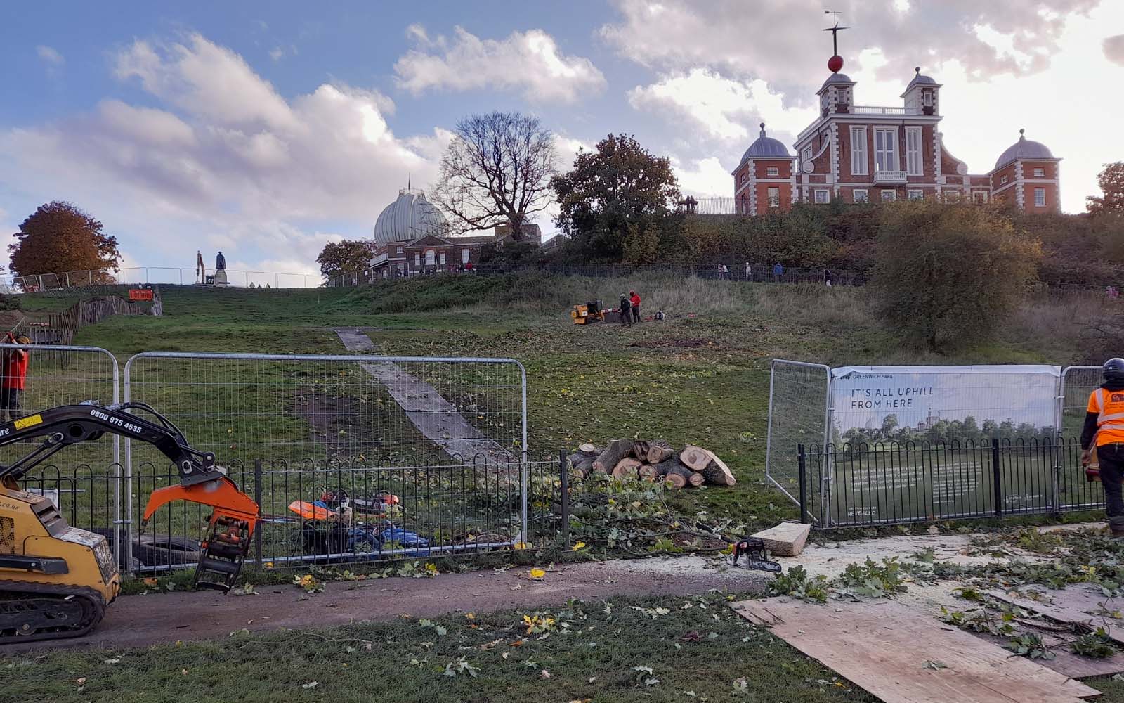
9 November 2023. Removing the trees on the west side of the Ascent. Works started a few days before the planning application 23/2509/SD was formally approved in writing on 14 November
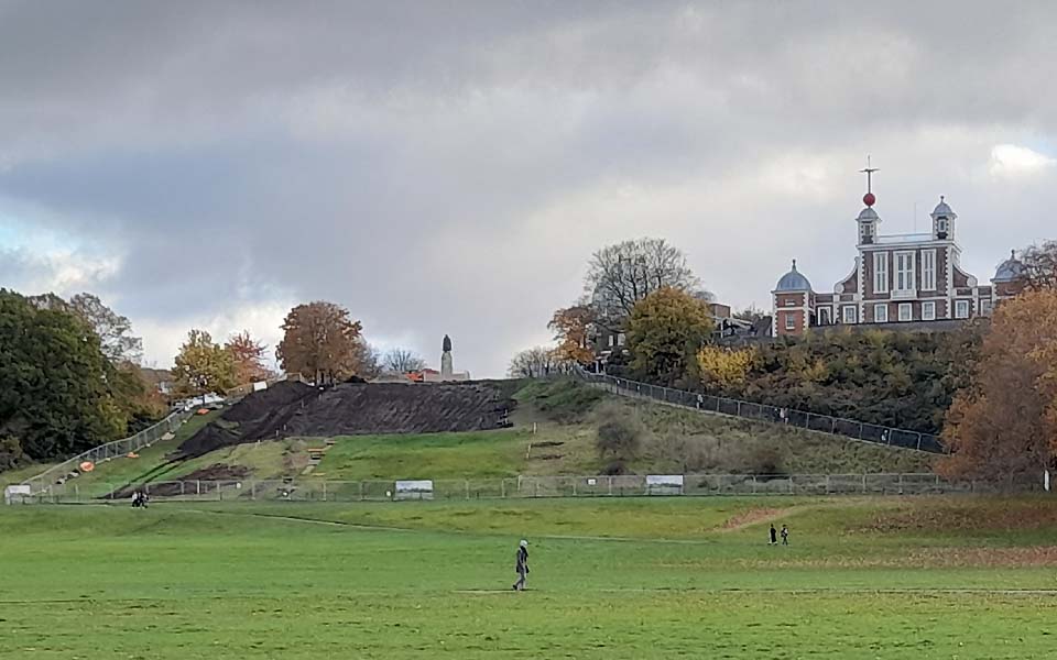
20 November 2023. The Ascent partially stripped of topsoil
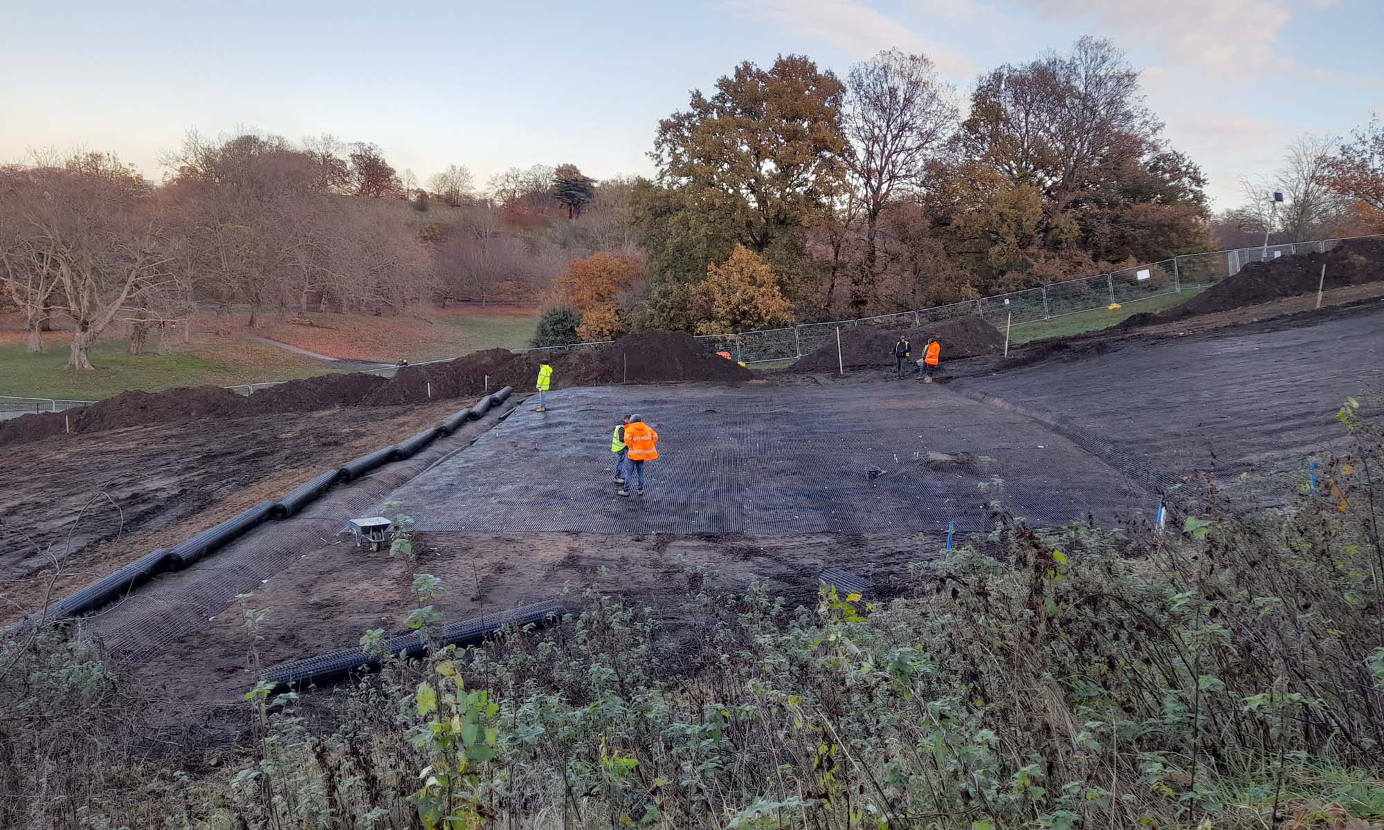
30 November 2023. Installing the geogrid and the 100mm diameter perforated drainage pipes. The purpose of the geogrid (which is anchored at intervals) is to reduce the risk of slippage between the retained layers and the fill material that is shortly to be placed above it
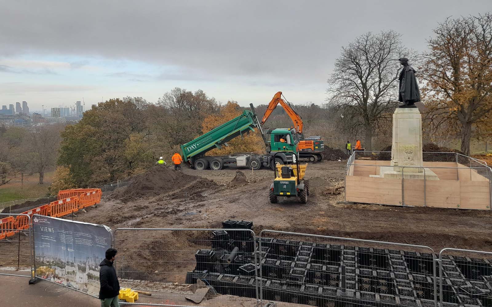
1 December 2023. Delivering one of many lorry loads of fill material

1 December 2003. Redistributing the fill material
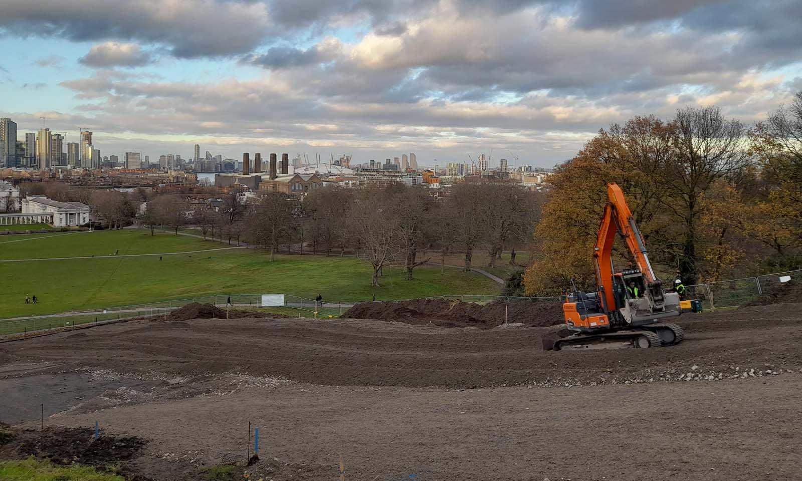
11 December 2023. The fill layer has now been spread over most of the Ascent. The mix contains pieces of stone which help stabilize the slope They are important as they help anchor the geogrid as some of them end up being embedded in the gaps in the grid. The Civil engineering stage 4 report p06-part-1 contains more information on how the grid is designed to work

20 December 2023. The steps are beginning to take shape. Once completed the maximum increase in height at any point compared to the ground levels before work started was planned to be 1.2m
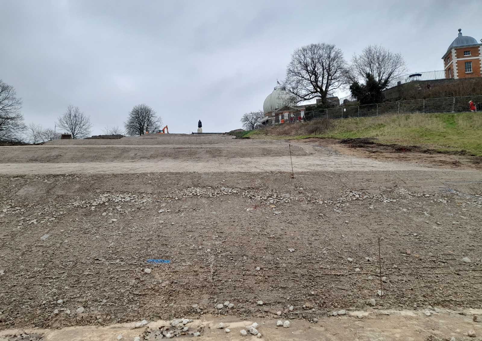
17 January 2024. The lower steps have been shaped and are now awaiting a covering of sand followed by a layer of topsoil
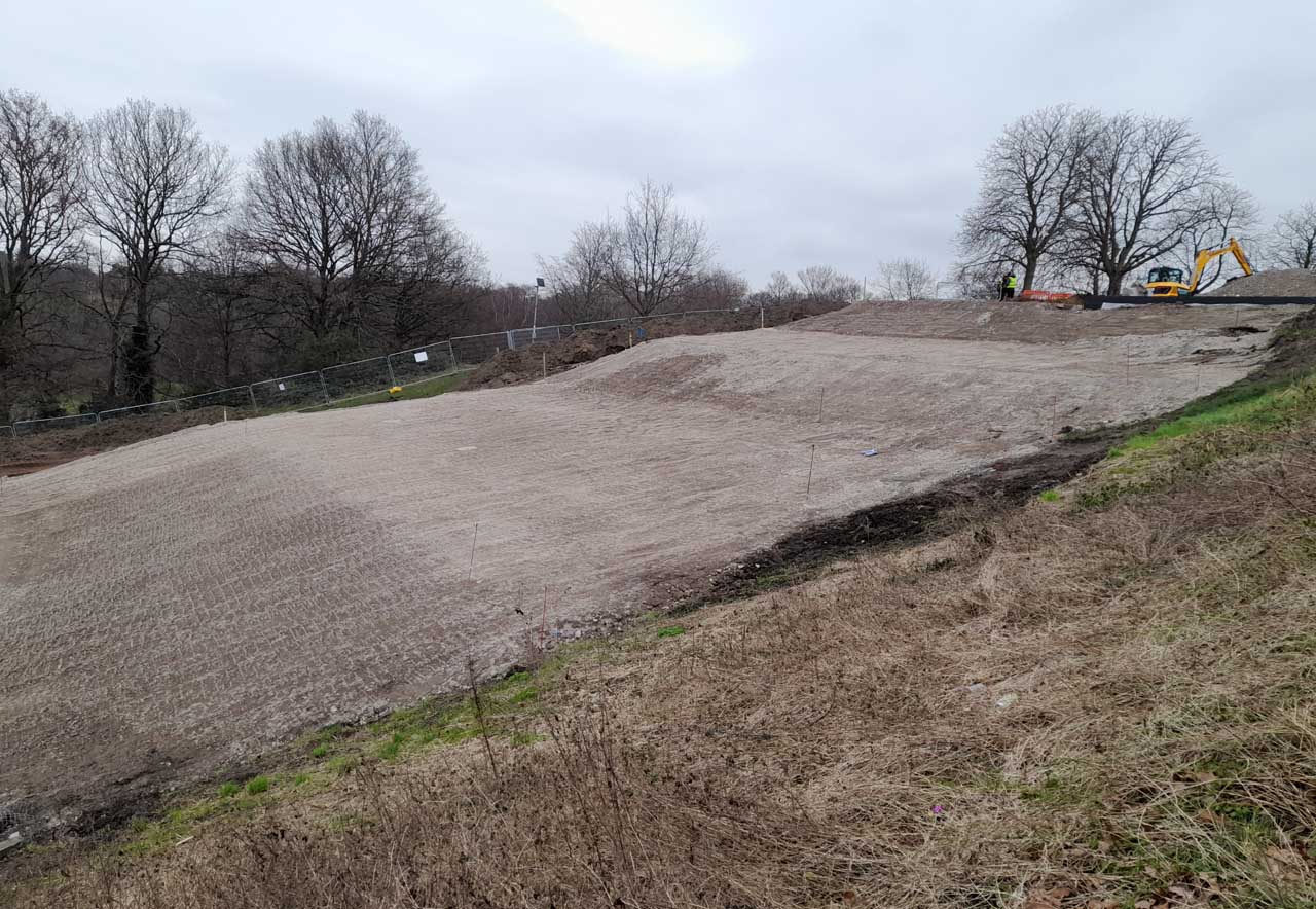
17 January 2024. The steps towards the top of the Ascent
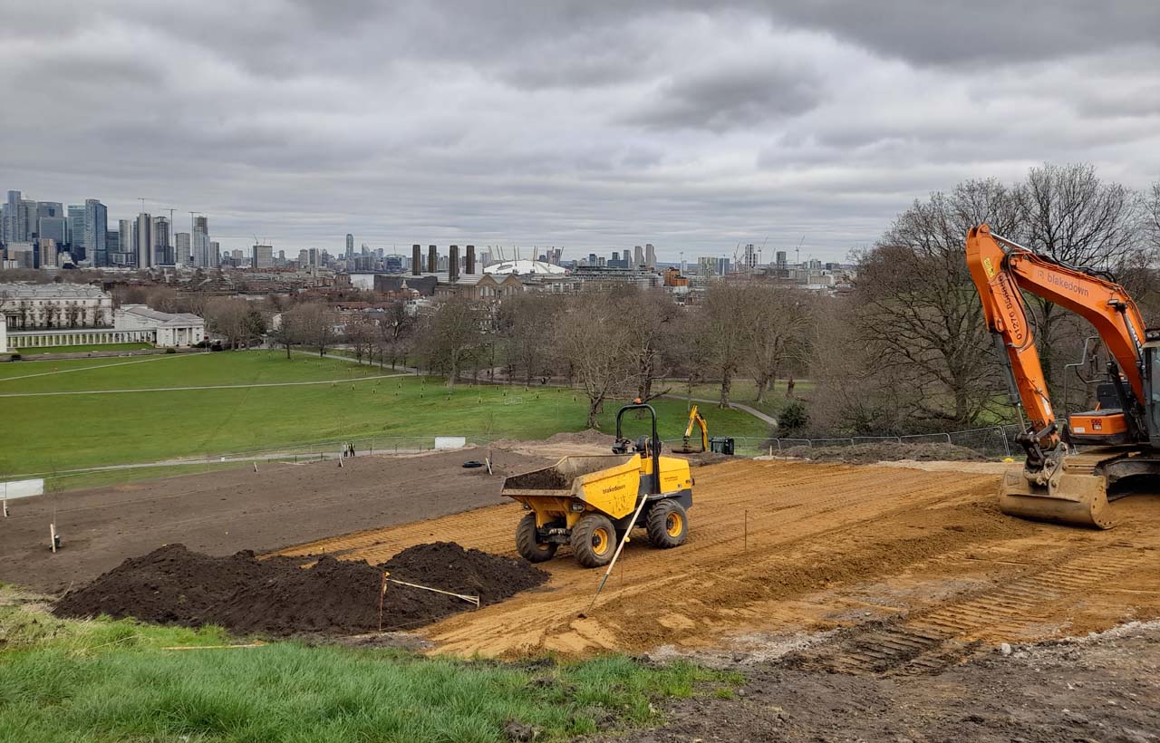
5 February 2024. The lower steps have been completed and the trees planted on the bottom three treads. Meanwhile, the sand layer has been constructed over most of the upper steps and top-soil is being brought back on site to spread over it

6 February 2024. The third riser and second and third treads have had the grass seed mix applied. The specification was for 'Earth Guard Fiber Matrix hydroseed erosion control system by GeoGrow or similar'. It is not known what was actually applied. Part of the newly planted hedge on the western side of the Steps is also visible in the foreground
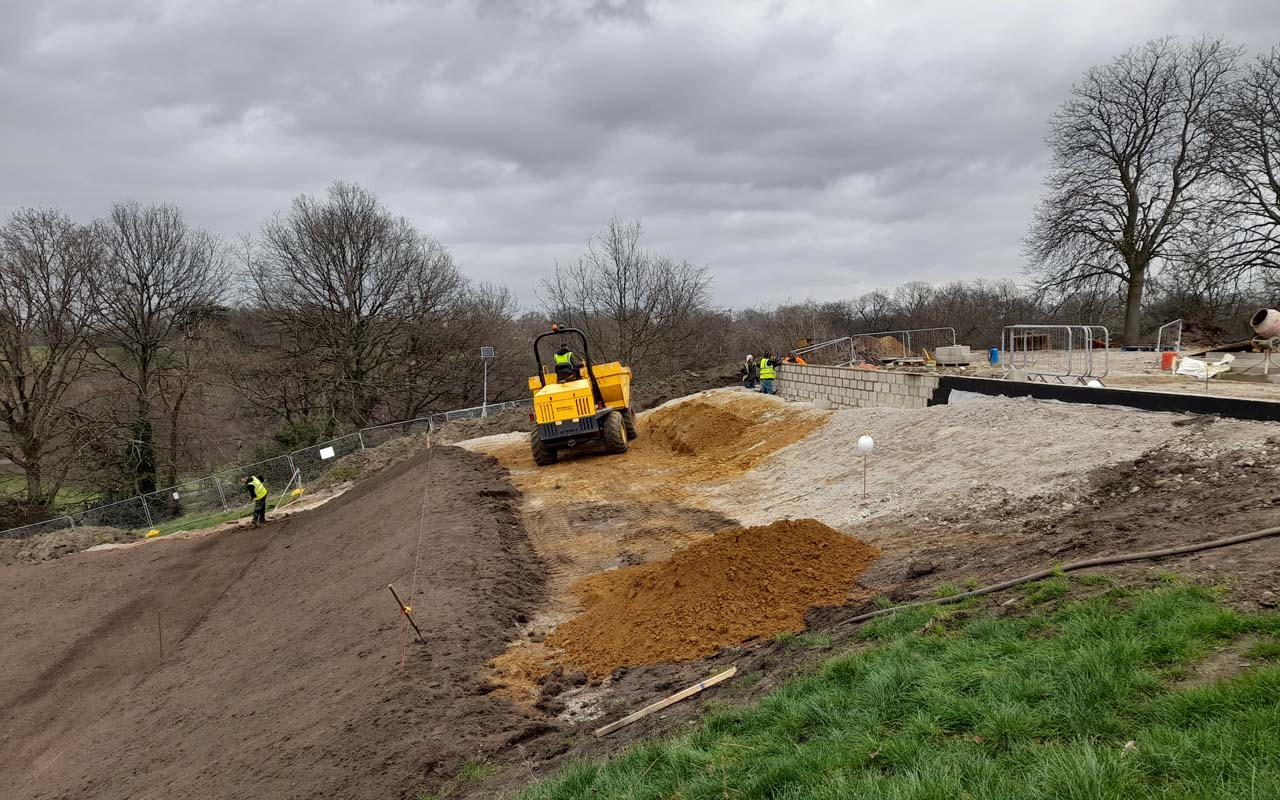
6 February 2024. At the top of the Ascent, the retaining wall designed to support a glass barrier was moving towards completion. The fifth riser had been prepared for seeding and the fifth tread and sixth riser still remained to be completed
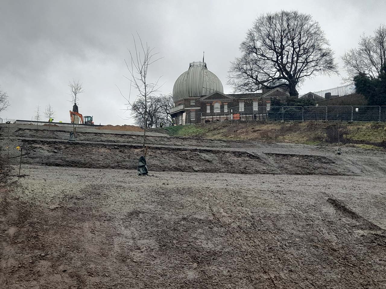
8 February 2024. Heavy rain in the early hours caused significant slumping of the bottom three risers, with risers two and three being particularly heavily affected. Ironically, had the risers been made up of layered turf, the slumping would not have occurred

9 February 2024. In this shot, the second riser is slumped more than in the picture above and most of the slumping that occurred on the bottom riser can be seen
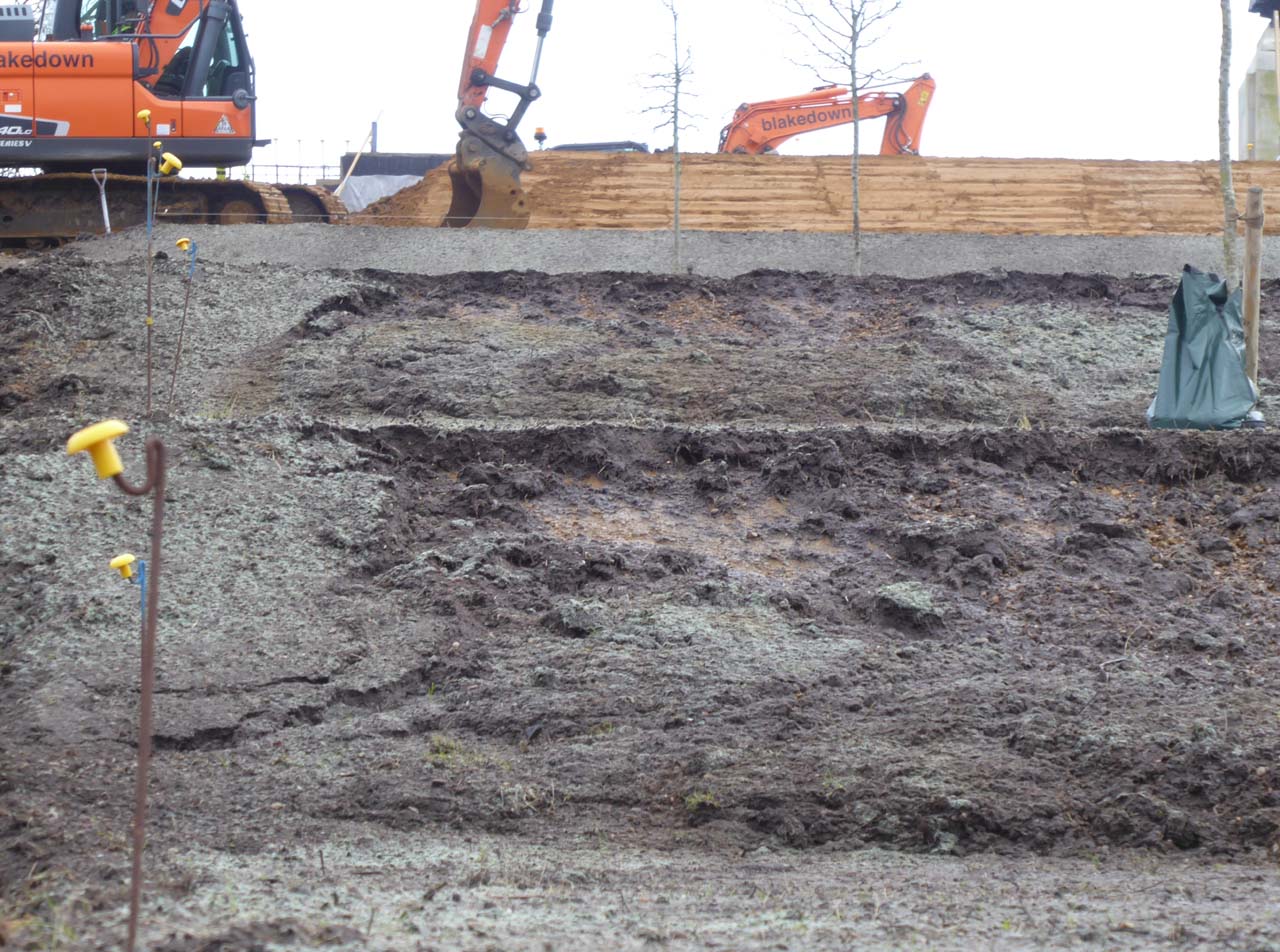
9 February 2024. A closer view of the slumping at the eastern end of the second and third risers
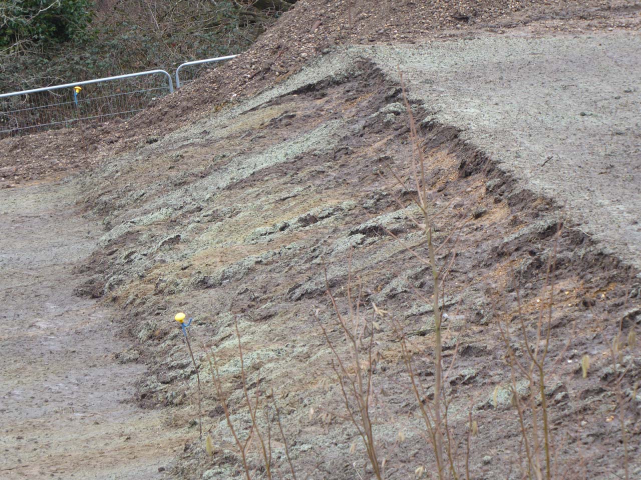
9 February 2024. The slumped third riser viewed from the west
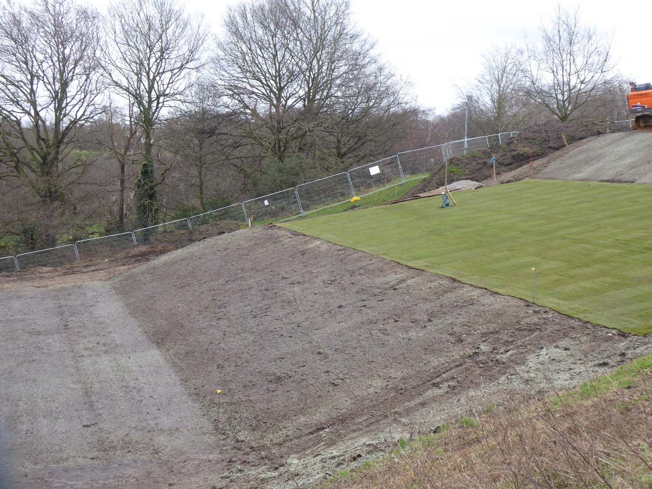
9 February 2024. The fourth and fifth risers were largely unaffected by the overnight rain on 7/8 February. The fourth tread was turfed either on the afternoon of 8 February or the morning of 9 February. The fifth riser is also believed to have been seeded during this period whilst the fourth riser appears to have been seeded before the rain
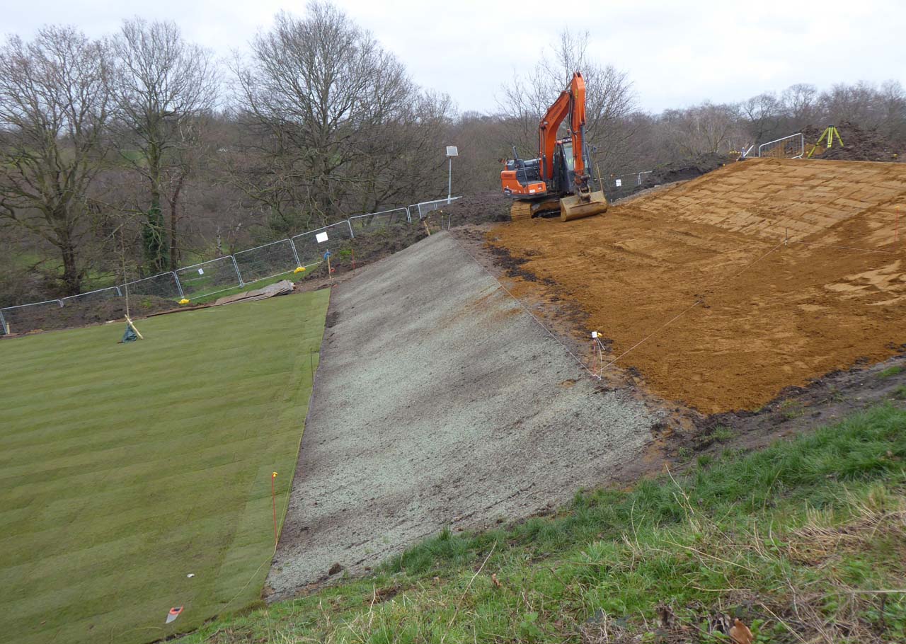
9 February 2024. The fifth tread and sixth riser are still being constructed and the fifth riser is newly seeded
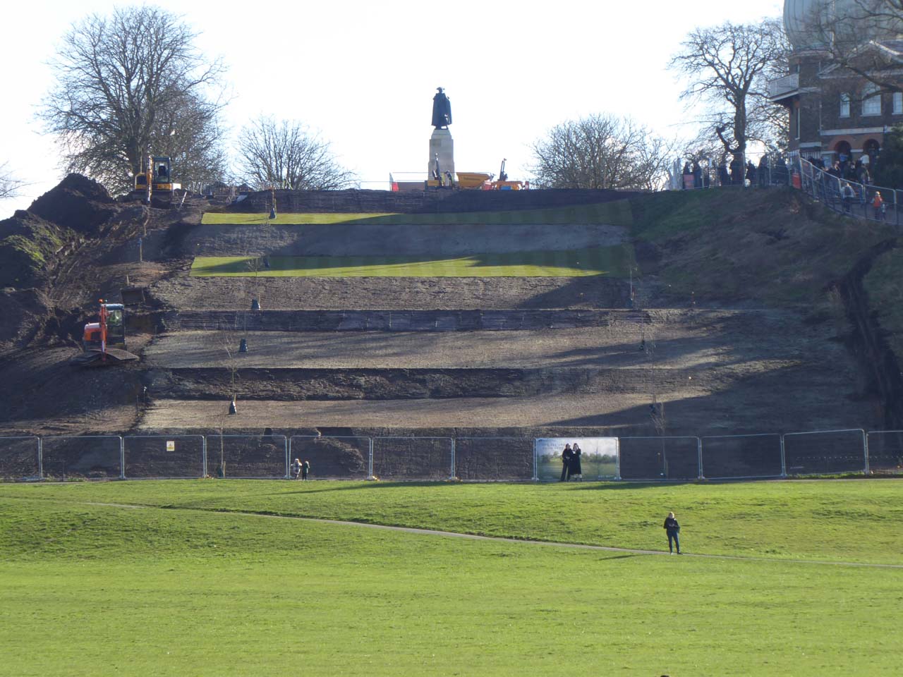
12 February 2004. According to the agreed plans treads four and five were due to be turfed, whilst the other treads and risers were all due to be seeded. In this view, the turf is now in place, the sixth (top) riser has had the top-soil added, repairs have been carried out on the third riser and work is about to start on reshaping the second
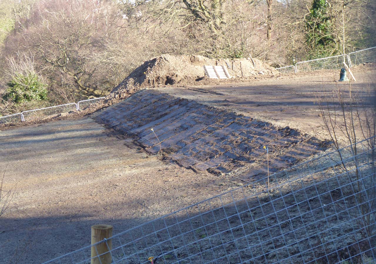
12 February 2024. The repaired third riser
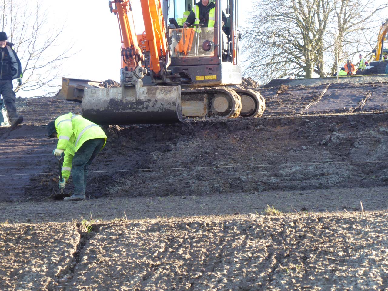
12 February 2024. Repairing the second riser

14 February 2024. Repairs to the bottom three risers have been completed, though channels on the bottom two risers caused by water run-off have been left untouched. On the right a group of men is working on the hedge at the western edge of the steps
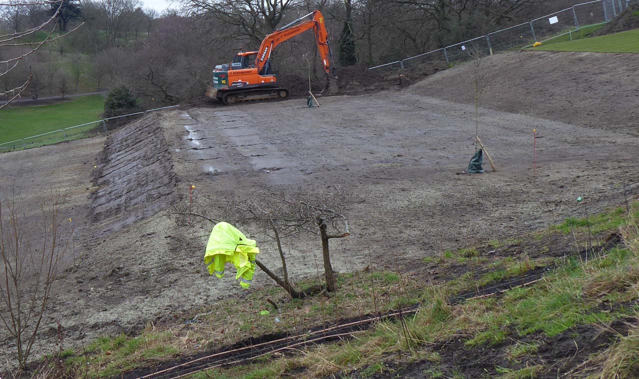
14 February 2024. A closer view of the repaired third riser and the irrigation pipes for the hedge at the western end of the Steps
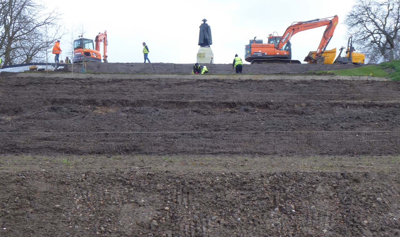
19 February 2024. Further slumping has occurred on the second and third risers (the top of the first riser can be seen at the bottom of the photo)
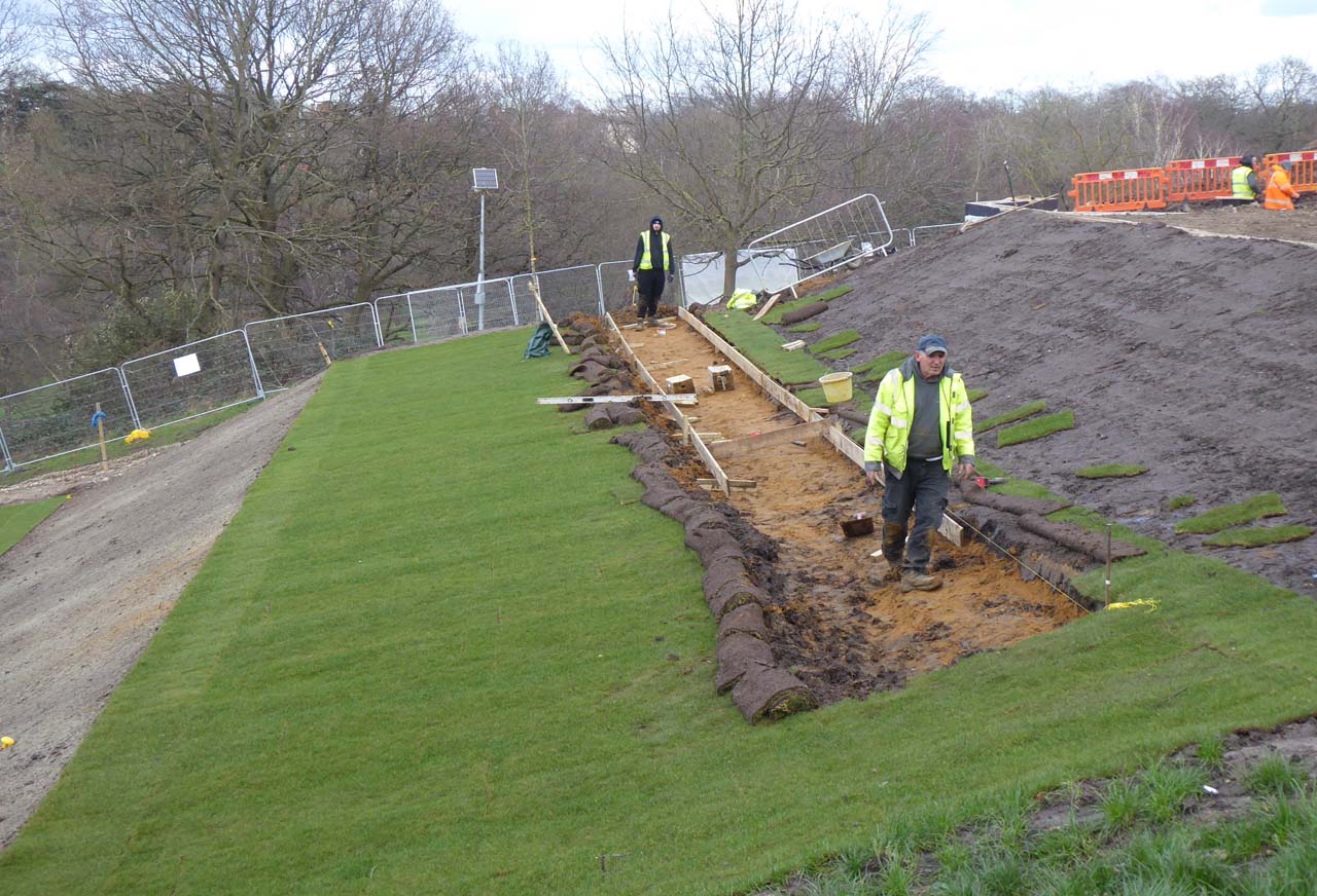
19 February 2024. Although only recently turfed, the fifth tread at top of the Ascent has been opened up to allow for the construction of the reinforced path that gives access to the Ascent for maintenance purposes. The plans specified Golpla reinforced grass or similar approved
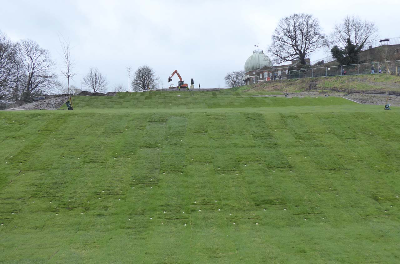
21 February 2024. At some point (presumably soon after the slumping occurred) a decision was clearly made to install turf on all of the Steps rather than just the treads of the top two. As well as helping prevent further slumping, this may also result in the creation of a more homogeneous covering. The downside however is the introduction of yet more soil from elsewhere. Work on laying the additional turf is thought to have commenced on the 20 February and was nearing completion when this photo was taken. On the lower risers, each piece was secured with pegs with a white top
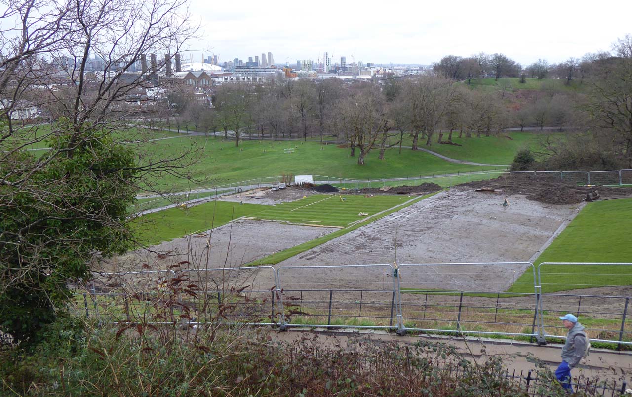
21 February 2024. About half the second tread and most of the third are still waiting to be turfed
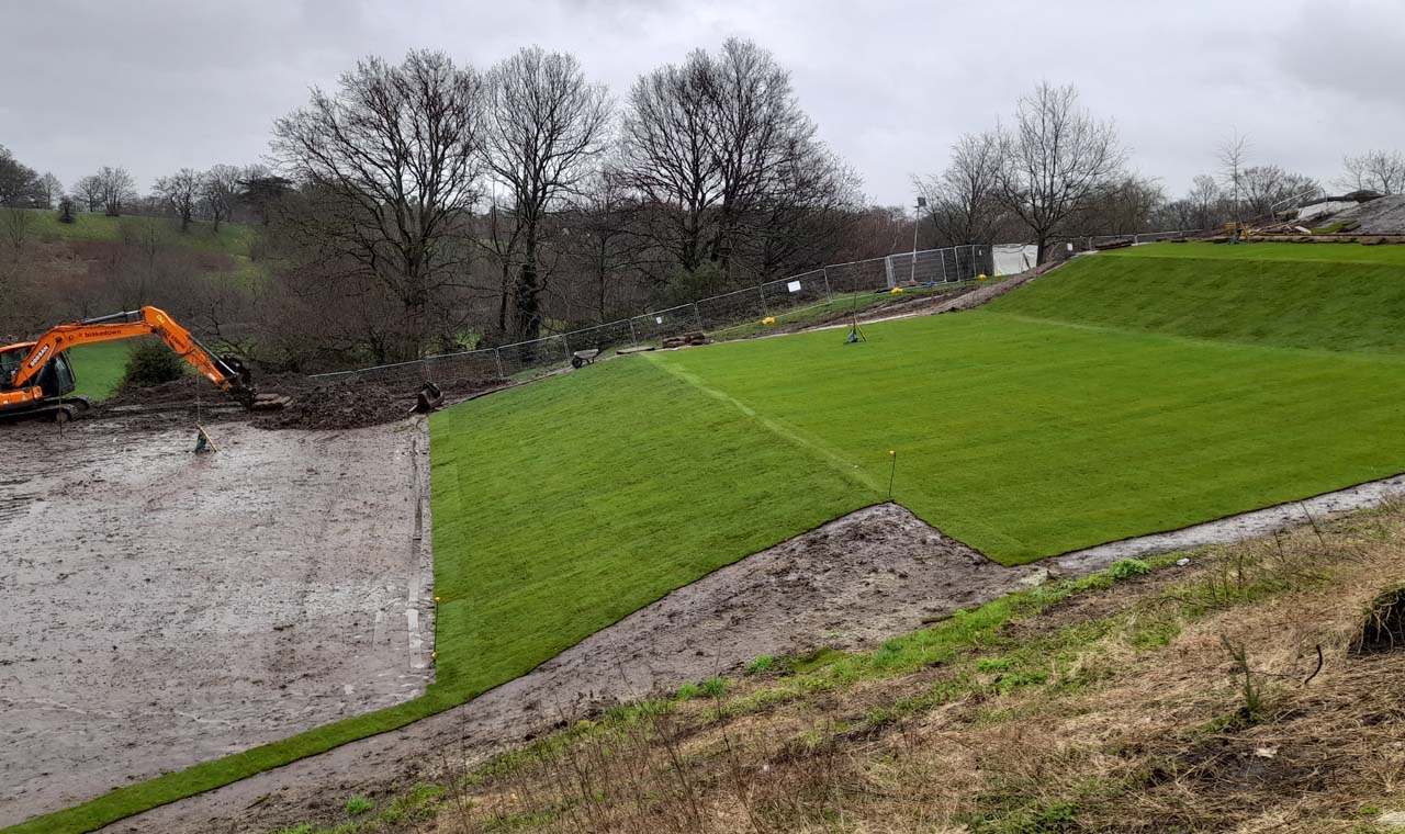
21 February 2024. This picture captures the top of the Ascent from the third tread upwards. As well as most of the third tread, the whole of the top riser and part of the fourth riser remain to be turfed
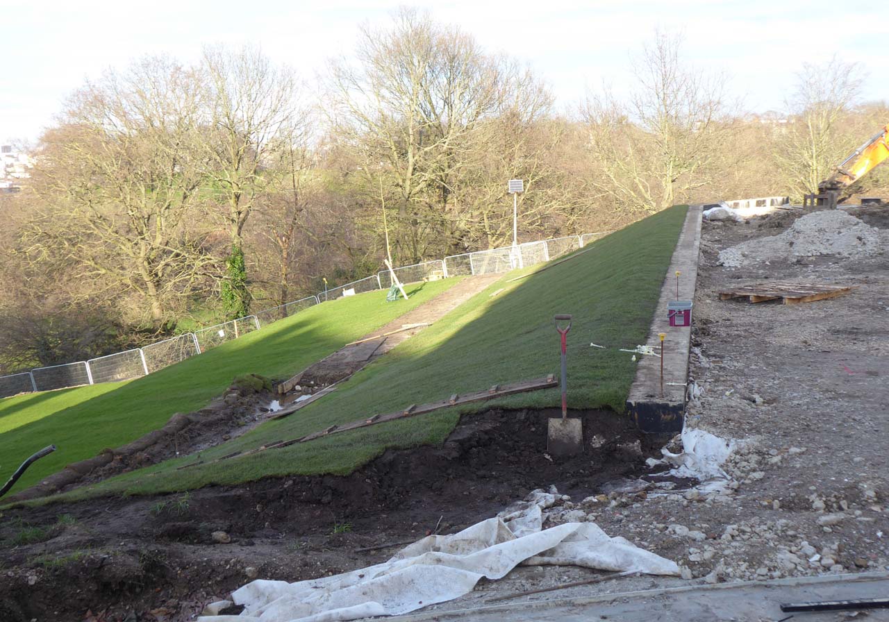
27 February 2024. The top riser has now been turfed, but the access path still needs to be completed
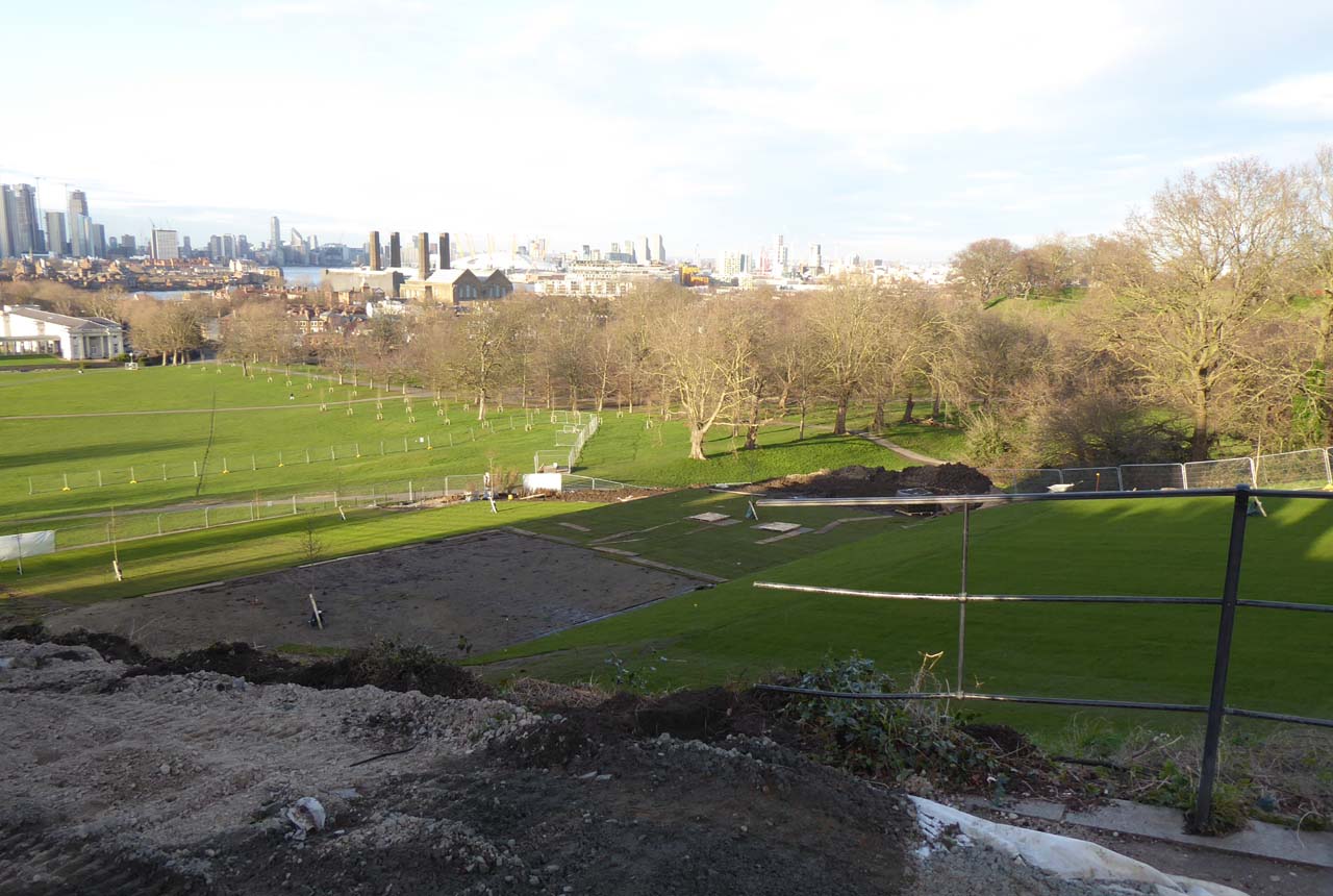
27 February 2024. Part of the third tread and the fourth riser are still awaiting their turf
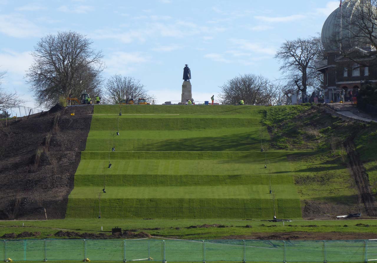
14 March 2024. The turfing is now complete apart from the eastern end of the access path. The earthworks on the Ascent have been completed as has most of the planting. A new fence has also been erected at the bottom though the eastern end (not visible here) still requires completion

14 March 2024. The gate where the person is standing in the centre of the photo gives access to the bottom of the Ascent for maintenance purposes
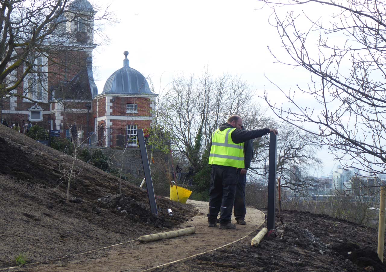
14 March 2024. Installing the gate posts on the path that gives access to the top of the Ascent for maintenance purposes
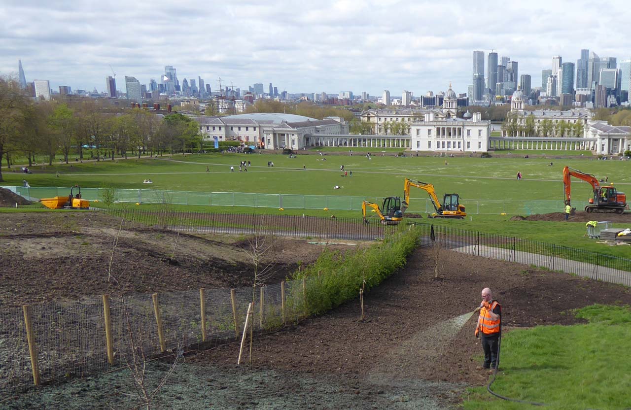
11 April 2024. Spray planting the grass seed and wild flower mix at the eastern boundary. The specification was for 'meadow mixture for sandy soils EM7 or similar approved'. The same mix was also scheduled to be used on the western boundary. However, unlike on the eastern boundary, much of the original vegetation remained. To what extent this will affect the appearance of the Ascent in the years to come remains to be seen

14 April 2024. The bowser pumping out the seed mix
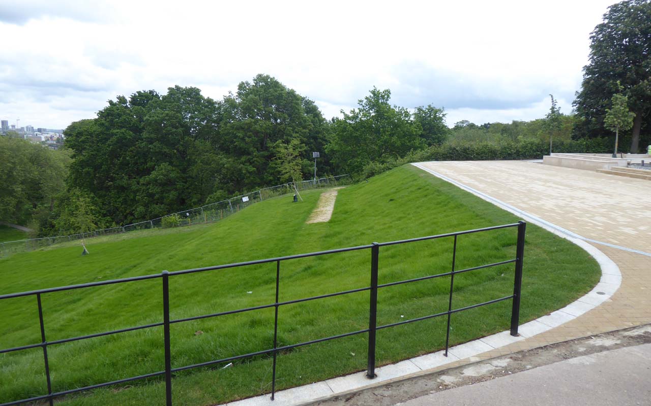
14 May 2024. The western end of the access path has been turfed and the eastern end seeded. Any mismatch between the soil used to construct the reinforced path and that used in the grassed area around it is likely to lead to the grass on it having a different appearance, particularly in dry spells. Further sections of fence still need to be erected as does the glass barrier at the top of the Ascent
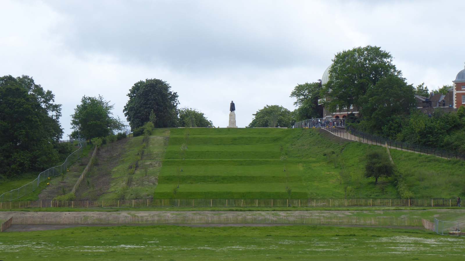
14 May 2024. The seed mix planted on 11 April is starting to germinate. The grass on the treads has been cut, but that on the risers has not. This has contributed to the lumpy and uneven appearance of the edges where the treads and the risers meet. The photo was taken from the entrance doors of the Queen's House
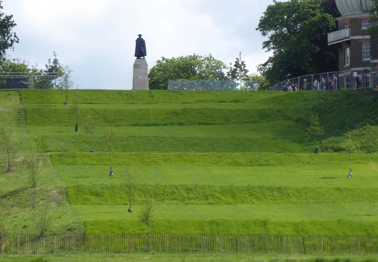
23 May 2024. Construction of the glass barrier at the top of the Ascent has begun
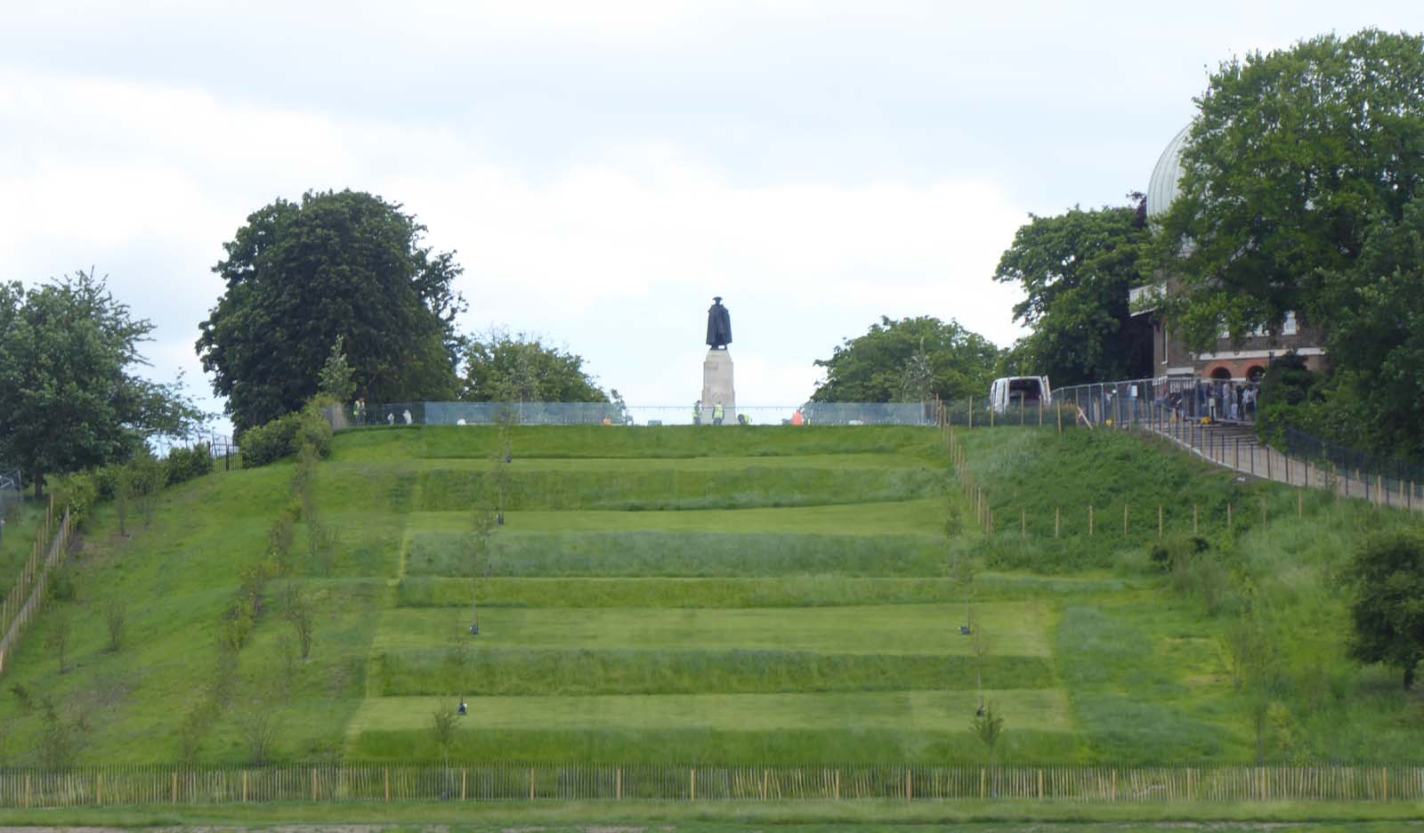
5 June 2024. The glass barrier has been completed and a fence (that did not appear in the plans) has been erected in the top right corner of the Ascent beneath the white van. The section leading up to the top of the Ascent is on an alignment that converges with the alignment of the newly planted trees
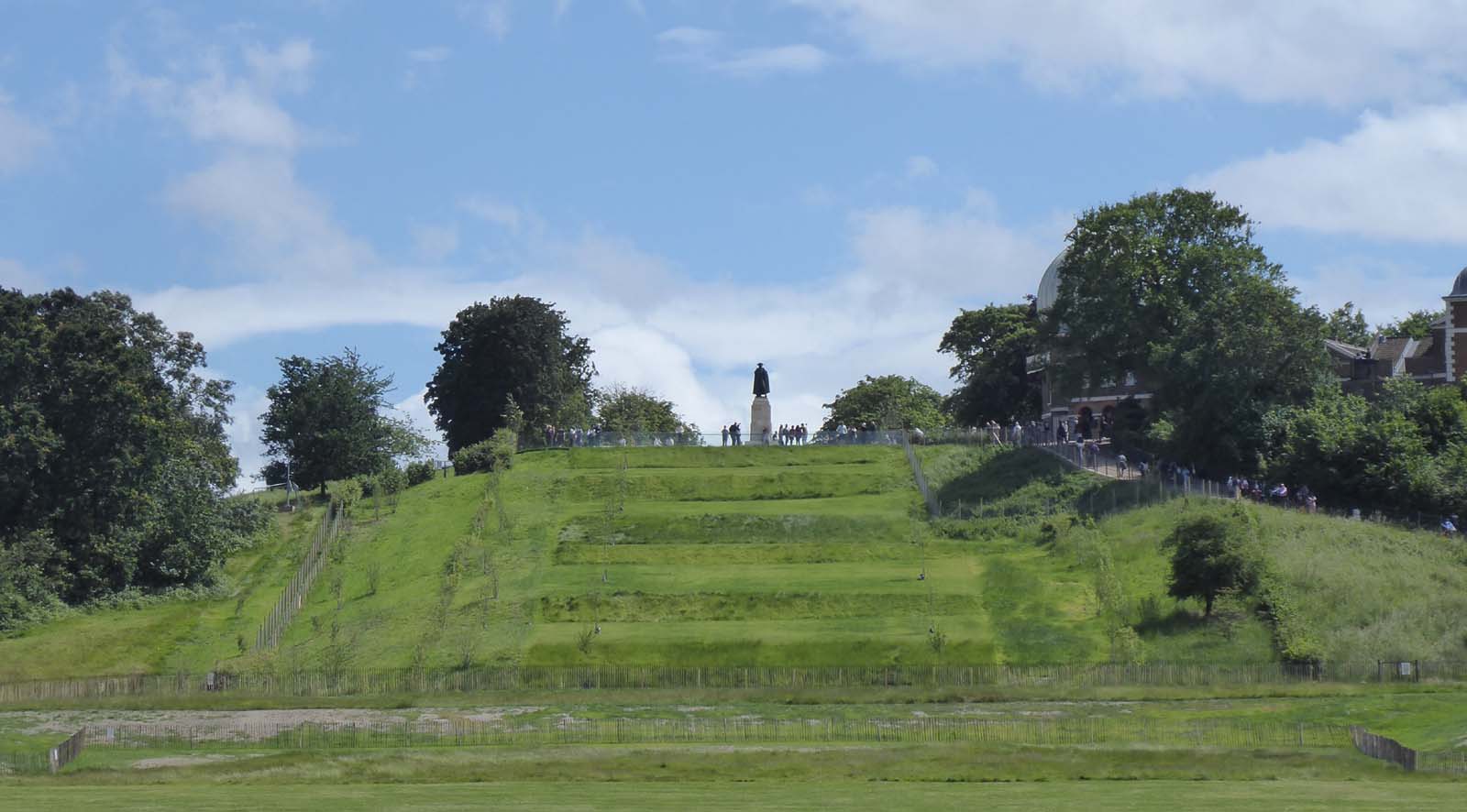
14 June 2024. The first full day following the reopening of the area around the Wolfe Statue and the reopening of the path up to the Observatory. The grass on the risers, which is still uncut, has an increasingly patchy appearance as a result of being flattened in places by the wind and possibly some kind of animal like a fox
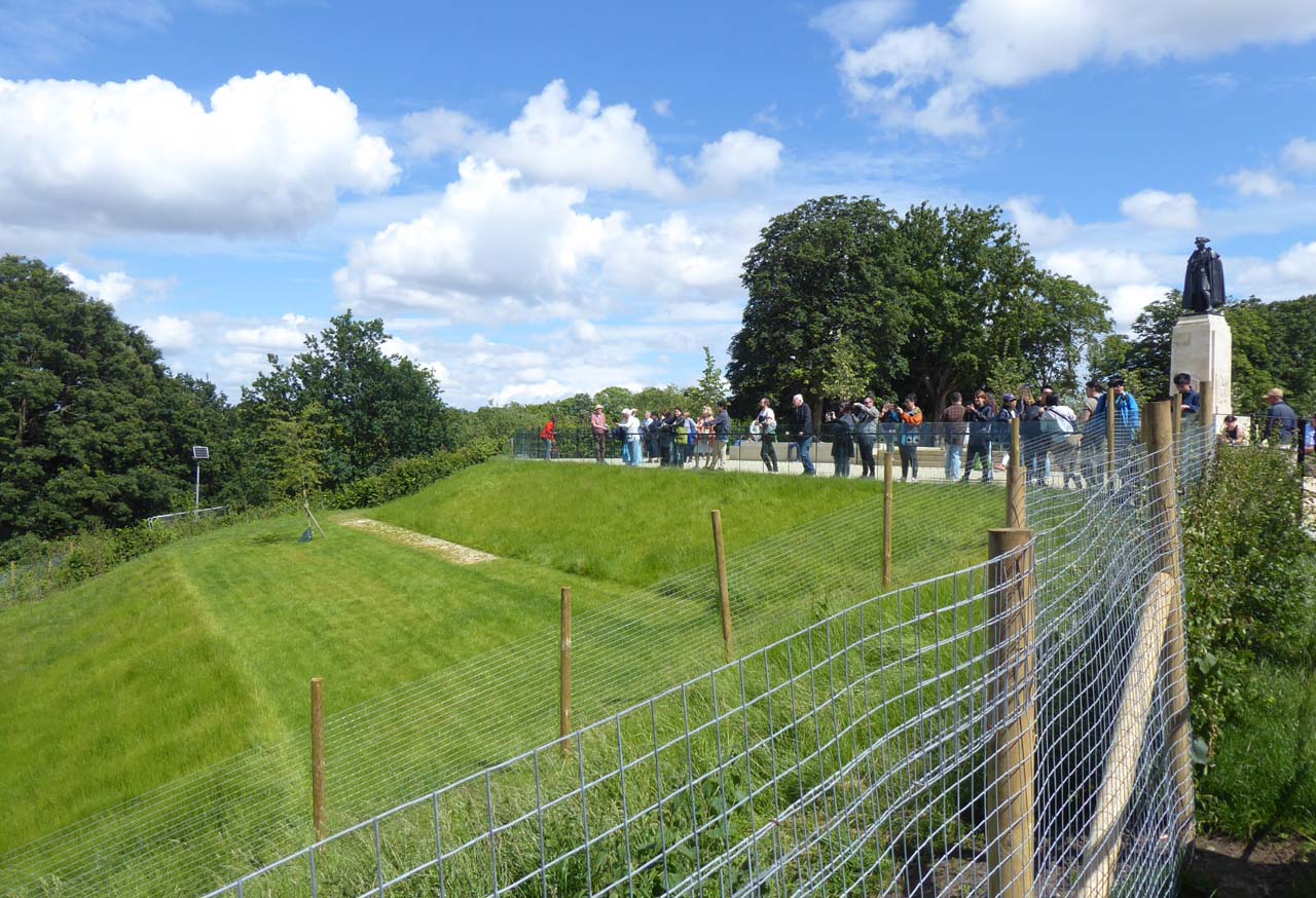
14 June 2024. Visitors enjoying the view down the Ascent towards the Queen's House
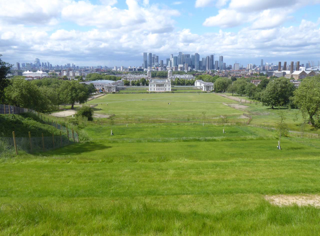
14 June 2024. Looking down the Ascent towards the Queen's House
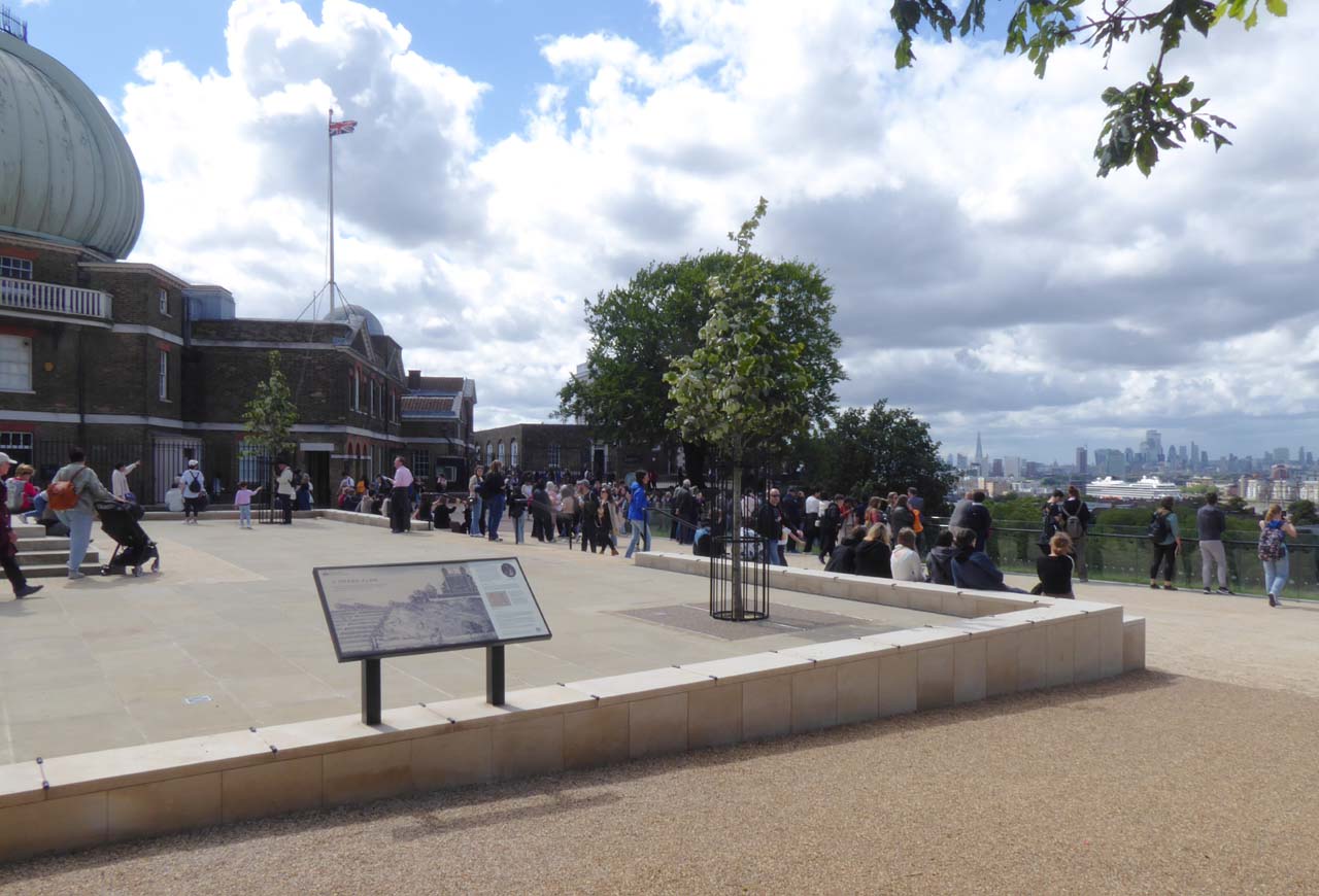
14 June 2024. The redesigned viewing area at the base of the Wolfe Statue. Despite the fact that the newly recreated steps look nothing like the original, the Royal Parks had no qualms about including a reproduction of the etching Facies Speculae Septen on the newly erected information board. Others erected nearby have the etching Prospectus Orientalis

27 June 2024. The first cut of the risers is nearing completion. The mower is a remote controlled Spider ILD 01

27 June 2024. The view from the steps of the Queen's House shortly after the mowing had been completed. The mower is being guided to the top of the Ascent for departure through the top access gate. After drying in the sun for a short while, the grass cuttings were later removed with a leaf blower
Further reading
A history of gardening in England, Evelyn Cecil (1910)
Greenwich – An Architectural History of the Royal Hospital for Seamen & the Queens House, John Bold (2000)
Garden Works in Greenwich Park, 1662–1728, David Jacques (2014)
Charles Bridgeman (c.1685-1738): A Landscape Architect of the Eighteenth Century, Susan Haynes (2023)
Greenwich Park conservation plan 2019–2029, Royal Parks
The Royal Parks Management Plans
Historic England aerial views from the Aerofilms archive:
1924, view from the north (Photo - EPW010756)
1946, view from the south-east (Photo - EAW002293)
1948, view from the west (Photo - EAW016232)
1948, view from the north-west (Photo - EAW016233)
1948, view from the north (Photo - EAW016224)
List (with dates) of all the Observatory enclosures from Greenwich Park
Acknowledgements and Image licensing
The images from the British Museum are reproduced under an Attribution-NonCommercial-ShareAlike 4.0 International (CC BY-NC-SA 4.0) license, courtesy of the The Trustees of the British Museum. All have been further compressed for this website. MG.718 has also been reduced in size. Museum Number: 1880,1113.5519 consists of two plates that have been digitally joined and cropped. Museum number:
Museum number: 1865,0610.949
Museum number: 1865,0610.950
Museum number: 1880,1113.5510
Museum number: 1880,1113.5519
Museum number: 1880,1113.5546
The following paintings are reproduced courtesy of the Yale Center for British Art under a Creative Commons No Copyright License.
Paul Mellon Collection:
Vosterman. Accession Number: B1976.7.112
Dawson. Accession number: B1981.25.216
Nathaniel Buck. Accession Number B1977.14.19080
The following two images are reprodcued courtesy of the Victoria and Albert Museum, London (V&A)
A.J. Swete. Accession No: 7-1891
William Collingwood. Accession Number P.9-1928
The 1857 oil paining by George William Mote, Reproduced under a Creative Commons Attribution-NonCommercial (CC BY-NC) License courtesy of The Cooper Gallery (Reference Number CP/TR 299) and Art UK (Reference: 68902) see below
The plan of the Observatory grounds as they existed in December 1846 is reproduced courtesy of Bayerischen Staatsbibliothek under a No Copyright - Non-Commercial Use Only licence. It is taken from the 1845 volume of Greenwich Observations published in 1847.
The two Ordnance Survey maps and air photo mozaic are reproduced with the permission of the National Library of Scotland under the terms of the Creative Commons Attribution (CC-BY) License.
Ordnance Survey map, 1:2500. London - Middlesex & Kent XII.22. Surveyed: 1867, Published: 1871
Ordnance Survey map, 1:1250. TQ3877SE – A. Surveyed: 1950, Published: 1951
Photo © Peter Shimmon is Reproduced under a CC-BY-SA 2.0 License via the following link www.geograph.org.uk/photo/7209162. The original has been straightened, cropped, reduced in size and re-compressed for reproduction here.
Photo © David Dixon is Reproduced under a CC-BY-SA 2.0 License via the following link www.geograph.org.uk/photo/3624110. The original has been cropped and re-compressed for reproduction here.
Photo © Gordon Beach is Reproduced under a CC-BY-SA 2.0 License via the following link www.geograph.org.uk/photo/2217681. The original has been straightened, cropped and re-compressed for reproduction here.
Photo © Nick Macneill is Reproduced under a CC-BY-SA 2.0 License via the following link www.geograph.org.uk/photo/1518919. The original has been cropped and re-compressed for reproduction here.
Photo © Robert Lamb is Reproduced under a CC-BY-SA 2.0 License via the following link www.geograph.org.uk/photo/1925510. The original has been lightened, cropped and re-compressed for reproduction here.
Photo © Richard Cooke is Reproduced under a CC-BY-SA 2.0 License via the following link www.geograph.org.uk/photo/1925510. The original has been lightened, cropped and re-compressed for reproduction here.
© 2014 – 2025 Graham Dolan
Except where indicated, all text and images are the copyright of Graham Dolan